Update 2015-06-22: SOS will remain focused on the Lower Suwannee.
Can’t tell the players without a card, and there’s a new player at Monday’s
Suwannee-Satilla Regional Water Planning Council 2015-06-15,
in between south of Satilla Riverkeeper and WWALS Watershed Coalition: Save Our Suwannee.
Also, WWALS is now WWALS Watershed Coalition, a WATERKEEPER® Affiliate, conserving the Alapaha and Withlacoochee River basins, including the watersheds of all their tributaries.
In Florida,
 the
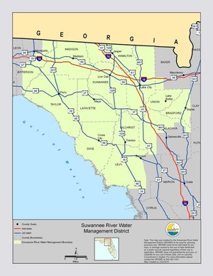
Suwannee River Water Management District includes
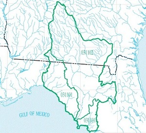
several rivers that are not in the Suwannee River Basin, but that are in what USGS calls the Suwannee Subregion, hydrologic unit code (HUC) 0311:
the Aucilla, partly in Georgia, and the Econfina and Waccasassa, wholly in Florida.
the
Suwannee River Water Management District includes
several rivers that are not in the Suwannee River Basin, but that are in what USGS calls the Suwannee Subregion, hydrologic unit code (HUC) 0311:
the Aucilla, partly in Georgia, and the Econfina and Waccasassa, wholly in Florida.
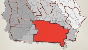 None of those are in Georgia’s
Suwannee-Satilla Region, which includes only (most of) the Georgia
parts of HUC 031102, the Suwannee River Basin proper, plus the upper parts of HUC 03070201 Satilla River, and I think 03070202 Little Satilla River.
You all know Ashby Nix, Satilla Riverkeeper, responsible for about 4,000 square miles.
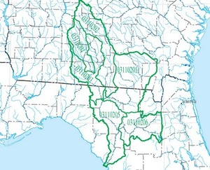
- Alapaha River (HUC 03110202; 1840 sq. mi.
- including its tributary the Willacoochee River)
- and Withlacoochee River (HUC 03110203; 1510 sq. mi.)
run from Georgia to Florida before flowing into the Suwannee,
- while the Withlacoochee’s tributary the Little River (HUC 03110204; 884 sq. mi.) is entirely in Georgia,
So WWALS is responsible for about 4234 sq. mi., of which about 3816 sq. mi. are in Georgia.
WWALS represents about 43% of HUC 031102, the Suwannee River Basin, and that WWALS 43% is mostly in Georgia.
Another 43% 16% of the Suwannee River Basin is represented by
Save Our Suwannee (SOS),
and most of that is in Florida.
 SOS’s new president Merrillee Malwitz-Jipson
wants to have considered having the same fun WWALS has
with both Florida and Georgia politics, by representing
all of the Suwannee River proper:
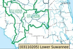
- Upper Suwannee (HUC 0310201; 2720 sq. mi.)
- + Lower Suwannee (HUC 0310205; 1590 sq. mi.).
 for about 4310 sq. mi., with about 1904 sq. mi. in Georgia,
including much of the Okefenokee Swamp.
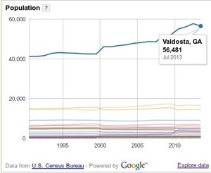
Of the Georgia part of the Suwannee River Basin, WWALS represents about 66% with all the biggest population centers (Valdosta in Lowndes County, Tifton in Tift County, and Moultrie in Colquitt County). Those are the biggest population centers not just in the Georgia part, but also in the entire Suwannee River Basin.
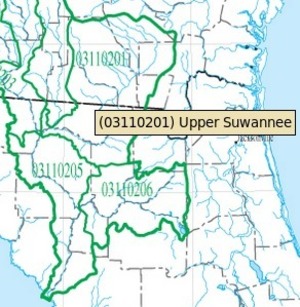
SOS The Upper Suwannee HUC represents about 34% of the Georgia part of the
Suwannee River Basin, with some of the most ecologically
sensitive areas, including part of the Okefenokee Swamp
and the
GDOT-and-USACE-proposed widening of US 84 between
Homerville and Waycross, which is being challenged by
Southern Environmental Law Center on behalf of Satilla
Riverkeeper, Save Our Suwannee, WWALS Watershed Coalition,
St. Marys Earthkeepers, and Silentdisaster.org (based in Waycross).
So, as you can see, SOS is already active in Georgia. Other Georgia watershed organizations probably want to know that.
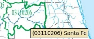 Merrillee is also president of
Our Santa Fe River, for the other
big tributary of the Suwannee, the Santa Fe River (HUC 03110206;
1390 sq. mi.), which is entirely in Florida (and its own tributary
the Ichetucknee River is represented by the Ichetucknee Alliance).
For more detail, please see How big are WWALS watersheds?
FYI, WWALS, OSFR, and SOS have long been cooperating in opposing the Sabal Trail pipeline and fracking, and in dealing with the Valdosta wastewater situation.
WWALS Ambassador Dave Hetzel and WWALS President John S. Quarterman, as well as SOS President Merrillee Malwitz-Jipson, will be at the SSRWPC meeting tomorrow, and I would guess Satilla Riverkeeper Ashby Nix will, as well. See you there.
-jsq
Short Link:


Pingback: How big are WWALS watersheds? - WWALS Watershed Coalition