Update 2018-04-24: deadfall pinpointed, with latlong and map, and see trip report.
Sometimes it takes paddlers from Atlanta to alert us to a river obstruction, in this case Robert Marshall about the Alapaha River:
A group of seven of us mostly from Atlanta paddled from GA-135 south of Willacoochee, to US-129 east of Lakeland, this last weekend. Loved the river, and appreciate all your organization does to promote its preservation.
You probably already know this, but there is a huge tree totally blocking the river, about halfway between the GA-168 bridge and the US-129 bridge. Water level at Statenville was about 3.5 during our trip. The tree’s top surface was probably a foot and a half above water level, and it spanned from bank to bank. We portaged on the right side.
That’s between Berrien Beach Boat Ramp and Lakeland Boat Ramp. As for more specifically where:
I didn’t set a waypoint at that location, but I know that it was in a GPS-mapped leg that started about 8 miles from the 168 bridge, and ended about 10 miles from the bridge. We were using the USA Topo app (GPS location tracked on USGS topo mapping).
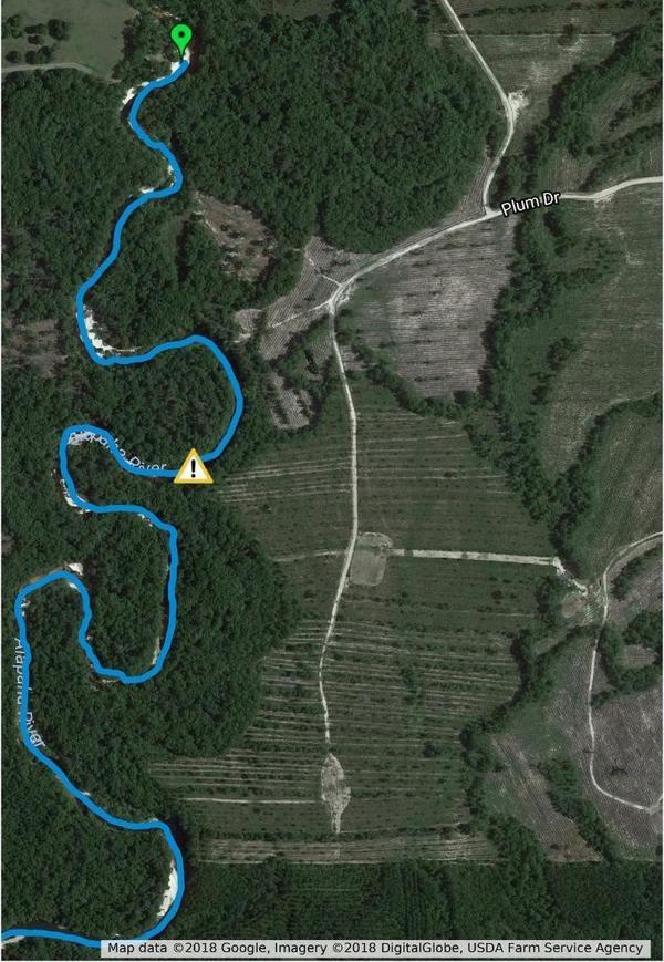
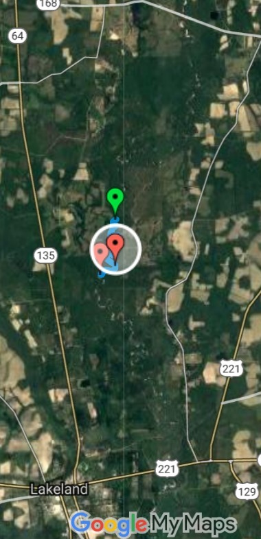
So that would be somewhere around here (my guesstimate from his reports): 31.09586, -83.05895. Somewhere between Plum Drive and the unnamed road across from Fender Church on River Road, in Lanier County, Georgia.
OK, he has pinpointed the real location:
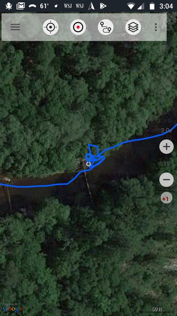
I finally figured out how to pinpoint the location of the deadfall I previously reported. It is 31.101379, -83.058658
A screenshot of our GPS track at that point clearly shows the tree, and our scouting and portaging activity on the right side. This track is shown overlayed here on the Google satellite image data, which is up to date (shows as 2018 imagery).
That is a couple river loops north of my guesstimate, which is about 800 feet downstream of a track to the river from Plum Drive.
One of our crew had a video-cam running at the time we encountered the full-river-blocking deadfall, and this is a screen-cap from that video. BIG tree! We portaged to the right.
That leg of our trip started at 2:45 pm, at a point 8 miles down from the 168 bridge. We encountered the deadfall at 3:12 (time-stamp on the video at that point), and we had been averaging 3 miles per hour, to that point, on all of our prior legs. So this was probably about 1.5 miles into that leg, or 9.5 miles down from the bridge.

Updated 2018-04-24: to match pinpointed location.
He also remarked:
Please note that our GPS tracker recorded the distance between the 168 bridge and the US-129 bridge as 17.7 miles, which is about 10% more than what your mileage between access points shows. In any event, it appears to be about halfway between the two bridges.
We just recalculated the miles for the Withlacoochee and Little River Water Trail and miles for the Alapaha River Water Trail are next.
Meanwhile, Robert Marshall projects “a trip report, with photos, in the next week”. And here it is.
-jsq, John S. Quarterman, Suwannee RIVERKEEPER®
You can join this fun and work by becoming a WWALS member today!
Short Link:


