
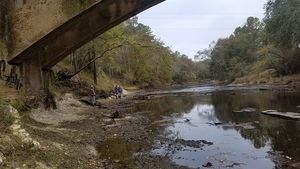
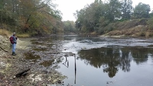
We made it to Spook Bridge from US 84! It was a small group, four of us, on a cold November afternoon. And we saw the sad remains of Wade Spring.
Paddling upstream was not practicable, with the US 84 Quitman Gauge at 1.73′ (85.23′ NAVD88).
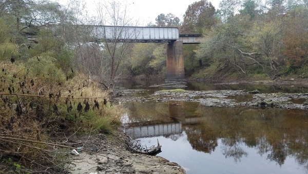
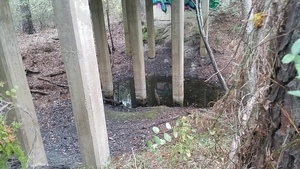
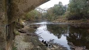
Downstream might be paddleable, but we couldn’t see under the RR bridge around the bend to Spook Bridge.
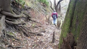
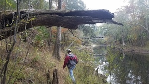
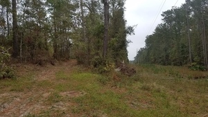
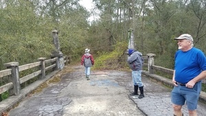
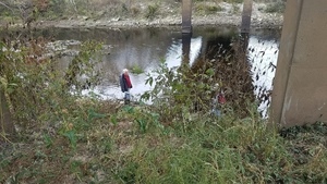
So when the intrepid explorers arrived….

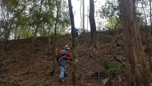
We decided to walk.

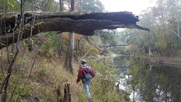
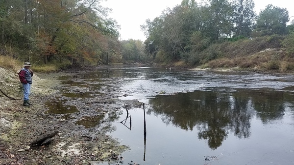
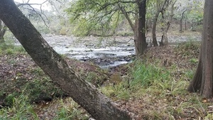
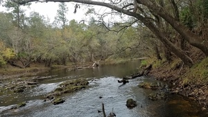
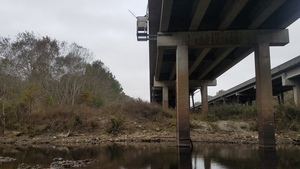
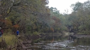
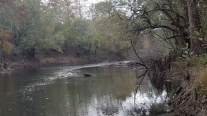
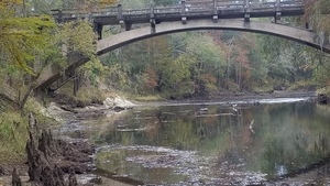
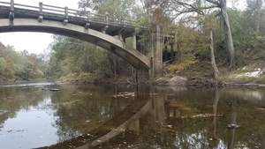
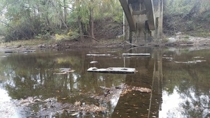
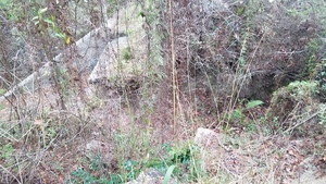
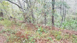
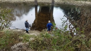
There it is!

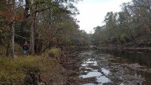
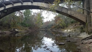
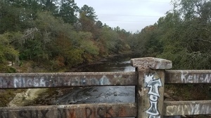
In the middle you can see back to the railroad bridge, but not to the US 84 bridge.
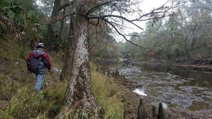
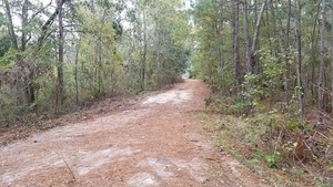
Our destination is closer:
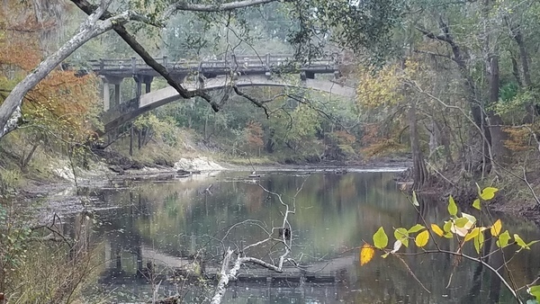
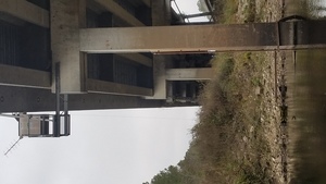
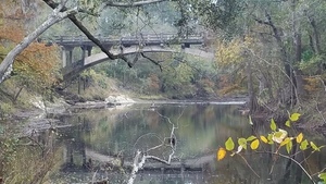
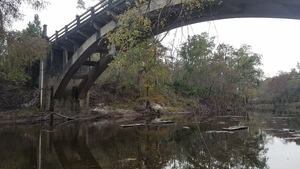
It makes some nice pictures.
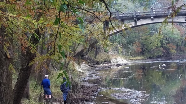
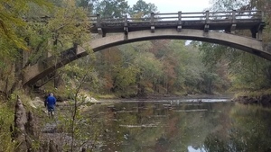
The birds were not perturbed by our shenanigans.
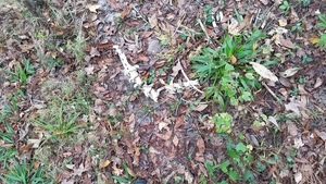
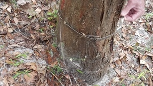
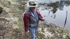
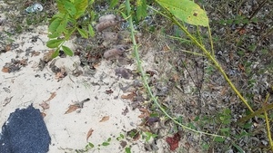
Fresh mussell shell.

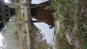
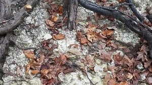
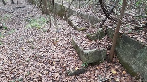
Apparently there was a smaller bridge before.

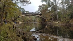
Quite the picture.

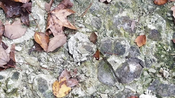
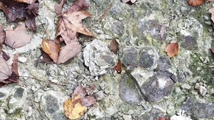
Are these fossilized oyster shells, like at the Dead River?
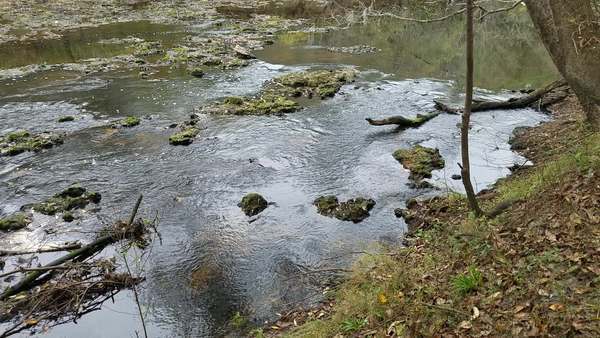
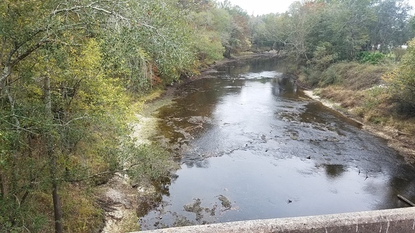
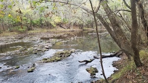
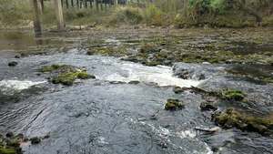
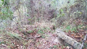
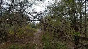
Small rapids downstream.
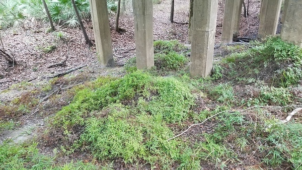
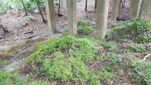
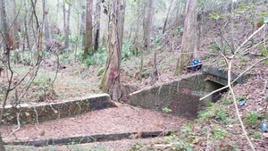
A carpet of invasive exotic Japanese Climbing Fern under the Lowndes County abutment. Nasty stuff: it spreads both by spores and underground. Fire doesn’t even kill it.
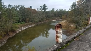
Downstream rapids seen from the bridge.
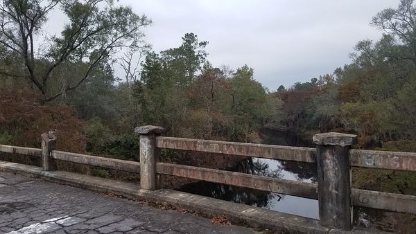
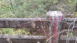
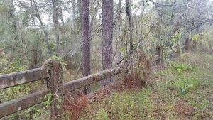
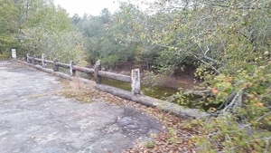
Upstream, with missing railing.
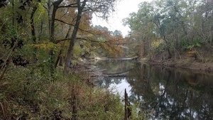
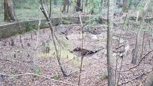
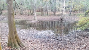
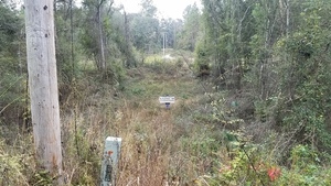
You could easily think this is the river, but it’s just a slough, presumably an old course of the river. Notice the color of the water: it’s not tea colored. That’s because it’s just rainwater, not colored by tannic acid from tree roots.

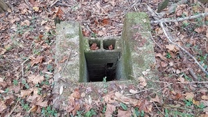
Wade Spring was completely dry, unlike back in May when it had a trickle, or in March when it had standing water in it.

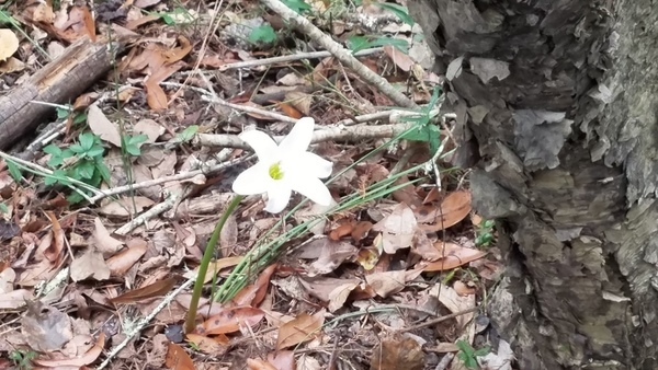
Why is this spring flower blooming in a cold November? This is clearly a Treat’s Rain Lily.
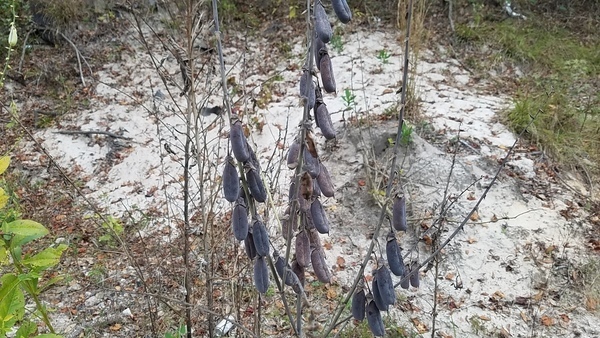
Another invasive exotic, Crotalaria spectabilis Roth, poisonous to cattle. Also called rattlebox, because when its seed pods are dry like this, they rattle in the wind or if you shake them.
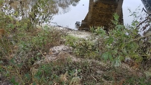
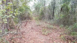
Going back down was easier than it looks.

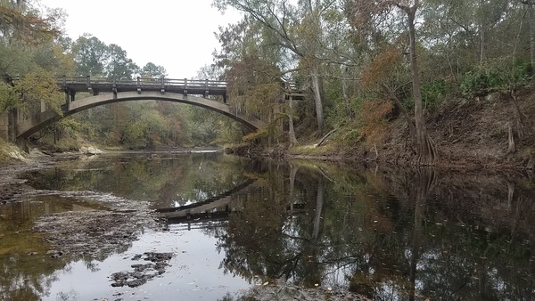
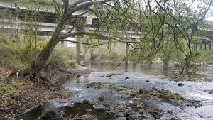
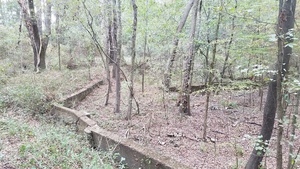
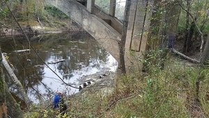
A very pretty bridge. With no traffic, it could remain standing a very long time.
There are still more pictures below of this outing.
For more outings, see the WWALS calendar. We have at least one a month, but I think we’ll avoid three events on the same day in the future.
-jsq, John S. Quarterman, Suwannee RIVERKEEPER®
You can join this fun and work by becoming a WWALS member today!
Shoals, 12:32:04,, Upstream of US 84 30.7939672, -83.4531928
Sloppy hunters, 12:32:19,, Upstream of US 84 30.7939672, -83.4531928
Rapids, 12:32:32,, Upstream of US 84 30.7939672, -83.4531928

Movie: Rapids, 13:28:22, (21M), Upstream of US 84 30.7913497, -83.4568524
US 84 bridge, 12:34:03,, Upstream of US 84 30.7900038, -83.4585197
Stretch of open water, 12:34:07,, Upstream of US 84 30.7900038, -83.4585197
Movie: Waterfall, 14:15:00, (7.6M), Upstream of US 84 30.7897414, -83.4554755
Sand slope, 12:40:48,, Below the downstream bridge 30.7900038, -83.4585197
Across, 12:40:52,, Below the downstream bridge 30.7900038, -83.4585197

RR bridge, 12:41:23,, Below the downstream bridge 30.7900038, -83.4585197
Quitman (US 84) Gauge, 12:43:21,, Below the downstream bridge 30.7900038, -83.4585197
Quitman Gauge portrait, 12:43:27,, Below the downstream bridge 30.7929864, -83.4527534
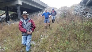
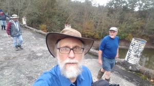
Paul Tolar, Tom Potter, Phil Hubbard, 13:04:59,, Explorers 30.7939477, -83.4524591
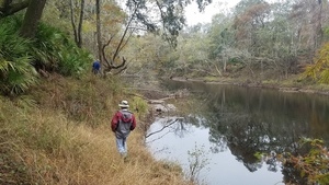
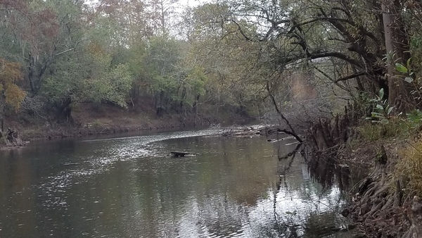
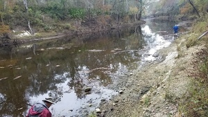
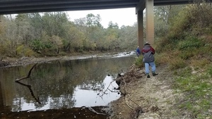
Downstream, 13:12:32,, Explorers 30.7900038, -83.4585197
Cypress knees, 13:14:28,, Explorers 30.7900038, -83.4585197
Sighted, 13:15:32,, Spook Bridge 30.7909541, -83.4631881
From the river, 13:15:41,, Spook Bridge 30.7900038, -83.4585197
Approaching, 13:15:53,, Spook Bridge 30.7915593, -83.4526473
Upstream to RR bridge, 13:15:58,, Spook Bridge 30.7915593, -83.4526473
Deadfall frame, 13:18:59,, Spook Bridge 30.7909541, -83.4631881
Birds and branches, 13:19:19,, Spook Bridge 30.7900038, -83.4585197
Fall bridge, 13:20:05,, Spook Bridge 30.7900038, -83.4585197

Birds not perturbed by our shenanigans, 13:20:38,, Spook Bridge 30.7901551, -83.4615208
Reflected birds, 13:21:08,, Spook Bridge 30.7901551, -83.4615208
Trap? Boat tiedown?, 13:21:40,, Spook Bridge 30.7901551, -83.4615208
Missing railing, 13:22:16,, Spook Bridge 30.7905873, -83.4518152
Reflection and far shore, 13:22:41,, Spook Bridge 30.7905873, -83.4518152
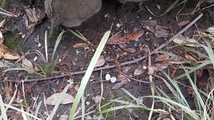
Mussel shell, 13:23:00,, Spook Bridge 30.7905873, -83.4518152
Brooks abutment, 13:23:44,, Spook Bridge 30.7900038, -83.4585197
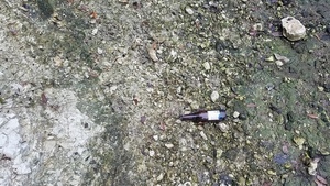
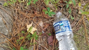
Beer bottle among oyster fossils?, 13:24:13,, Spook Bridge 30.7900038, -83.4585197
Its large, 13:24:19,, Underneath 30.7900038, -83.4585197
Apparently there was a smaller bridge before, 13:24:33,, Underneath 30.7900038, -83.4585197
Looking upstream, 13:25:00,, Underneath 30.7900038, -83.4585197
Oyster fossils?, 13:25:56,, Underneath 30.7900038, -83.4585197
Roots and oyster fossils?, 13:26:13,, Underneath 30.7900038, -83.4585197
Small rapids downstream, 13:26:44,, Underneath 30.7900038, -83.4585197
Cannot see upstream bridges, 13:26:50,, Underneath 30.7896916, -83.4514700
A metal handle?, 13:27:19,, Underneath 30.7913497, -83.4568524
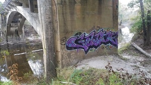
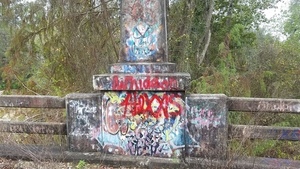
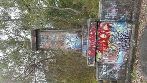
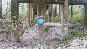
Graffiti, 13:28:10,, Upwards 30.7913497, -83.4568524
Japanese climbing fern, 13:28:39,, Upwards 30.7913497, -83.4568524
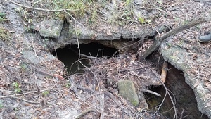
Sinkhole, 13:28:52,, Upwards 30.7913497, -83.4568524
Power line across the river, 13:30:24,, Upwards 30.7900038, -83.4585197
Power line going east, 13:30:28,, Upwards 30.7900038, -83.4585197
Road up, 13:30:29,, Upwards 30.7900038, -83.4585197
Road out, 13:31:15,, Upwards 30.7897349, -83.4514089
To the bridge, 13:31:18,, Upwards 30.7897349, -83.4514089
Concrete, 13:31:38,, Upwards 30.7897349, -83.4514089
Step down and up, 13:31:44,, Upwards 30.7897349, -83.4514089
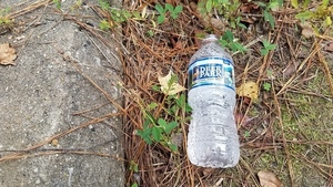
Deer Park water bottle, 13:32:26,, Upwards 30.7895772, -83.4513558
Nestled out of Florida springs, 13:32:30,, Upwards 30.7895772, -83.4513558
Colors and vines, 13:32:43,, On top 30.7895772, -83.4513558
Woods, 13:32:53,, On top 30.7895772, -83.4513558
Railing, 13:33:01,, On top 30.7895772, -83.4513558
Arching limbs, 13:33:08,, On top 30.7926825, -83.4478480

Downstream, 13:33:40,, On top 30.7897463, -83.4512836

Upstream, 13:33:45,, On top 30.7897463, -83.4512836
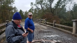
Tom and Phil are pleased, 13:33:48,, On top 30.7909541, -83.4631881
Lets go see Wade Spring, 13:34:04,, On top 30.7909541, -83.4631881
Graffiti, 13:34:20,, On top 30.7900038, -83.4585197

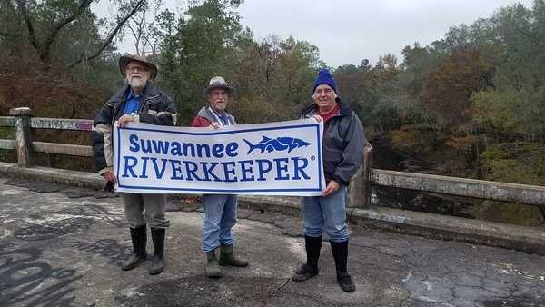
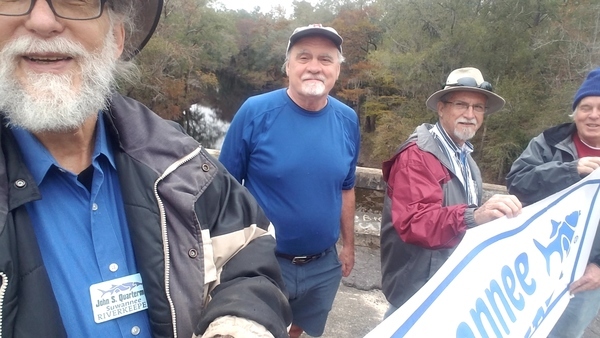
Banner selfie, 13:36:10,, On top 30.7900000, -83.4583333
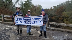
Banner, 13:36:38,, On top 30.7900038, -83.4585197
Fancy colors, 13:37:55,, On top 30.7898374, -83.4518126
Portrait colors, 13:37:57,, On top 30.7898227, -83.4521352
North side, 13:39:24,, Slough 30.7898227, -83.4521352
South side, 13:39:26,, Slough 30.7909541, -83.4631881
Selfie, 13:39:41,, Slough 30.7897222, -83.4530556
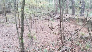
Overgrown pool, 13:45:04,, Wade Spring 30.7897245, -83.4532784
Culvert, 13:45:06,, Wade Spring 30.7897245, -83.4532784
Pool edge, 13:45:09,, Wade Spring 30.7897245, -83.4532784
The spring, 13:46:52,, Wade Spring 30.7897245, -83.4532784
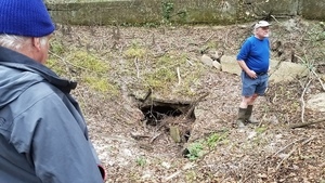
Completely dry, 13:47:08,, Wade Spring 30.7909541, -83.4631881
Pool steps, 13:48:25,, Wade Spring 30.7897245, -83.4532784
Spring with cypress knees, 13:48:40,, Wade Spring 30.7897245, -83.4532784
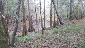
Cypress pond, 13:49:13,, Wade Spring 30.7902049, -83.4557045
Pond chimney, 14:05:52,, Wade Spring 30.7969513, -83.4545180
Fish beds?, 14:06:02,, Wade Spring 30.7969513, -83.4545180
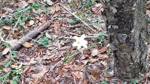
A spring flower blooming in a cold November, 14:07:57,, Flower and road 30.7900038, -83.4585197
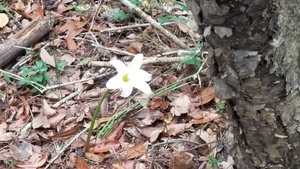
Treats Rain Lily, 14:08:03,, Flower and road 30.7900038, -83.4585197
Up and out, 14:09:46,, Flower and road 30.7900038, -83.4585197
Phil went through the culvert, 14:11:47,, Flower and road 30.7900038, -83.4585197
Crotalaria, 14:15:00,, Rattlebox 30.7897414, -83.4554755

Crotalaria spectabilis Roth, 14:15:18,, Rattlebox 30.7897414, -83.4554755
Tom Below, 14:24:39,, Back down 30.7909541, -83.4631881
Pyramid, 14:25:07,, Back down 30.7909541, -83.4631881
Downstream, 14:25:34,, Back down 30.7909541, -83.4631881
Upstream, 14:25:39,, Back down 30.7909541, -83.4631881

Hindsight, 14:27:36,, Back down 30.7909541, -83.4631881
Bridge, 14:39:03, US 84
The way up, 14:39:44,, US 84 30.7900038, -83.4585197
Contemplating, 14:39:55,, US 84 30.7934837, -83.4533991
Short Link: