Update 2022-03-15: Due to high water, replaced by
Hike: Bell Springs to Big Shoals, Suwannee River 2022-03-19.
Join us for a geologic education paddle through millions of years, on a scenic two-mile stretch
of the Suwannee River.
Led by Practicing Geologist Dennis J. Price of Hamilton County, Florida,
we will pass White Sulphur Spring, the first Floridan Aquifer Spring encountered on the Suwannee River.
Once you land, you can go on up to the Wild Azalea Festival!
The festival is conveniently located at the corner of Spring and Bridge Street, 10499 Spring St, White Springs, FL 32096.
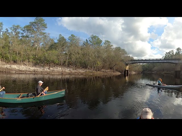
![[US 41 Bridge past FL 136 Bridge, Suwannee River, White Springs, Florida]](https://www.wwals.net/pictures/2022-03-19--white-springs-bridge-to-bridge-suwannee-river/map.jpg)
US 41 Bridge past FL 136 Bridge, Suwannee River, White Springs, Florida
Dennis Price explains, “For millions of years, Florida was a limestone platform not connected to the now North American continent. For eons the limestone bed would emerge, the bed surface would erode then sink again, several times. Each time the limestone would build again with a different set of fossils. The last limestone bed to deposit was the Suwannee Limestone. Florida thru this time was separated from the continent by the Suwannee Straits, similar to the Florida straits separating Florida from Cuba. Erosional sediments from the continent was slowly filling the Straits and when finally filled, sediments began covering the limestone that was Florida. These sediments are known as the Hawthorne formation today.”
When:
Gather 8 AM, launch 8:30 AM, end 10 AM, Saturday, March 19, 2022
Put In:
Suwannee River Wayside Park Ramp @ US 41.
From White Springs, travel south on US 41 to the river; the ramp is on the south side in the town park, in Hamilton County.
This is where the Suwannee River Wilderness Trail officially starts,
although the WWALS web pages and map include the entire river up into Georgia and the Okefenokee Swamp.
GPS: 30.3255, -82.739167
,
Take Out:
Stephen Foster Folk Culture Center State Park Launch, 11016 Lillian Saunders Drive/U.S. Highway 41, White Springs FL 32096.
$5.00 per vehicle (up to 8 people) State Park entry fee.
White Sulphur Springs is after the second bridge but before the takeout.
It was one of the first tourist attractions in Florida.
Nowadays you can visit the empty bathhouse,
see the trickle of water coming out,
and
read what Dennis wrote:
The NFRWSP’s job is to figure out how to increase water levels in the aquifer. –Dennis J. Price 2016-12-12.
Bring: the usual personal flotation device, boat, paddles, food, drinking water, warm clothes, and first aid kit.
Also trash pickers and trash bags: every WWALS outing is also a cleanup.
Mosquitoes can be bad at dusk so come prepared.
Free: This outing is free to WWALS members, and $10 (ten dollars) for non-members.
You can pay the $10 at the outing, or online:
https://wwals.net/outings
We recommend you support the work of WWALS by
becoming a WWALS member today!
https://wwals.net/donations/#join
Continue reading →

![[Trash in water, No Dumping sign, trash where no fence]](https://www.wwals.net/pictures/2022-02-26--flying-j-trash/many.jpg)
![[Paddlers, banners, sunset, moonrise]](https://www.wwals.net/pictures/2022-02-16--pictures-banks-lake-full-moon/many.jpg)
![[US 41 Bridge, Little Alapaha River, Suwannee River, Alapaha River Rise]](https://www.wwals.net/pictures/2022-02-05--last-stretch-alapaha-pictures/many.jpg)
![[Gretchen Quarterman at Planning Commission, aquifer recharge zone, sinkholes]](https://www.wwals.net/pictures/2022-02-08--loco-sprawl/many.jpg)
![[Moonrise --Shirley Kokidko]](https://www.wwals.net/pictures/2021-12-18--banks-lake-full-cold-moon-pictures/sk-moonrise-269436667_10227002787639794_4574390632223567606_n.jpg)
![[Distributary, Swallet, Sinkhole]](https://www.wwals.net/pictures/2022-01-07--chitty-bend-east-distributary-shirley-kokidko/many.jpg)
![[Roline, Gator, Turner Bridge, Byerly Creek]](https://www.wwals.net/pictures/2021-12-16--roline-fl-6-suwannee-pictures/many.jpg)
![[Sunset big sky]](https://www.wwals.net/pictures/2021-12-18--banks-lake-full-cold-moon-pictures/20211218_173257.jpg)