Category Archives: creeks

WWALS July 19 outing.

Update 2014-07-17: River water too low. Outing instead at 8:30AM Saturday 19 July 2014 at Banks Lake.

We should be @ Gaskins Environment Education Center By noon so we can put in @ 12:30 on the Alapaha River upstream and back paddle. Time on water: 2 hr. Tour the center before or after paddle. The Gaskins Forest Education Center is location @ 3359 Moore Sawmill Rd, Alapaha, GA 31622. Alternate if water too low: Banks lake at Ga. hwy 122.

Proposed EPA Water rule

The U.S. Environmental Protection Agency proposes some new rules to clarify Clean Water Act protection. Some people and organizations have concerns about that, and the EPA has now responded to those concerns. Comment periods are still open for you to provide input directly to EPA about the proposed rule.

Here’s the EPA’s Waters of the United States Proposed Rule. EPA says clarification of the Clean Water Act was requested by a broad range of state, tribal, and local government agencies and elected officials and NGOs, ranging from AASHTO to the National Association of State Foresters. One of the two examples EPA cites of state enforcement problems is on the Flint River in Georgia:

Recreation in Lake Blackshear, Georgia

Continue reading

Outing at Avera’s Mill Pond (Lewis Lake)

Lewis Lake, site of today’s outing at 4PM, is Avera’s Mill Pond. According to Wenda Gaile Bailey, “there was a partial draining of the lake late last year”, but she checked the water level yesterday. Here’s some history, and some pictures from five years ago of what you may see today.

WG Bailey wrote for WG Bailey photos, unknown date, Old Fashioned Pond Draining at Lake Lewis,

Avera’s Mill Pond, the oldest and largest pond in Berrien County, was founded by William M. Avera, son of pioneer, Daniel Avera, covers 1470 acres, and was built in the 1870’s at a cost of $3800.87

The mill dam is located Continue reading

Grants to clean up two creeks in south Georgia

Funds are available for farmers, ranchers, and forest owners to help clean up two creeks in WWALS watersheds: Deep Creek in Turner County, a tributary of the Alapaha River, and Piscola Creek in Thomas and Brooks Counties, a tributary of the Withlacoochee River. The deadline for applications is May 16th.

WCTV via AP 5 April 2104, Georgia to Clean Up Waterways, Continue reading

How Many Trees Does It Take to Protect a Stream?

Stroud Water Center wrote in their Upstream Newsletter, VOL. 2014, ISSUE 1, February 2014,

Scientists Set Buffer Width Minimum Standard.

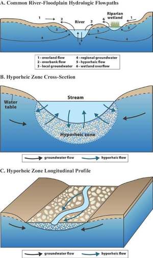
A strip of forest along a stream channel, also called a riparian forest buffer, has been proposed and used for decades as a best management practice to protect streams by filtering out contaminants from agriculture and other land uses before they can enter them.Their benefits are many, but one benefit has dominated social and political conversations, and that is their role in preventing contaminants from entering streams.

20140317-140845.jpg
Stroud Center Director Bern Sweeney practicing what he preaches at a tree planting event. Photo: David Arscott

A few years ago, Stroud Water Research Center proposed that riparian forest buffers also play another important role by Continue reading