Category Archives: Outing

WWALS February outing is cancelled.

20140221-211322.jpg

WWALS February outing scheduled for tomorrow the 22nd has been cancelled. It was planned to be on the Alapaha River. The launching point would have been from the HWY 84 bridge near Naylor to the landing point at Mayday bridge on Howell Rd. near Howell. It is an 11.1 mile section of the Alapaha with rapids and a small waterfall. We hope to enjoy this trip sometime in the future. At this time, the water levels on the Alapaha River are rising. The level at the HWY 84 bridge is currently over 11′ with a fast moving current. Unfortunately, high water and fast currents are not safe for recreational canoeing and kayaking. It would be great to see all WWALS members at our scheduled outing for next month! The Second Annual Big Little River Paddle Event scheduled for March 22nd at 9:30AM. -CLG

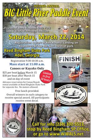
Second annual BIG Little River Paddle Event

Update 15 Feb 2014: You can also apply to Sponsor (Gold, Silver, or Bronze) on the event page.

A fundraiser for nonprofits Friends of Reed Bingham State Park and WWALS Watershed Coalition, this is a scenic three mile flatwater paddle on the Little River from Red Roberts landing (at Rountree Bridge, 31 11 32.05 N 83 31 13.25 W) in the north end of the park, to the boat ramp on the Colquitt Co. side of the park lake (park map).

You can do it as a race, or as a scenic leisure paddle. Cost is $25 per boat if you register before March 15, and $30 per boat after that (registration includes park day pass/admission). You must either provide your own boat or rent one at the park (separate fee). Participants get a free shuttle and lunch. Fastest boats in various categories win a prize. Registration is at Red Roberts landing between 9:30 and 10:30 a.m. (to allow time for a shuttle). Mass start at 11 a.m.

You can sign up and pay online. Continue reading

Alapaha River at Statenville: January WWALS Outing

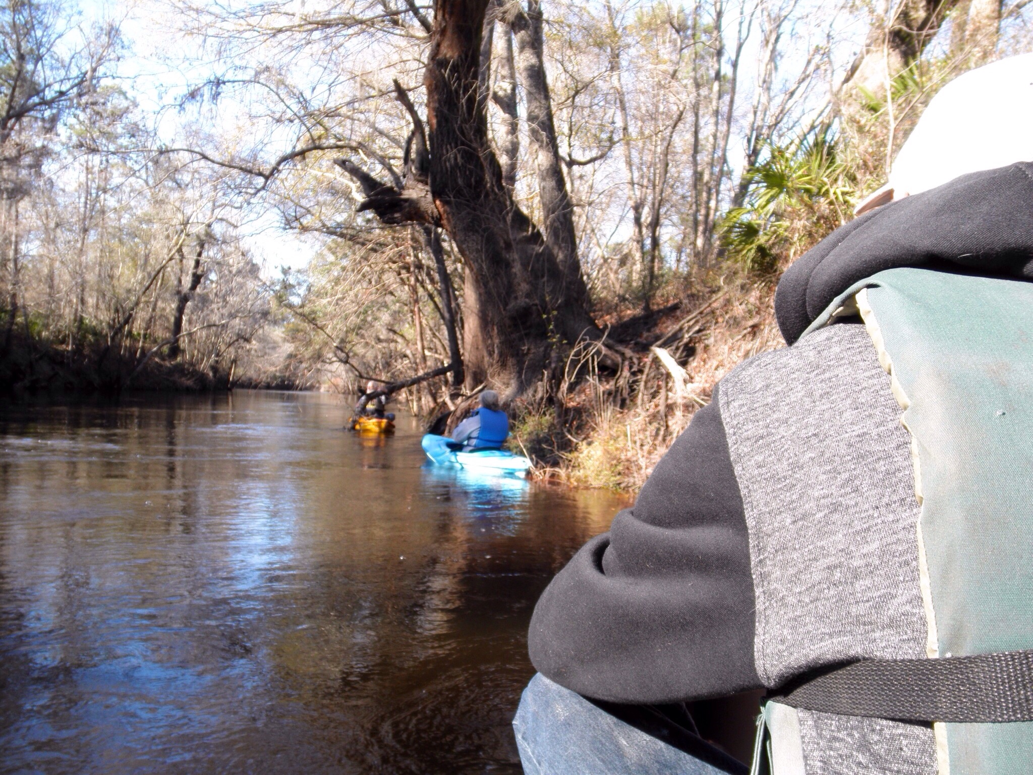
Meet at the boat ramp/parking lot on the left just before you get to Statenville heading east on Hwy 94 at 1:30. Boat launch is at 2. We will paddle upstream for 30 to 45 min. and then float back down. The river will likely be up, so it should be a work out.

The river water temperature is currently 50 degrees Fahrenheit, so dress warmly. The Alapaha River at Statenville is currently at 9 feet and rising, which is well above the level recommended by Brown’s Guide for this river.

Jungle-like in its remoteness and luxurious with exotic vegetation, the dark reddish-brown waters of the Alapaha wind through a swampy wonderland teeming with wildlife. Signs of habitation are rare along the river’s course; only a few isolated cabins intrude on the remote tranquility.

Here’s a map: Continue reading

Alapahoochee River

Proposed for the WWALS January 2014 outing: the river most people know nothing about, from the convergence of Mud Swamp Creek where Grand Bay Creek forms the border between Lowndes County and Echols County in Georgia east of Valdosta, about 14 miles through Echols County between Lake Park and Statenville, to the Alapaha River in Hamilton County, Florida east of Jennings: the Alapahoochee River.

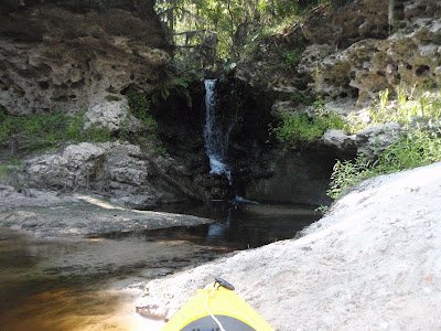
It has a waterfall, limestone caves, and boat ramps, all pictured by South Georgia Kayak Fishing 3 September 2011 in Alapahoochee convergence at Alapaha River – Jennings, FL.

Here’s a brief day paddle description, Florida whitewater, Alapahoochee River Grand Bay Canal), by riverfacts.com:

Echols / Hamilton county, GA SR 135 to FL SR 150 on Alapaha section whitewater kayaking, rafting, and paddling information.

This stretch of Alapahoochee River Grand Bay Canal) in Echols / Hamilton County is 4.5 miles long and is according to American Whitewater a class II section of whitewater.

They include a map.

Continue reading

WWALS Outing: Rivers Alive Little River Clean Up 2013-09-28

8AM to 1PM this coming Saturday at Reed Bingham State Park, it’s also the September WWALS outing now: Rivers Alive Little River Clean Up. Bring your canoe or kayak or rent one there for half price to volunteers!

Explore Georgia wrote:

We will be removing trash from the Little River and Reed Bingham Lake. Experienced canoeists and kayakers have the opportunity to paddle down the little river while picking up garbage. Canoes and kayaks are available to volunteers for half off. Please register in advance to ensure your rental spot is available. Non-boaters can walk around and in the lake and river picking up garbage and debris. $5 parking. 229-896-3551.

WWALS will be participating in the boating part. You can let us know you’re coming by joining the WWALS facebook event. Or Continue reading

Paddle the Alapaha at US 82 2PM Saturday 27 July 2013

Join WWALS on our monthly outing, on the exotic Alapaha River:

Jungle-like in its remoteness and luxurious with exotic vegetation, the dark reddish-brown waters of the Alapaha wind through a swampy wonderland teeming with wildlife. — Alapaha River Paddling Guide, by Suzanne Welander

Yet it’s right here in Berrien County, Georgia, only an hour’s drive from Valdosta and less from Adel, Lakeland, Tifton, etc.

Meet at the intersection of Hwy 82 bridge and the Alapaha River, about 2 miles east of Alapaha, GA.

Park cars at the top near a derelict brick building (south of highway). There is a road down to the river but it is badly washed out so you probably want to take a look before you drive down.

We’re planning to paddle upstream a ways and then float back down.

Join the facebook event or just come paddle!

-jsq

Withlacoochee River from Nankin Landing to GA 31: WWALS June Outing 2013-06-22

A few pictures from today’s WWALS Outing on the Withlacoochee River from Clyattville-Nankin Road to GA 31, with 12 people in 8 boats (4 kayaks, 4 canoes).

Gage height, US 84 Quitman: 3.25 feet (86.75 feet NAVD 1988).

Withlacoochee River at Clyattville-Nankin Landing:

Withlacoochee River at Clyattville-Nankin Landing

Heather sets out:

Heather sets out

Continue reading

Withlacoochee River Outing: Clyattville-Nankin Road to GA 31

The June WWALS outing is from Clyattville-Nankin Road to Horn Bridge on Sun tree Madison Highway (GA 31) on the Withlacoochee River. Meet at the Clyattville-Nankin Road putin at 9AM, put in at 10AM, Saturday, 22 June 2013. Join the facebook event if you like. See you there!

Update 20 June 2013: How are we getting back to our vehicles with this trip? We’ll deposit all the boats at the put-in (Clyattville-Nankin Road), take most of the vehicles down to the take-out (Horn Bridge on Madison Highway aka GA 31), carpool in a few vehicles back to the put-in, and float down the river.

Tom Baird described this nine-mile two-hour trip as:

The section includes where Clyatt Mill Creek enters, a truly fun set of rapids (two drops) at the Ga – Fla border, a very nice Second Magnitude Spring (that I have yet to find the correct name), the remains of the enormous abandoned trestle over the river of the Georgia & Florida Railroad, or Ole God Forsaken as it was nicknamed, the ghost town of Olympia on the Georgia side, and several Indian quarry sites. It is along this section that the river cuts deeply enough that the banks switch from sand banks to limerock cliffs. Paddle distance is about 9 miles, so a little over two hours paddling time. There are plenty of places to stop and look around.

There are shoals right at the state line, so beware, esp. if you’re in a canoe. The book Canoeing and Kayaking Georgia, by Susanne Welander, Bob Sehlinger, and Don Otey (2004) says: Continue reading

Your pictures of Georgia outdoors

Got pictures of a designated Wilderness Area in Georgia? Send them to the Georgia Sierra Club by June 1 with $25 for the 2013 Wilderness Georgia Photo Contest or by November for the Smithsonian Photocontest 2013 or bring them to the silent auction tomorrow at the WWALS Janisse Ray fundraiser in Tifton.

A few excerpts: Continue reading