American Rivers
released Wednesday its list of
America’s Most Endangered Rivers® 2013,
and our neighbor to the west, the Flint River, is on it.
Some of the Flint’s problems are the same as in our WWALS watersheds,
including
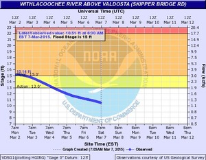
drought and floods.
The writeup doesn’t mention it, but I think
the arsenic wellwater problem
extends over there, too.
The Flint does have Atlanta at its headwaters,
and Flint Riverkeeper and others just had to fight off
a legislative attempt to frack Flint water for Atlanta.
However,
the overpumping problem was apparently already much worse
in parts of our watersheds way back in 1980.
And the Flint doesn’t have
the Lowndes County Commission, which prefers to
close its only public access to the Alapaha River
rather than
listen to 350 people wanting to keep it open for demonstrated
public uses. -jsq
American Rivers
released Wednesday its list of
America’s Most Endangered Rivers® 2013,
and our neighbor to the west, the Flint River, is on it.
Some of the Flint’s problems are the same as in our WWALS watersheds,
including
drought and floods.
The writeup doesn’t mention it, but I think
the arsenic wellwater problem
extends over there, too.
The Flint does have Atlanta at its headwaters,
and Flint Riverkeeper and others just had to fight off
a legislative attempt to frack Flint water for Atlanta.
However,
the overpumping problem was apparently already much worse
in parts of our watersheds way back in 1980.
And the Flint doesn’t have
the Lowndes County Commission, which prefers to
close its only public access to the Alapaha River
rather than
listen to 350 people wanting to keep it open for demonstrated
public uses. -jsq
At Risk: Water supply for communities, farms, recreation, and wildlife
Threat: Outdated water management
The Flint River provides water for over one million people, 10,000
farms, unique wildlife, and 300 miles of exceptional fishing and
paddling. Despite being in a historically wet area of the country,
in recent years many Flint River tributaries are drying up
completely and the river’s low flows have dropped dramatically.
American Rivers and Flint Riverkeeper are working in collaboration
with diverse partners to restore the flows and health of the Flint.
The State of Georgia also has a role to play and must act to protect
the Flint in droughts and at all times to safeguard the river’s
health for today and future generations.
The Threat
The Flint is a river running dry. The reasons are many, and include
Continue reading →

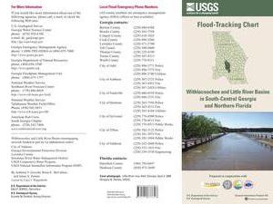
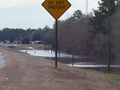
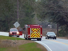
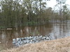
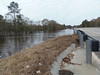
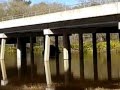
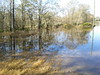
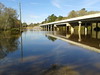
 National Weather Service Tallahasee, FL 240 PM EST THU MAR 5 2015,
Spring Flood Potential Outlook for Southeast Alabama, Southwest
and South Central Georgia, and the Florida Panhandle and Big Bend,
National Weather Service Tallahasee, FL 240 PM EST THU MAR 5 2015,
Spring Flood Potential Outlook for Southeast Alabama, Southwest
and South Central Georgia, and the Florida Panhandle and Big Bend,