Tag Archives: GA 122

GA 122 @ Withlacoochee River 2017-05-17

A clearcut near the Withlacoochee River at GA 122 in Lowndes County, Georgia, led to some visual observations.

School bus heading west
School bus westbound on Hagan Bridge over the Withlacoochee River.

The clearcut starts east of the river and west of Hambrick Road. Here you can see the entrance to it from GA 122: Continue reading

Berrien Beach Landing (GA 168) to Lakeland (GA 122), WWALS Outing 2017-02-11

12 + 4 boats and about 18 paddlers went even faster down the Alapaha River than we expected: six hours on the water between GA 168 and GA 122, including a lunch stop. That’s about 3 miles per hour on a chilly morning and a fine breezy warm day. And there were bon-bons and kumquats!

WWALS banner by Gretchen Quarterman
WWALS banner at lunch stop; picture by Gretchen Quarterman for WWALS.

Lots of native vegetation, no invasive species, some birds (buzzards, ducks, heron, flycatcher, cardinals), no animals on the land or in the water. People fishing at Lakeland said they didn’t even get a nibble. I did see a few fish beds below a creek confluence.

The water level was Continue reading

Sabal Trail erosion and waterlogged, Brooks County, GA 2017-01-23

End of pipe in water, CR 146, towards Tallokas Road 30.9873162, -83.6535762 Is that pipe supposed to be wallowing in water? Is that end supposed to be in the water? What about the obvious erosion? Remember Sabal Trail is only burying its 36-inch pipe 36-inches deep most places. Erosion could expose it and make it even more likely to corrode.

WWALS video playlist and more pictures below. Continue reading

Okapilco Creek flooding @ GA 122 2017-01-23

Narrow Bridge 30.9955325, -83.6041529 Half a mile wide: Okapilco Creek one week ago on GA 122 between Barney and Pavo, Georgia.

Usually you have to peer down into the woods to see if you can see any water in the creek. After the recent storms, you could see water beside the highway half a mile before you got to the creek bridge.

WWALS video: Continue reading

GA 168 (Berrien Beach) to GA 122 (Lakeland) Alapaha River Outing 2017-02-11

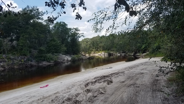
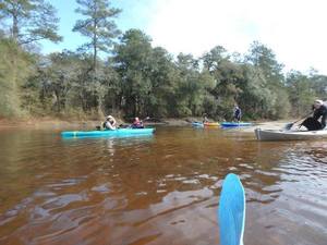
Long, but if the water is high, should be fast: 16 1/2 miles from Berrien Beach Landing to Lakeland Boat Ramp on the lovely wild Alapaha River Water Trail. 
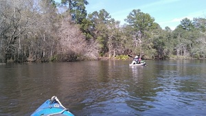
As long as the rains keep coming, the river should be high and it should take less time than the usual estimate of eight hours. Bring the usual personal flotation device, boat paddles, food, drinking water, warm clothes, and first aid kit. There is no good place to take out before the end point, so be prepared to paddle all day.

When: 7:00AM, Saturday, February 11th, 2017

Put In: Berrien Beach Ramp, on GA 168 east of Nashville, Berrien County, Georgia, at 31.159076, -83.045554. Continue reading

Cook County Landing (GA 76) to Folsom Bridge (GA 122), Little River 20162017-01-14

Not a great boat ramp but public access it is. In January the water should be up like a year ago at this three-hour tour of the idyllic Little River between Brooks County and Cook and Lowndes Counties, Georgia. There should be no need to drag boats, like there was in July.

When: 10 AM Saturday January 14th 2017

Put In: Cook County Landing (GA 76) between Adel, Cook County and Barney, Brooks County, Georgia

GPS Coordinates: Continue reading

Withlacoochee River with water @ GA 122, 2016-09-07

It does rain some times. Back in September at Hagan Bridge on GA 122 over the Withlacoochee River in Lowndes County, Georgia on the Withlacoochee and Little River Water Trail. The USGS gage at Skipper Bridge read 8 feet (128.5 NAVD).

-jsq

You can join this fun and work by becoming a WWALS member today!

Upstream 31.0135720, -83.3016070

Upstream

Downstream 31.0132885, -83.3015747

Continue reading

Little River Scouting 2016-07-10

My phone’s pedometer said I walked four miles of the six miles of this section of the Little River, with many fish, two white birds, lots of sand bars, some eroded bluffs, not a lot of trash after we got beyond the GA 76 bridge, and only one spot of invasive species (Japanese climbing fern).

Walk along home

This section would be better with about half a foot more water. The USGS GA 122 Little River gage showed about 3.71 feet for July 10th 2016, so let’s say at least 4.2 feet would be good. This is because there are many sand bars, including one directly upstream from the GA 122 bridge, where the water level is much closer to zero when that gage says 3.71.

Following up a report, Continue reading

Hutchinson Mill Creek at Withlacoochee River, GA 122

Deadfalls on this creek, backing up flood waters onto Skipper Bridge Road forcing a bridge to close in 2009, Movie: Hutchinson Mill Creek (2.0M) 31.0155182, -83.3020477 were one reason for the formation of WWALS. Here are some pictures and a very brief movie.

In a typical day for a Waterkeeper®, starting slow after a road trip to Atlanta the previous day with several Riverkeepers and other environmental organizations, I was preparing for the movie in Live Oak Friday evening when I got a message from Noelani Mathews wanting an interview about the pipeline movie. As I threw a kayak in the truck, the Yellow Dog hopped in, and Continue reading