Tag Archives: Japanese climbing fern

Arnold Springs, Mozell Spells, Withlacoochee River 2017-10-14

Update 2025-10-13: better picture format, and links to the previous parts.

A fine fall day on the Withlacoochee River with WWALS Watershed Coalition and Suwannee Riverkeeper, diving and landowners at Arnold Springs, Old Clyattville Road Bridge, exotic invasive Japanese Climbing Fern, Horn Bridge. and Mozell Spells (State Line Ramp). Thanks to all who came to paddle from as far as two hours from Gainesville, Florida and four hours from Pine Mountain, Georgia.

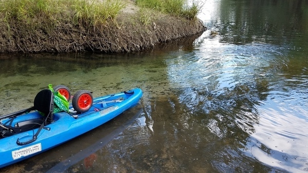
[Clear spring water, 2017-10-14, 15:13:01, 30.6410851, -83.3367726 --jsq for WWALS]
Clear spring water, 2017-10-14, 15:13:01, –jsq for WWALS 30.6410851, -83.3367726
Blue-green Arnold Springs water meets tea-colored Withlacoochee River water.

The Quitman Gauge (US 84) read 2.17 feet (85.67 NAVD88), which was slightly above our recommended low level, and just fine for Arnold Springs. Here are some pictures and a Google Map. A few videos will follow.

This part of the outing was all in Georgia, but we paddled downstream from Florida to get there; see Continue reading

Shoals into out of Florida, Withlacoochee River 2017-10-14

The Withlacoochee River goes into and out of Florida twice before it makes up its mind. We saw karst, shoals, and rapids, into Florida and back to Georgia all downstream, Valdosta Railway Trestle, Madison County Four Freedoms Trail, and exotic invasive Japanese Climbing Fern, on a fall day on the Withlacoochee River with WWALS.

[White water, 2017-10-14, 13:58:34, 30.63457, -83.34178 --jsq for WWALS]
White water, 2017-10-14, 13:58:34, –jsq for WWALS 30.6345700, -83.3417800

This is Part 2, after Continue reading

Cleanup and outing, Nankin, Mcintyre and Arnold Springs, Mozell Spells, Withlacoochee River 2017-10-14

Update 2025-10-13: improved image format, and separated the shoals into another post.

Tires and trash cleaned up at Nankin Boat Ramp, saw Clyatt Mill Creek, and swimming and diver tales at McIntyre Spring. This was also a Georgia Rivers Alive cleanup, all on a fall day on the Withlacoochee River with WWALS Watershed Coalition and Suwannee Riverkeeper. Thanks to all who came to paddle from as far as two hours from Gainesville, Florida and four hours from Pine Mountain, Georgia.

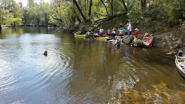
[A free diver, 2017-10-14, 12:47:33, 30.6416153, -83.3661699 --jsq for WWALS]
A free diver, 2017-10-14, 12:47:33, –jsq for WWALS 30.6416153, -83.3661699

Here are some pictures. There are more in the following two parts. Continue reading

Sulak’s Defeat at Jennings Defeat 2020-08-26

Explorer Dr. Ken Sulak has solved an Alapaha River rapids naming mystery. He recounts:


So in 1797, Samuel Taylor Coleridge wrote a poem inspired by a dream.

Where Alph, the sacred river, ran
Through caverns measureless to man
   Down to a sunless sea.

So twice five miles of fertile ground
With walls and towers were girdled round:
And there were gardens bright with sinuous rills,
Where blossomed many an incense-bearing tree;
And here were forests ancient as the hills,
Enfolding sunny spots of greenery.

Insert three ‘A” and the dreamscape river becomes the Alapaha, and appropriately so. Yesterday, I embarked on the foolish idea of a solo kayak journey up 3 miles of the Alapaha from Sasser Landing (just below the confluence of the Alapaha and the Alapahoochee rivers) to the site of the 1800s Roebucks Ferry and later Roebucks Bridge.

[Jennings Defeat Rapids, Ogeechee Gum, GS&F RR trestle below CR 150]
Jennings Defeat Rapids, Ogeechee Gum, GS&F RR trestle below CR 150

That crossing brought settlers and other travelers from Jacksonville and Fernandina along the GA/FL border across the Alapaha to Miccotown, the old Seminole Indian town in the triangle of land protected by the two flanking rivers. The road/trail (gone now on both sides) continued west across the Alapahoochee at the site of the early 1900s Beatty Bridge (undoubtedly preceded in the mid-1800s by an undocumented ferry), and on to Hickstown in Madison County and westward. Miccotown became the first county seat of Hamilton County as the settlers suppressed the Seminoles and the old Indian town faded into obscurity in 1839. Continue reading

Arnold Springs, Mozell Spells, Withlacoochee River 2017-10-14

A fine fall day with diving and landowners at Arnold Springs, Old Clyattville Road Bridge, exotic invasive Japanese Climbing Fern, Horn Bridge, and Mozell Spells (State Line Ramp): on the Withlacoochee River with WWALS Watershed Coalition, Suwannee Riverkeeper. Thanks to all who came to paddle from as far as two hours from Gainesville, Florida and four hours from Pine Mountain, Georgia.

Clear spring water, 15:13:01,, Arnold Springs
Blue-green Arnold Springs water meets tea-colored Withlacoochee River water.

The Quitman Gauge (US 84) read 2.17 feet (85.67 NAVD88), which was slightly above our recommended low level, and just fine for Arnold Springs. Here are some pictures and a Google Map. A few videos will follow.

This part of the outing was all in Georgia, but we paddled downstream from Florida to get there; see Continue reading

Cleanup and outing, Nankin, Mcintyre and Arnold Springs, Mozell Spells, Withlacoochee River 2017-10-14

Update 2025-10-13: replaced by a post in better image format.

Tires and trash cleaned up at Nankin Boat Ramp, swimming and diver tales at McIntyre Spring, a creek, karst, shoals, and rapids, into Florida and back to Georgia all downstream, Valdosta Railway Trestle, Madison County Four Freedoms Trail, and exotic invasive Japanese Climbing Fern, all on a fall day on the Withlacoochee River with WWALS Watershed Coalition, Suwannee Riverkeeper. Thanks to all who came to paddle from as far as two hours from Gainesville, Florida and four hours from Pine Mountain, Georgia.

A free diver, 12:47:33,, McIntyre Spring

The Quitman (US 84) Gauge was at about 2.6′ (86′ NAVD88).

Here are some pictures.

This post is just the first part; more pictures will follow are posted with diving and landowners at Arnold Springs, Old Clyattville Road Bridge Horn Bridge, and Mozell Spells (State Line Ramp). and a Google Map, and a few videos are still to come.

These are some of our many favorite spots on the Withlacoochee and Little River Water Trail.

Watch wwals.net for more outings are they are announced, or the WWALS outings and events web page. We have outings at least once a month.

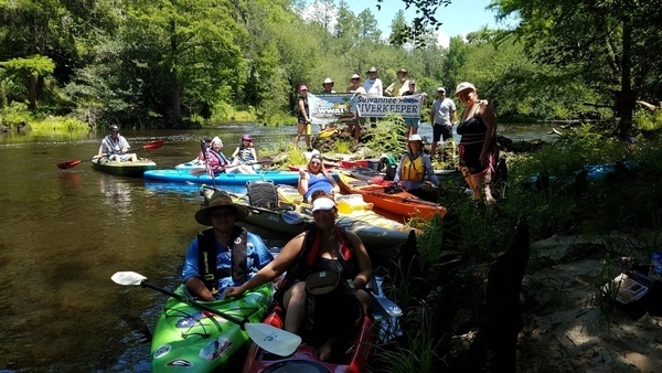
Banner and fourteen picker-uppers, 09:55:21,, Georgia Adopt-A-Stream Cleanup 30.6749200, -83.3939200

Continue reading

A fine day on the Withlacoochee River from Sullivan Landing to Madison Blue Spring 2017-06-24

Nineteen paddlers had a good time on a breezy summer Withlacoochee River Saturday from Sullivan Launch to Madison Blue Spring. The water was a foot higher (41.27 feet) than two years ago (42.56 feet at the USGS Madison (FL 6) gage), but there were still plenty of rapids, which gained us three new Fallers!

Banners picture, Say water bottle! No, don’t, you’ll fall in! Hm, but then you’ll win a Fallers Award.

Every WWALS outing is also a cleanup, and we collected Continue reading