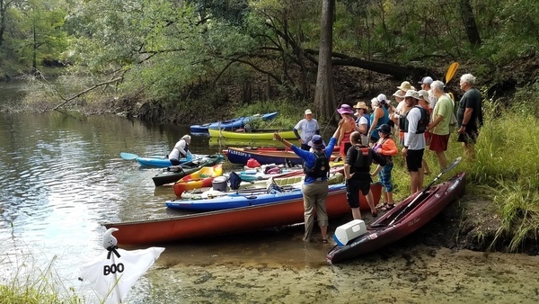
A fine fall day with diving and landowners at Arnold Springs, Old Clyattville Road Bridge, exotic invasive Japanese Climbing Fern, Horn Bridge, and Mozell Spells (State Line Ramp): on the Withlacoochee River with WWALS Watershed Coalition, Suwannee Riverkeeper. Thanks to all who came to paddle from as far as two hours from Gainesville, Florida and four hours from Pine Mountain, Georgia.
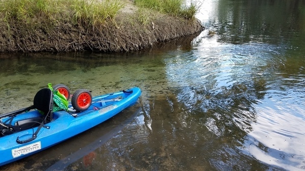
Blue-green Arnold Springs water meets tea-colored Withlacoochee River water.
The Quitman Gauge (US 84) read 2.17 feet (85.67 NAVD88), which was slightly above our recommended low level, and just fine for Arnold Springs. Here are some pictures and a Google Map. A few videos will follow.
This part of the outing was all in Georgia, but we paddled downstream from Florida to get there; see previous post about tires and trash cleaned up at Nankin Boat Ramp, swimming and diver tales at McIntyre Spring, a creek, karst, shoals, and rapids, into Florida and back to Georgia all downstream, Valdosta Railway Trestle, and Madison County Four Freedoms Trail.
These are some of our many favorite spots on the Withlacoochee and Little River Water Trail.
Watch wwals.net for more outings are they are announced, or see the WWALS calendar or the WWALS outings and events web page. We have outings at least once a month.
Yay, 14:50:21,, Arnold Springs 30.6412291, -83.3364876
One of only six second magnitude springs in Georgia, Arnold Springs at Withlacoochee River mile 29.06 is about two and a half miles below McIntyre Spring at mile 31.46; see previous post.

Photographer getting ready, 14:50:22,, Arnold Springs 30.6412291, -83.3364876

Photographer in water, 14:53:47,, Arnold Springs 30.6410963, -83.3365979

Margaret likes it, 14:56:27,, Arnold Springs 30.6410950, -83.3365980

Spring water, 14:56:36,, Arnold Springs 30.6410404, -83.3370198

Movie: Diver coming up, 15:27:16,, Arnold Springs 30.6410400, -83.3370200

Diver looking down, 15:00:04,, Arnold Springs 30.6412325, -83.3367841

Movie: Ripples, 10:44:42,, Arnold Springs 30.6412325, -83.3367841

Spring water meets river, 15:11:21,, Arnold Springs 30.6410600, -83.3366000

Spring down into river, 15:11:43,, Arnold Springs 30.6410631, -83.3365822

Green yellow red, 15:11:45,, Arnold Springs 30.6410633, -83.3365825

Blue-green spring water, 15:12:46,, Arnold Springs 30.6411465, -83.3367514

Clear spring water, 15:13:01,, Arnold Springs 30.6410851, -83.3367726

Spring bank, 15:13:04,, Arnold Springs 30.6410851, -83.3367726

Green canoe, green water, 15:16:26,, Arnold Springs 30.6410533, -83.3366343

River water eddying into spring water, 15:16:31,, Arnold Springs 30.6410533, -83.3366343

Spring water, river water, 15:16:42,, Arnold Springs 30.6410533, -83.3366343
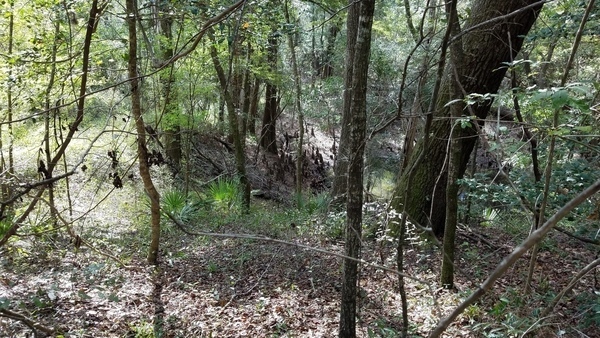
Gully, 15:26:39,, Woods 30.6414324, -83.3359659

Path, 15:26:56,, Woods 30.6411700, -83.3364300

River, 15:27:15,, Woods 30.6411700, -83.3364300

River more, 15:27:16,, Woods 30.6412100, -83.3363600
At spring, 15:35:06,, Landowners 30.6411076, -83.3367886

Boaters, 15:35:08,, Landowners 30.6411076, -83.3367886

Canoe heading out, 15:35:50,, Landowners 30.6411076, -83.3367886

Canoe from spring into river, 15:36:07,, Landowners 30.6411076, -83.3367886

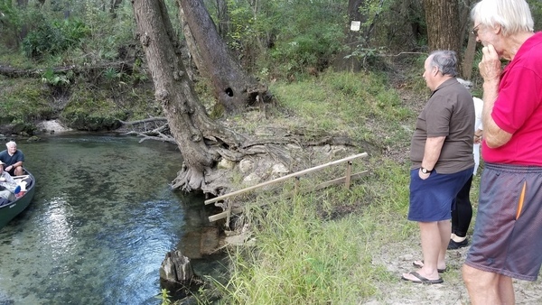
Gretchen and a landowner, 15:40:18,, Landowners 30.6410820, -83.3367979
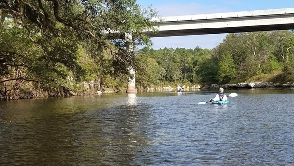
Gretchen and the bridge, 15:58:11,, Old Clyattville Road Bridge 30.6404700, -83.3314800
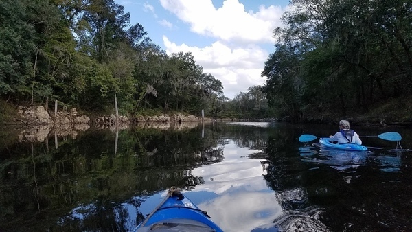
Not much but a few posts left of Old Clyattville Road Bridge.

Path on bank, 15:58:50,, Old Clyattville Road Bridge 30.6404300, -83.3313100

Right Bank, 15:58:52,, Old Clyattville Road Bridge 30.6404436, -83.3312789

Post, 15:58:57,, Old Clyattville Road Bridge 30.6404300, -83.3311900

Posts, 15:58:59,, Old Clyattville Road Bridge 30.6404200, -83.3311600

Post2.0, 2017:10:14 15:59:00,, Old Clyattville Road Bridge 30.6404100, -83.3311600

Post2.1, 15:59:02,, Old Clyattville Road Bridge 30.6404100, -83.3311500

Post2.2, 15:59:04,, Old Clyattville Road Bridge 30.6404000, -83.3311400

Post 2.3, 15:59:05,, Old Clyattville Road Bridge 30.6403900, -83.3311300

Post 2.4, 15:59:06,, Old Clyattville Road Bridge 30.6403800, -83.3311200
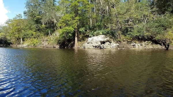
Karst outcrop, 16:04:26,, Olympia Bend Plantation 30.6426900, -83.3287200
Usually you’ll hear this place as Olympia Bend Shooting Range. If you paddle by in June or July, look for the Halberdleaf Rosemallow. Each flower blooms only one day, and they were all bloomed out when we went by in October.

Movie: Reflections on karst, 14:50:22,, Olympia Bend Plantation 30.6427000, -83.3287200

Climbing fern, 16:09:42,, Olympia Bend Plantation 30.6433900, -83.3263500

Flat rocks and trail, 16:10:39,, Olympia Bend Plantation 30.6430884, -83.3256647

Movie: Flat rocks, 13:26:06,, Olympia Bend Plantation 30.6430885, -83.3256640
In distance, 16:27:44,, Horn Bridge 30.6364900, -83.3160200
Also known as GA 31 Bridge or the new Horns Ferry Bridge.

With ghost ship, 16:27:57,, Horn Bridge 30.6363800, -83.3157700

Close ship, 16:28:55,, Horn Bridge 30.6359842, -83.3153110

Cypress, 16:29:21,, Horn Bridge 30.6359928, -83.3150264

Gretchen and ghost ship under bridge, 16:32:34,, Horn Bridge 30.6355513, -83.3126804

Right bank, 16:32:39,, Horn Bridge 30.6356448, -83.3125767
Under bridge, 16:32:41,, State Line Ramp 30.6356448, -83.3125767
State Line Ramp, also known as Mozell Spells (local people), or Madison Highway Boat Ramp (VLPRA), or GA 31 Ramp (SRWMD), or CR 145 Bridge Launch (FDEP).

Boats approaching, 16:32:50,, State Line Ramp 30.6355579, -83.3125709

Getting out, 16:34:42,, State Line Ramp 30.6355648, -83.3112632

Up the ramp, 16:34:45,, State Line Ramp 30.6355811, -83.3112766

Want some help?, 16:34:46,, State Line Ramp 30.6355578, -83.3112079
-jsq, John S. Quarterman, Suwannee RIVERKEEPER®
You can join this fun and work by becoming a WWALS member today!
Google Map
Follow this link for the interactive google map, and it’s also embedded below.
Short Link:

