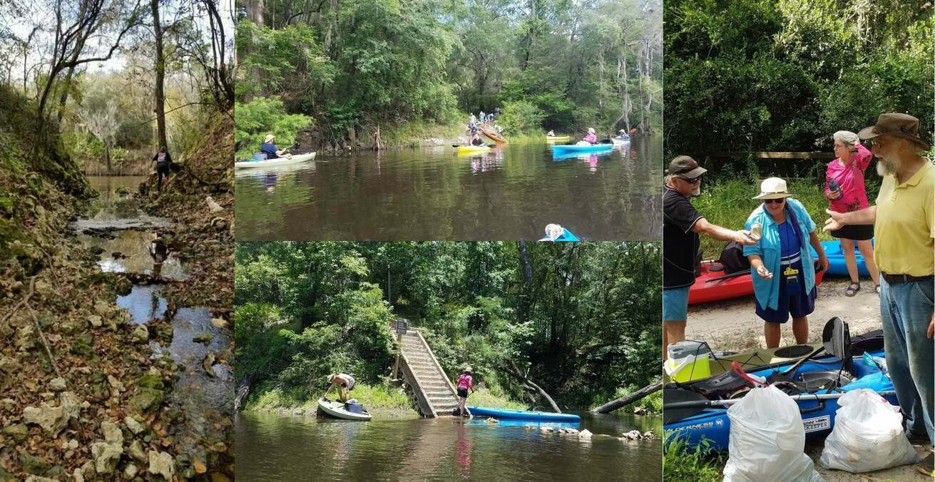
A fine day, balmy, breezy, sunny, with springs and rapids and fine company,
from Sullivan Launch to Madison Blue Spring on the Withlacoochee River,
in the October WWALS Outing, October 24, 2015.
![[Onwards from Hardee Spring 30.5444069, -83.2500076]](https://www.wwals.net/pictures/2015-10-24--wwals-withlacoochee/KIMG2757.jpg)
Onwards from Hardee Spring 30.5444069, -83.2500076
This is part of the
Withlacoochee and Little River Water Trail,
and you can join the committee!
Below are some pictures.
Click on any small picture to see a larger version.
Pictured: many shoals and rapids.
![[Pinetta Gage steps and old-style measure 30.5957374, -83.2598038]](https://www.wwals.net/pictures/2015-10-24--wwals-withlacoochee/KIMG2695.jpg)
Pinetta Gage steps and old-style measure 30.5957374, -83.2598038
The Pinetta gage (pictured) read 6.4 feet.
Any lower and more dragging boats would have been necessary.
Lots of cypress, oaks, pines, and other native species.
Not pictured: a large turtle, numerous birds (heron, ibis, hawk, buzzard, others),
and fish (mullet, bass).
No gators.
Very few invasive species, except the notorious Japanese climbing fern.
Watch the
WWALS Outings for more outings and events!
https://wwals.net/outings/
-jsq, John S. Quarterman, Suwannee RIVERKEEPER®
You can help with clean, swimmable, fishable, drinkable, water in the 10,000-square-mile Suwannee River Basin in Florida and Georgia by becoming a WWALS member today!
https://wwals.net/donations/
![[WWALS at Madison Blue Spring --Gretchen Quarterman]](https://www.wwals.net/pictures/2015-10-24--wwals-withlacoochee/sign.jpg)
WWALS at Madison Blue Spring –Gretchen Quarterman
![[Gathering]](https://www.wwals.net/pictures/2015-10-24--wwals-withlacoochee/KIMG2691.jpg)
Gathering
![[Pinetta Gage Tower 30.5957374, -83.2598038]](https://www.wwals.net/pictures/2015-10-24--wwals-withlacoochee/KIMG2694.jpg)
Pinetta Gage Tower 30.5957374, -83.2598038
![[Belleville Bridge buttress from below 30.5953369, -83.2596130]](https://www.wwals.net/pictures/2015-10-24--wwals-withlacoochee/KIMG2696.jpg)
Belleville Bridge buttress from below 30.5953369, -83.2596130
![[CR 150 bridge, looking upstream 30.5956955, -83.2594681]](https://www.wwals.net/pictures/2015-10-24--wwals-withlacoochee/KIMG2700.jpg)
CR 150 bridge, looking upstream 30.5956955, -83.2594681
![[Shoals 30.5941982, -83.2590637]](https://www.wwals.net/pictures/2015-10-24--wwals-withlacoochee/KIMG2705.jpg)
Shoals 30.5941982, -83.2590637
![[Gretchen and the boaters 30.5822926, -83.2627106]](https://www.wwals.net/pictures/2015-10-24--wwals-withlacoochee/KIMG2708.jpg)
Gretchen and the boaters 30.5822926, -83.2627106
![[More shoals 30.5819988, -83.2626953]](https://www.wwals.net/pictures/2015-10-24--wwals-withlacoochee/KIMG2710.jpg)
More shoals 30.5819988, -83.2626953
![[Coffee Spring 30.5775184, -83.2618179]](https://www.wwals.net/pictures/2015-10-24--wwals-withlacoochee/KIMG2714.jpg)
Coffee Spring 30.5775184, -83.2618179
![[Froth 30.5762119, -83.2609482]](https://www.wwals.net/pictures/2015-10-24--wwals-withlacoochee/KIMG2718.jpg)
Froth 30.5762119, -83.2609482
![[Sighting the rapids 30.5697098, -83.2624817]](https://www.wwals.net/pictures/2015-10-24--wwals-withlacoochee/KIMG2720.jpg)
Sighting the rapids 30.5697098, -83.2624817
![[Two directions 30.5679722, -83.2606277]](https://www.wwals.net/pictures/2015-10-24--wwals-withlacoochee/KIMG2722.jpg)
Two directions 30.5679722, -83.2606277
![[Island, or rather eyott? 30.5653133, -83.2575378]](https://www.wwals.net/pictures/2015-10-24--wwals-withlacoochee/KIMG2730.jpg)
Island, or rather eyott? 30.5653133, -83.2575378
![[Fossils for lunch 30.5626812, -83.2563248]](https://www.wwals.net/pictures/2015-10-24--wwals-withlacoochee/KIMG2734.jpg)
Fossils for lunch 30.5626812, -83.2563248
![[House 30.5626812, -83.2563248]](https://www.wwals.net/pictures/2015-10-24--wwals-withlacoochee/KIMG2737.jpg)
House 30.5626812, -83.2563248
![[Island on left 30.5626812, -83.2563248]](https://www.wwals.net/pictures/2015-10-24--wwals-withlacoochee/KIMG2738.jpg)
Island on left 30.5626812, -83.2563248
![[Confab 30.5626812, -83.2563248]](https://www.wwals.net/pictures/2015-10-24--wwals-withlacoochee/KIMG2741.jpg)
Confab 30.5626812, -83.2563248
![[White water 30.5529365, -83.2608795]](https://www.wwals.net/pictures/2015-10-24--wwals-withlacoochee/KIMG2743.jpg)
White water 30.5529365, -83.2608795
![[Spring coming up 30.5446434, -83.2505264]](https://www.wwals.net/pictures/2015-10-24--wwals-withlacoochee/KIMG2745.jpg)
Spring coming up 30.5446434, -83.2505264
![[Hardee Spring dam 30.5446434, -83.2505264]](https://www.wwals.net/pictures/2015-10-24--wwals-withlacoochee/KIMG2747.jpg)
Hardee Spring dam 30.5446434, -83.2505264
Onwards from Hardee Spring 30.5444069, -83.2500076
![[Dan and the rock tree 30.5336761, -83.2483062]](https://www.wwals.net/pictures/2015-10-24--wwals-withlacoochee/KIMG2761.jpg)
Dan and the rock tree 30.5336761, -83.2483062
![[Undercut caves 30.5118561, -83.2455368]](https://www.wwals.net/pictures/2015-10-24--wwals-withlacoochee/KIMG2770.jpg)
Undercut caves 30.5118561, -83.2455368
![[A boat ramp 30.5118217, -83.2455063]](https://www.wwals.net/pictures/2015-10-24--wwals-withlacoochee/KIMG2771.jpg)
A boat ramp 30.5118217, -83.2455063
![[Interesting black rocks 30.4932423, -83.2414474]](https://www.wwals.net/pictures/2015-10-24--wwals-withlacoochee/KIMG2774.jpg)
Interesting black rocks 30.4932423, -83.2414474
![[Rapids 30.4910717, -83.2443161]](https://www.wwals.net/pictures/2015-10-24--wwals-withlacoochee/KIMG2780.jpg)
Rapids 30.4910717, -83.2443161
![[Karst tree 30.4899406, -83.2438965]](https://www.wwals.net/pictures/2015-10-24--wwals-withlacoochee/KIMG2785.jpg)
Karst tree 30.4899406, -83.2438965
![[Green bank, white bird 30.4822121, -83.2433777]](https://www.wwals.net/pictures/2015-10-24--wwals-withlacoochee/KIMG2790.jpg)
Green bank, white bird 30.4822121, -83.2433777
![[FL 6 bridge from downstream 30.4812660, -83.2434616]](https://www.wwals.net/pictures/2015-10-24--wwals-withlacoochee/KIMG2794.jpg)
FL 6 bridge from downstream 30.4812660, -83.2434616
![[Just around those logs 30.4810009, -83.2436981]](https://www.wwals.net/pictures/2015-10-24--wwals-withlacoochee/KIMG2797.jpg)
Just around those logs 30.4810009, -83.2436981
-jsq, John S. Quarterman, Suwannee RIVERKEEPER®
You can help with clean, swimmable, fishable, drinkable, water in the 10,000-square-mile Suwannee River Basin in Florida and Georgia by becoming a WWALS member today!
https://wwals.net/donations/

![[Banners, River, Springs]](https://www.wwals.net/pictures/2022-06-04--florida-campsites-withlacoochee-pictures/many.jpg)
![[Pinetta Gage steps and old-style measure 30.5957374, -83.2598038]](https://www.wwals.net/pictures/2015-10-24--wwals-withlacoochee/small/KIMG2695.jpg)
![[Gage pipe and warning on door 30.5953369, -83.2596130]](https://www.wwals.net/pictures/2015-10-24--wwals-withlacoochee/small/KIMG2697.jpg)
![[Remains of Belleville Bridge, Madison County side 30.5957298, -83.2596435]](https://www.wwals.net/pictures/2015-10-24--wwals-withlacoochee/small/KIMG2692.jpg)
![[Fallen girders of Belleville Bridge, Hamilton County side 30.5956020, -83.2597732]](https://www.wwals.net/pictures/2015-10-24--wwals-withlacoochee/small/KIMG2698.jpg)
![[Down the Withlacoochee River 30.5956001, -83.2593307]](https://www.wwals.net/pictures/2015-10-24--wwals-withlacoochee/small/KIMG2701.jpg)
![[Chris and Deanna picking up trash 30.5956001, -83.2593307]](https://www.wwals.net/pictures/2015-10-24--wwals-withlacoochee/small/KIMG2702.jpg)
![[Movie: Shooting the rapids 30.5941982, -83.2590637 (9.6M)]](https://www.wwals.net/pictures/2015-10-24--wwals-withlacoochee/small/KVID2706.jpg)
![[Smooth water 30.5842590, -83.2621613]](https://www.wwals.net/pictures/2015-10-24--wwals-withlacoochee/small/KIMG2707.jpg)
![[Starting the rapids 30.5819034, -83.2627106]](https://www.wwals.net/pictures/2015-10-24--wwals-withlacoochee/small/KIMG2711.jpg)
![[Not bad 30.5819054, -83.2627029]](https://www.wwals.net/pictures/2015-10-24--wwals-withlacoochee/small/KIMG2712.jpg)
![[Ripples 30.5814247, -83.2629699]](https://www.wwals.net/pictures/2015-10-24--wwals-withlacoochee/small/KIMG2713.jpg)
![[Boating in the spring 30.5775299, -83.2618256]](https://www.wwals.net/pictures/2015-10-24--wwals-withlacoochee/small/KIMG2715.jpg)
![[Another spring? 30.5776119, -83.2620239]](https://www.wwals.net/pictures/2015-10-24--wwals-withlacoochee/small/KIMG2717.jpg)
![[Sunbeams on Chris and Deanna Mericle 30.5761909, -83.2609329]](https://www.wwals.net/pictures/2015-10-24--wwals-withlacoochee/small/KIMG2719.jpg)
![[Boater 30.5698356, -83.2623672]](https://www.wwals.net/pictures/2015-10-24--wwals-withlacoochee/small/KIMG2721.jpg)
![[Onwards 30.5678921, -83.2606430]](https://www.wwals.net/pictures/2015-10-24--wwals-withlacoochee/small/KIMG2723.jpg)
![[Rock bottom]](https://www.wwals.net/pictures/2015-10-24--wwals-withlacoochee/small/KIMG2731.jpg)
![[The other side of the island]](https://www.wwals.net/pictures/2015-10-24--wwals-withlacoochee/small/KIMG2732.jpg)
![[Movie: Sand and rocks 30.5653133, -83.2575378 (12M)]](https://www.wwals.net/pictures/2015-10-24--wwals-withlacoochee/small/KVID2733.jpg)
![[A prehistoric scraper 30.5626812, -83.2563248]](https://www.wwals.net/pictures/2015-10-24--wwals-withlacoochee/small/KIMG2735.jpg)
![[Onwards 30.5626812, -83.2563248]](https://www.wwals.net/pictures/2015-10-24--wwals-withlacoochee/small/KIMG2740.jpg)
![[Could that be karst? 30.5529404, -83.2608642]](https://www.wwals.net/pictures/2015-10-24--wwals-withlacoochee/small/KIMG2742.jpg)
![[Somebody following me 30.5509796, -83.2578125]](https://www.wwals.net/pictures/2015-10-24--wwals-withlacoochee/small/KIMG2744.jpg)
![[Hardee Spring sign 30.5446434, -83.2505264]](https://www.wwals.net/pictures/2015-10-24--wwals-withlacoochee/small/KIMG2749.jpg)
![[Hardee Spring steps 30.5446434, -83.2505264]](https://www.wwals.net/pictures/2015-10-24--wwals-withlacoochee/small/KIMG2750.jpg)
![[Hardee Spring cavern goes through to a karst window, 30.544662, -83.250057]](https://www.wwals.net/pictures/2015-10-24--wwals-withlacoochee/small/KIMG2752.jpg)
![[KIMG2754 Looking out from Hardee Spring 30.5444069, -83.2500076]](https://www.wwals.net/pictures/2015-10-24--wwals-withlacoochee/small/KIMG2754.jpg)
![[Dan and the portrait rock tree 30.5337314, -83.2483062]](https://www.wwals.net/pictures/2015-10-24--wwals-withlacoochee/small/KIMG2762.jpg)
![[A boat at a bend in the river 30.5337410, -83.2490692]](https://www.wwals.net/pictures/2015-10-24--wwals-withlacoochee/small/KIMG2763.jpg)
![[A net of roots 30.5188904, -83.2391357]](https://www.wwals.net/pictures/2015-10-24--wwals-withlacoochee/small/KIMG2768.jpg)
![[Clouds 30.5188904, -83.2391357]](https://www.wwals.net/pictures/2015-10-24--wwals-withlacoochee/small/KIMG2769.jpg)
![[Shirley Kokidko 30.4990539, -83.2425766]](https://www.wwals.net/pictures/2015-10-24--wwals-withlacoochee/small/KIMG2772.jpg)
![[Rocks on bank 30.4932537, -83.2414703]](https://www.wwals.net/pictures/2015-10-24--wwals-withlacoochee/small/KIMG2775.jpg)
![[Rocks from the river 30.4929829, -83.2421799]](https://www.wwals.net/pictures/2015-10-24--wwals-withlacoochee/small/KIMG2776.jpg)
![[Tall rock: petrified tree? 30.4919090, -83.2447128]](https://www.wwals.net/pictures/2015-10-24--wwals-withlacoochee/small/KIMG2777.jpg)
![[A familiar shape 30.4918537, -83.2448120]](https://www.wwals.net/pictures/2015-10-24--wwals-withlacoochee/small/KIMG2778.jpg)
![[Horizontal rocks 30.4918537, -83.2448120]](https://www.wwals.net/pictures/2015-10-24--wwals-withlacoochee/small/KIMG2779.jpg)
![[Shirley and Dan 30.4910507, -83.2443466]](https://www.wwals.net/pictures/2015-10-24--wwals-withlacoochee/small/KIMG2781.jpg)
![[Shoals ahead 30.4910946, -83.2444839]](https://www.wwals.net/pictures/2015-10-24--wwals-withlacoochee/small/KIMG2782.jpg)
![[Shoals behind 30.4903641, -83.2442551]](https://www.wwals.net/pictures/2015-10-24--wwals-withlacoochee/small/KIMG2783.jpg)
![[More rocks 30.4902477, -83.2441711]](https://www.wwals.net/pictures/2015-10-24--wwals-withlacoochee/small/KIMG2784.jpg)
![[Narrow 30.4899750, -83.2439499]](https://www.wwals.net/pictures/2015-10-24--wwals-withlacoochee/small/KIMG2786.jpg)
![[Smooth 30.4863148, -83.2434845]](https://www.wwals.net/pictures/2015-10-24--wwals-withlacoochee/small/KIMG2787.jpg)
![[Two boats behind 30.4863338, -83.2434616]](https://www.wwals.net/pictures/2015-10-24--wwals-withlacoochee/small/KIMG2788.jpg)
![[Bird flying 30.4822121, -83.2433777]](https://www.wwals.net/pictures/2015-10-24--wwals-withlacoochee/small/KIMG2791.jpg)
![[Movie: Nearing the goal 30.4822121, -83.2433777 (6.7M)]](https://www.wwals.net/pictures/2015-10-24--wwals-withlacoochee/small/KVID2792.jpg)
![[Movie: Bridge1 30.4822121, -83.2433777 (16M)]](https://www.wwals.net/pictures/2015-10-24--wwals-withlacoochee/small/KVID2793.jpg)
![[Movie: Bridge2 30.4822121, -83.2433777 (19M)]](https://www.wwals.net/pictures/2015-10-24--wwals-withlacoochee/small/KVID2794.jpg)
![[Madison Blue Spring 30.4809627, -83.2436676]](https://www.wwals.net/pictures/2015-10-24--wwals-withlacoochee/small/KIMG2800.jpg)
![[Cover and inside]](https://www.wwals.net/pictures/2022-06-30--welander-book/many.jpg)
![[Distributary, Swallet, Sinkhole]](https://www.wwals.net/pictures/2022-01-07--chitty-bend-east-distributary-shirley-kokidko/many.jpg)
![[All clear, many samples, three rivers, Swim Guide]](https://www.wwals.net/pictures/2021-05-20--wq/many.jpg)
![[Results, Plates, River, Swim Guide]](https://www.wwals.net/pictures/2021-05-13--wq/many.jpg)
![[Mermaid, Suwannee Riverkeeper, OSFR, Regulatory Fallacy, Charles Keith, Attorneys, Motion to Permit, unanimous SRWMD Board]](https://www.wwals.net/pictures/2021-02-23--srwmd-nestle-pictures/many.jpg)
![[SRWMD Board: Larry Thompson, Lower Suwannee Basin; Charles Keith, At Large; Virginia H. Johns, Chair, At Large; Virginia Sanchez, At Large; Charles Schwab, Coastal Rivers Basin; Harry Smith, At Large; Larry Sessions, Upper Suwannee Basin]](https://www.wwals.net/pictures/2021-02-23--srwmd-nestle-pictures/srwmd-board.jpg)
![[Special SRWMD Meeting, Suwannee River Fair Pavilion, 2021-02-23]](https://www.wwals.net/pictures/2021-02-09--srwmd-board/many.jpg)
![[NO PERMIT postcard to SRWMD]](https://www.wwals.net/pictures/2021-01-29--no-nestle-permit-srwmd/big/no-nestle-postcard-0001.jpg)