Tag Archives: Spread 5

Gum Springs 3,000 feet from Sabal Trail and lower flow @ WWALS 2017-02-07

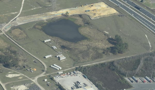
Interesting questions about Gum Springs, seen in this picture only 3,000 feet across Marion Oaks Golf Course from Sabal Trail:

Detail, SW corner Marion Oaks, FL,
Picture: Jim Tatum for WWALS on Southwings flight 2017-02-07.

Follow this link for the interactive google map, or it’s also embedded below. Continue reading

Aerials: Sabal Trail hydrostatic test pond at I-75 @ WWALS 2017-02-07

Good questions by Janet Barrow. Who has answers?

Janet Barrow
March 13, 2017 at 4:55 pm

Look at the first photo — “Sabal Trail north from I-75 to the Withlacoochee (south) River.” This shows the hydrostatic discharge point for Spread 5 (at least the site they reported that they will use) and the withdrawal point for Spread 6. Coordinates are: 28°52’47.99″N, 82°5’39.69″W

Thanks to Mark Skogman’s long lens on the Southwings flight for WWALS, we can zoom in on that spot.

Hydrostatic test pond at I-75

Janet Barrow
March 13, 2017 at 5:07 pm

Continue reading