Update 2025-09-21:
Graphs from
water.noaa.gov.
 Related to the
Withlacoochee and Little River Water Trail
and the
double USACE flooding study presentation tonight in Valdosta,
here are river level charts
upstream and down on the Little River,
Okapilco Creek, and the Withlacoochee River
related to a new USGS flood-tracking chart.
In the example charts on the right, you can see the Little River peaked days ago at Tifton and yesterday at Hahira.
The Withlacoochee River peaked yesterday at US 41. while downstream it’s
going up at US 84, and barely starting up at Pinetta (click on the above chart example for the rest).
Right now you can see all that in the charts below.
If this works, you’ll see something different later,
because you’ll see current charts whenever you refresh this page.
Tifton Gauge, Little River at Upper Ty Ty Road, near Tifton, GA, Tift County, GA
(02317797)
Highest safe 3.9 feet, 271 NAVD.
Lowest boatable 0.1 feet, 267.2 NAVD.


Adel Gauge, Little River near Adel, GA, Cook County, GA
(02318000)
Highest safe 7.9 feet, 181 NAVD.
Lowest boatable 2.2 feet, 175.3 NAVD.


Hahira Gauge, Little River at GA 122, near Hahira, GA, Lowndes County, GA
(02318380)
Highest safe 11 feet, 144 NAVD.
Lowest boatable 4.25 feet, 137 NAVD.


Skipper Bridge Gauge, Withlacoochee River at Skipper Bridge Road, near Bemiss, GA, Lowndes County, GA
(023177483)
Highest safe 10.7 feet, 131 NAVD.
Lowest boatable 2.3 feet, 122.6 NAVD.


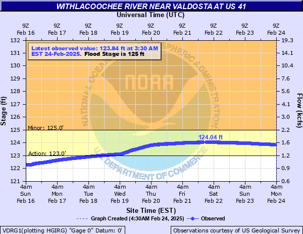
Valdosta Gauge, Withlacoochee River at US 41 near Valdosta, GA, Lowndes County, GA
(02317755)
Highest safe 12.7 feet, 123′ NAVD.
Lowest boatable 5.7 feet, 116′ NAVD.

Okapilco Creek Gauge, Okapilco Creek at GA 333, near Quitman, GA, Brooks County, GA
(02318700)


Quitman Gauge, Withlacoochee River at US 84, near Quitman, GA, Brooks County, GA
(02318500)
Highest safe 10.5 feet, 94 NAVD.
Lowest boatable 2.0 feet, 85.5 NAVD.


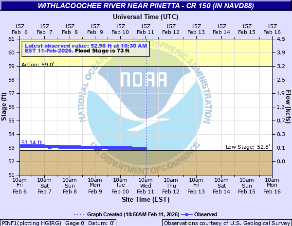
Pinetta Gauge, Withlacoochee River near Pinetta, FL., Madison County, FL
(02319000)
Highest safe 12.5 feet, 59 NAVD.
Lowest boatable 6.0 feet, 52.5 NAVD.

Madison Gauge, Withlacoochee River near Madison, FL , Madison County, FL
(02319300)
Highest safe 10.0 feet, 50 NAVD.
Lowest boatable 0.1 feet, 40.1 NAVD.

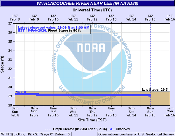
Lee Gauge, Withlacoochee River near Lee, FL, Madison County, FL
(02319394)
Highest safe 44.0 feet, 44 NAVD.
Lowest boatable 29.5 feet, 29.5 NAVD.

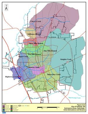
The watersheds
See also interactive map.

See also
Old updates
Update 2016-05-31: See sea level gage reports.
Update 2016-04-27: graphs from water.weather.gov and some
WRWT Safe Water Levels.
Update 2014-11-04: Simplified gage formatting.
Update 2014-11-03: That works, and see also Alapaha River water levels.
-jsq, John S. Quarterman, Suwannee RIVERKEEPER®
You can help with clean, swimmable, fishable, drinkable, water in the 10,000-square-mile Suwannee River Basin in Florida and Georgia by becoming a WWALS member today!
https://wwals.net/donations/
 The Withlacoochee River is out of its banks, actually up on the property containing the Withlacoochee Wastewater Treatment Plant (WWTP), but “according to the experts” not going to threaten the plant. “But lines are underwater”.

