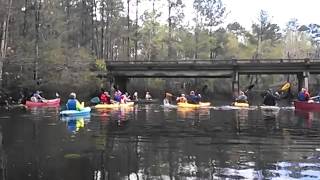
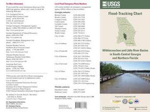
 An interesting flyer pointed out by Emily Davenport,
Storm Water Utilities Director, City of Valdosta.
It has many useful
contacts on the front,
and
tips on the back (don’t walk or drive through flood waters)
but the most useful part is
inside,
where the flood-tracking chart is, in
Flood-tracking chart for the Withlacoochee and Little River Basins in south-central Georgia and northern Florida,
2014, by Gotvald, Anthony J.; McCallum, Brian E.; Painter, Jaime A.,
USGS General Information Product: 155.
An interesting flyer pointed out by Emily Davenport,
Storm Water Utilities Director, City of Valdosta.
It has many useful
contacts on the front,
and
tips on the back (don’t walk or drive through flood waters)
but the most useful part is
inside,
where the flood-tracking chart is, in
Flood-tracking chart for the Withlacoochee and Little River Basins in south-central Georgia and northern Florida,
2014, by Gotvald, Anthony J.; McCallum, Brian E.; Painter, Jaime A.,
USGS General Information Product: 155.
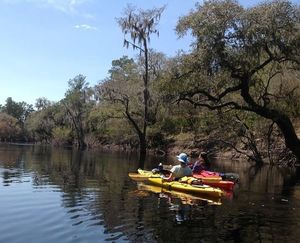
Here are the gages mentioned in the chart, with links to the live USGS FloodTracking pages, Continue reading