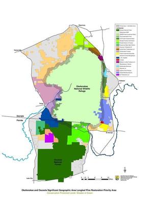
The idea is to stop wildfires coming out of the Okefenokee Swamp as they encounter a one-mile buffer
 of longleaf pine that has already had regular prescribed burns,
according to Hunter Bowman, who sent this map of where the
Okefenokee-Osceola Local Implementation Team works.
I live 60 miles west of that new buffer, yet I remember vividly the smoke from the 2007 fires, which even put people in the hospital farther west in Quitman, GA. All that smoke, not to mention runoff from the burned area, can’t be good for our waters.
A large image of the map is below, and PDF is on the WWALS website. As you can see, the Suwannee River above Fargo is entirely within the subject area, Continue reading

