Update 2019-02-13: And a version with Landings. See also Water Trails, with more detailed maps and access points.
Nobody seems to have done this, so we did:
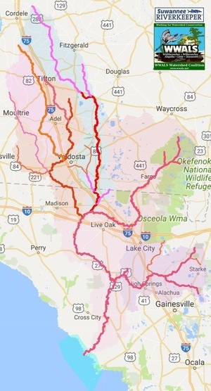
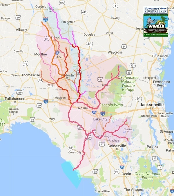
a map of the Suwannee River Basin, with the major watersheds and the Estuary
shaded, and all the major rivers, plus many of the creeks.
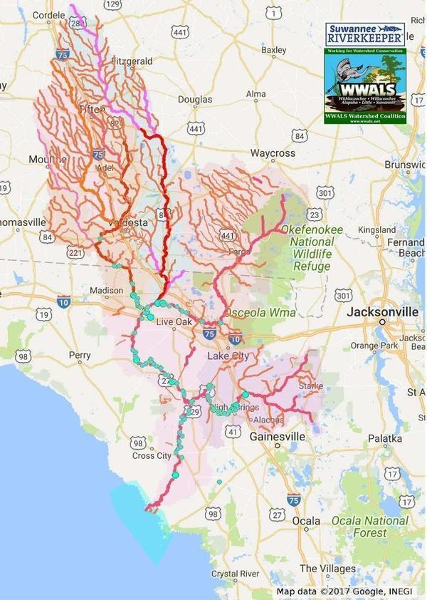
Bonus: springs!
 Click on this link for an interactive google map of the Suwannee River Basin.
The river traces come from USGS and Chris Graham. The watershed boundaries are from USGS. The springs are from the Florida Springs Institute, plus four Georgia springs collected by WWALS.
The eight-digit hydrologic unit codes (HUC8) for the Suwannee River Basin are:
-
HUC 03110203: Withlacoochee River
Our most populated River, with Valdosta right next to it and Nashville and Tifton upstream. The boundary between Madison and Hamilton Counties, Florida, half of the boundary between Brooks and Lowndes (the other half is the Little River), and half of the boundary Cook and Berrien Counties, Georgia (the other half is the New River). See Withlacoochee and Little River Water Trail.
-
HUC 03110204: Little River
Home of the annual BIG Little River Paddle Race at Reed Bingham State Park.
-
HUC 03110202: Alapaha River, including Willacoochee River
Our most remote and wildest river, with rapids and sinkholes including in the Dead River; see the Alapaha River Water Trail.
-
HUC 03110201: Upper Suwannee River
From the Okefenokee Swamp to the Withlacoochee Confluence: cypress swamps on a blackwater river with shoals.
-
HUC 03110205: Lower Suwannee River
From the Withlacoochee Confluence to the Gulf: manatees and sturgeon jumping over power boats.
-
HUC 03110206: Santa Fe River
Starting in Baker, Union, and Bradford Counties, Florida with the New River (different from the Georgia New River that flows into the Withlacoochee River), and its Alligator Creek, as well as Olustee Creek and the Itchetucknee River flowing into the Santa Fe River with Columbia, Alachua, Suwannee, and Gilchrist Counties.
-
Suwannee River Estuary
From Cedar Key on the south to Horseshoe Beach on the north. Whatever comes down the river ends up in the clam and oyster and fish beds in the Estuary.
With Springs and Creeks
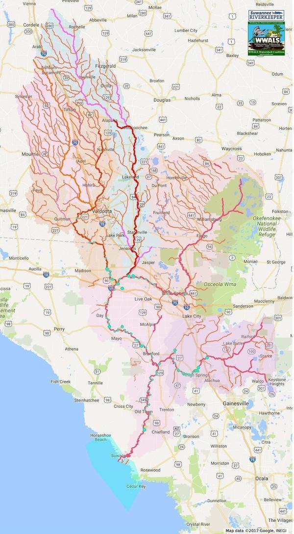
The screenshot below shows more detail of the Suwannee River Basin. To print, see the PDF. To zoom in for even more detail, use the interactive map.
Google Map of the Suwannee River Basin
Follow this link for the interactive google map of the Suwannee River Basin, and it is also embedded below.
More Detail

Another still, with even more detail.
How to construct a HUC google map like this
See the writeup in WWALS Watersheds Google Map.
Other Maps
Many other maps are available under Maps on the WWALS website.
-jsq, John S. Quarterman, Suwannee RIVERKEEPER®
You can join this fun and work by becoming a WWALS member today!
Short Link:


