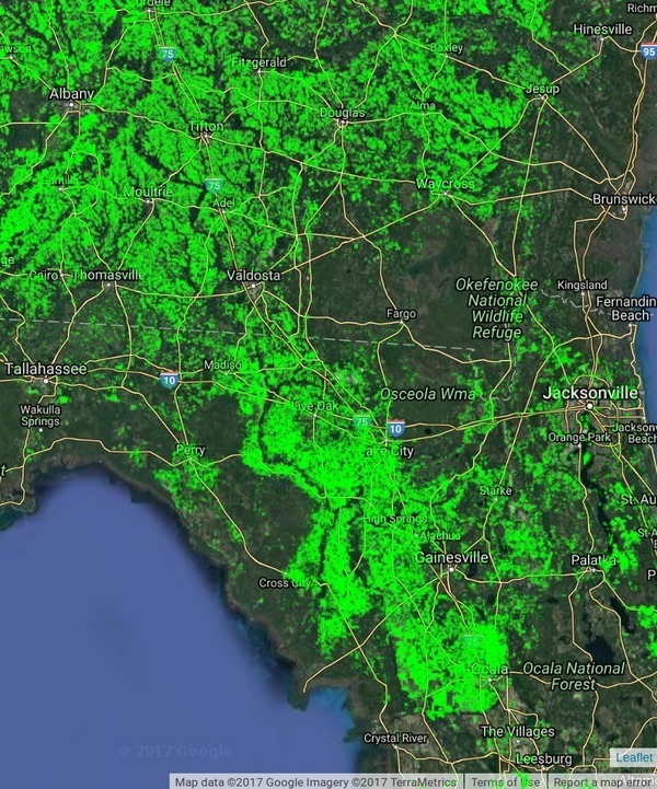
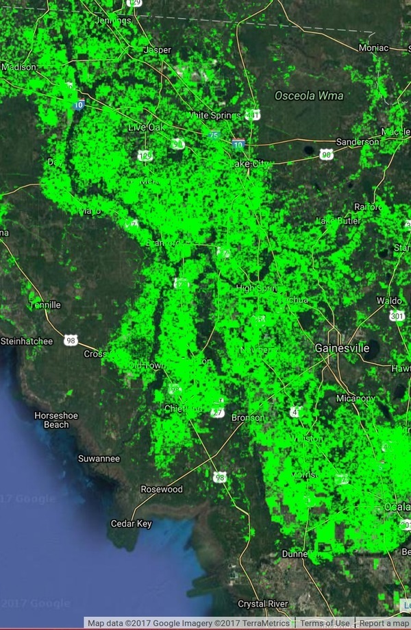
You can see on these maps that the Suwannee River Basin is massively agricultural, except where it’s forestry or swamp or other wetlands. Thus it’s no wonder that most of the nitrate runoff problem here is due to agriculture, as shown in the Basin Management Action Plans (BMAPs).
WWALS Science Committee Chair Tom Potter points to this Global Croplands map to illustrate the BMAP issues. The question remains of whether agricultural best management practices as advocated in the recent BMAP meetings will be sufficient to deal with the problem, considering they haven’t decreased it in the past decade.
Global Croplands About:
Global Food Security Analysis-Support Data at 30 Meters (GFSAD30) Project
The Overarching Goal of the GFSAD30 project is to map and produce cropland products of the world at 30 meter resolution.
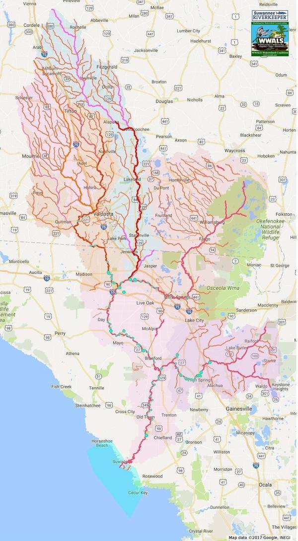
For comparison, here is a map of springs, creeks, rivers, and watersheds in the Suwannee River Basin:
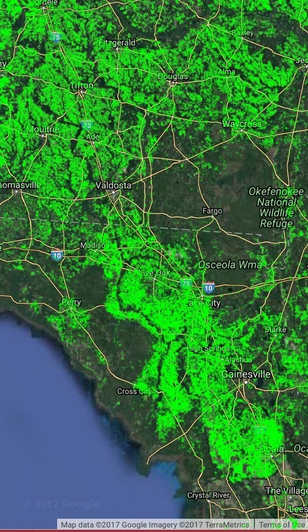
Let’s focus a bit more tightly on croplands in the Suwannee River Basin:
Lest anyone think that where there’s no agriculture it’s all cities, compare where nobody lives, as in census blocks with zero people:
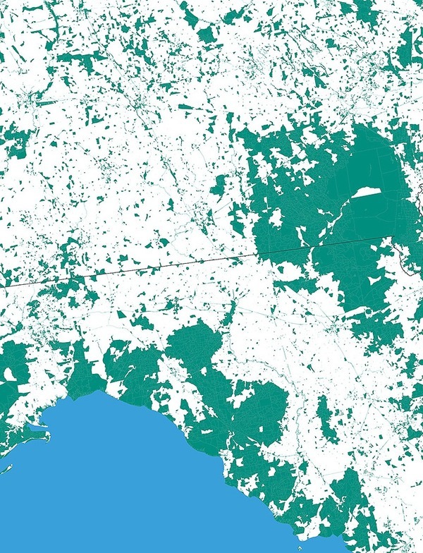
Nobody Lives Here:
Unpopulated U.S. Census Blocks,
screenshot by jsq from interactive map by
mapsbynik.
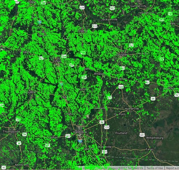
Actually, where it’s not croplands its generally either forestry, such as between Valdosta and Waycross, Georgia, or swamp, or floodplain, or other wetlands.
Here’s the Suwannee River Basin in Georgia:
And the Suwannee River Basin in Florida:
Compare the BMAP area map:

Figure ES-1. Suwannee River BMAP and PFA boundaries,
Draft Suwannee River Basin Management Action Plan 2017-11-14
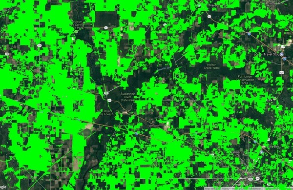
An example of more detail, from Madison Blue Spring to Live Oak, including the confluences of the Withlacoochee and Alapaha Rivers:
Context
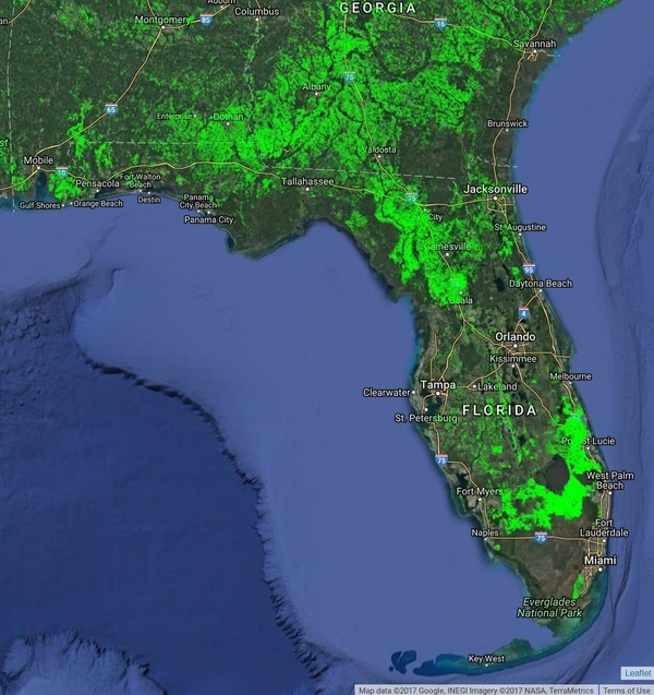
Let’s zoom out for context, and it’s obvious this is a more agricultural region than most of the rest of Florida:
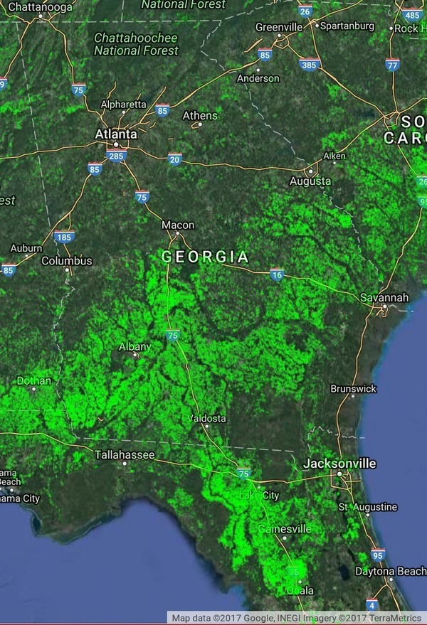
And if we look at Georgia, it’s obvious most of the agriculture is south of Macon, which is to say south of the gnat line, and much of it is in the Suwannee River Basin, plus there’s much forestry, for example between Valdosta and Waycross.
No wonder when people come down from Atlanta it’s like they’re from a foreign land.
-jsq, John S. Quarterman, Suwannee RIVERKEEPER®
You can join this fun and work by becoming a WWALS member today!
Short Link:

