
FERC just rubberstamped three pipelines before Commissioner Robert Powelson exits next month. Yet Commissioners Glick and LaFleur are still complaining every time about lack of use of Social Cost of Carbon to account for Greenhouse Gases (GHG). Those dissents started after Sierra Club won against FERC and Sabal Trail in the DC District Court on just that subject; recently FERC and Sabal Trail declined to appeal to the Supreme Court, thus admitting the pipeline company and its permitter lost that case.
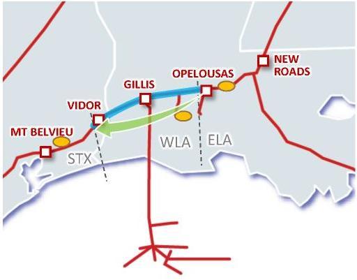
Open Season Maps, TX-LA Pipeline Project
Commissioner Cheryl LaFleur spelled out the connection in her dissent on Spectra’s Texas-Louisiana Markets Project:
I believe the fact pattern presented in this case, a pipeline designed to serve a specific known downstream powerplant, falls squarely within the precedent of Sierra Club v. FERC.1 Given that the majority’s analysis here suffers from the same flaws as its decision on remand in Sabal Trail,2 I respectfully dissent.
Commissioner Richard Glick in his dissent on the same pipeline also explicitly cited Sierra Club v. FERC (Sabal Trail) and went further about the specific underlying laws FERC is shirking:
“Today, the Commission issues a certificate to Texas Eastern Transmission, LP to construct and operate the Texas Industrial Market Expansion Project and the Louisiana Market Expansion Project (Projects), concluding that the Projects are required by the public convenience and necessity.1 The Commission also finds that the Projects will not have a significant effect on the environment.2 In reaching these conclusions, the Commission maintains that it need not consider the harm caused by the Projects’ contribution to climate change. The Commission’s refusal to do so falls well short of our obligations under the Natural Gas Act (NGA)3 and the National Environmental Policy Act (NEPA).4 Because I disagree with these conclusions and believe the Commission cannot find that the Projects are in the public interest without first considering the significance of the Projects’ contribution to climate change,5 I dissent in part from the Commission’s action today.
And yes, he really wrote “shirk”: Continue reading
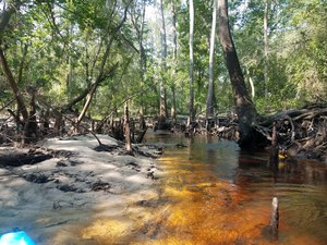
![[Log in tree, 2018:07:14 10:02:25, 30.8495694, -83.3402911]](https://www.wwals.net/pictures/2018-07-21--withlacoochee-troupville/20180714_100225.jpg)
![[Withlacoochee River at GA 133 in the WWALS map of the Withlacoochee and Little River Water Trail (WLRWT)]](https://www.wwals.net/pictures/2018-07-21--withlacoochee-troupville/google-map.jpg)
![[Beavers?, 2018:07:14 10:02:45, 30.8491566, -83.3404211]](https://www.wwals.net/pictures/2018-07-21--withlacoochee-troupville/20180714_100245.jpg)


![[Deer stand, 2018:07:14 10:11:39, 30.8472271, -83.3428214]](https://www.wwals.net/pictures/2018-07-21--withlacoochee-troupville/20180714_101139.jpg)
![[Side deadfall, 2018:07:14 10:17:13, 30.8461670, -83.3430003]](https://www.wwals.net/pictures/2018-07-21--withlacoochee-troupville/20180714_101713.jpg)
![[End of cutoff, 2018:07:14 10:18:11, 30.8467601, -83.3425382]](https://www.wwals.net/pictures/2018-07-21--withlacoochee-troupville/20180714_101811.jpg)
![[Trees, 2018:07:14 10:41:51, 30.8479584, -83.3408428]](https://www.wwals.net/pictures/2018-07-21--withlacoochee-troupville/20180714_104151-0.jpg)
![[Power line, 2018:07:14 10:52:08, 30.8499246, -83.3400640]](https://www.wwals.net/pictures/2018-07-21--withlacoochee-troupville/20180714_105208.jpg)
![[Submerged deadfall, 2018:07:14 11:14:34, 30.8519610, -83.3391584]](https://www.wwals.net/pictures/2018-07-21--withlacoochee-troupville/20180714_111435.jpg)