
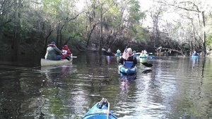
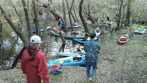
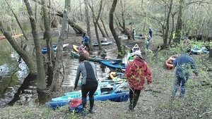
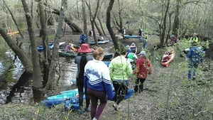
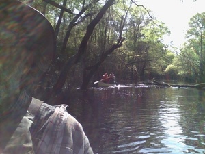
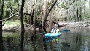
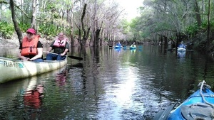
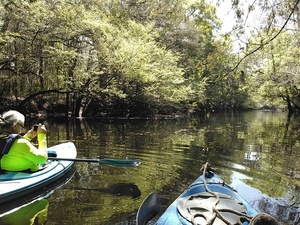
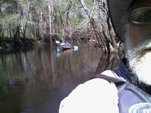
20 people in 17 boats on an astoundingly beautiful rural blackwater river into the biggest city in the entire Suwannee River Basin:
 here are pictures from
the WWALS outing from Staten Road Bridge in Lowndes County to Langdale Park on the edge of Valdosta, both in south Georgia, Spring Equinox,
Sunday 20 March 2016.
Thanks to everyone who came, especially to WWALS Outings Chair Chris Mericle for leading the expedition,
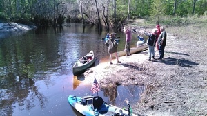
and to Georgia Page, Steve, and Travis of the Valdosta-Lowndes Parks and Recreation Authority (VLPRA) for letting us into Langdale Park even though it was closed for renovations.
Gretchen Quarterman went on Charlie Walker’s 99.5 KIX Country radio show the next morning to tell everybody about it.
here are pictures from
the WWALS outing from Staten Road Bridge in Lowndes County to Langdale Park on the edge of Valdosta, both in south Georgia, Spring Equinox,
Sunday 20 March 2016.
Thanks to everyone who came, especially to WWALS Outings Chair Chris Mericle for leading the expedition,
and to Georgia Page, Steve, and Travis of the Valdosta-Lowndes Parks and Recreation Authority (VLPRA) for letting us into Langdale Park even though it was closed for renovations.
Gretchen Quarterman went on Charlie Walker’s 99.5 KIX Country radio show the next morning to tell everybody about it.
Only four people fell into the river.
 That’s the same number as on
the last outing at Langdale Park,
but this time two of them fell in twice: Charlie Walker and Terri Duckett Jenkins.
All are well; the water was probably about 60 degrees, and the air the same or warmer, so while a few people got chilly, there was no serious danger of hypothermia.
But everybody got motivated to understand what I said at the start:
put your life jacket on before you fall in.
Everybody who fell in was actually wearing a personal floatation device,
but some of our normally recalcitrant boaters got motivated to be proactive
and put theirs on.
That’s the same number as on
the last outing at Langdale Park,
but this time two of them fell in twice: Charlie Walker and Terri Duckett Jenkins.
All are well; the water was probably about 60 degrees, and the air the same or warmer, so while a few people got chilly, there was no serious danger of hypothermia.
But everybody got motivated to understand what I said at the start:
put your life jacket on before you fall in.
Everybody who fell in was actually wearing a personal floatation device,
but some of our normally recalcitrant boaters got motivated to be proactive
and put theirs on.
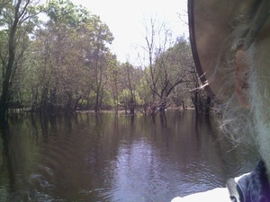
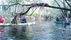
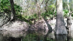
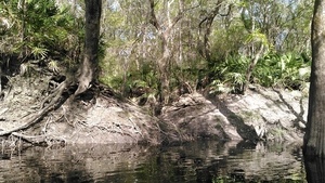
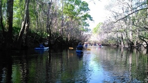
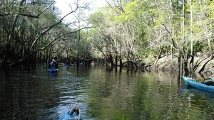
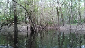
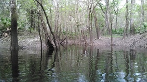
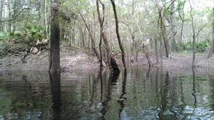
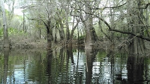
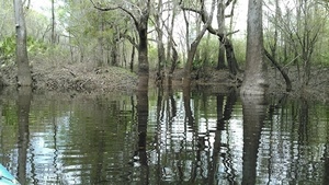
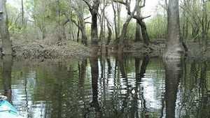
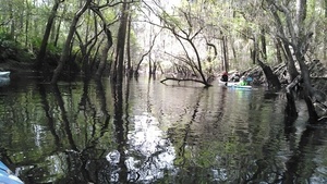
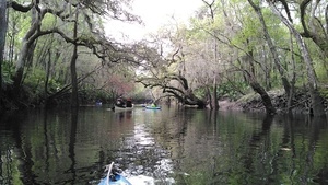
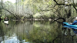
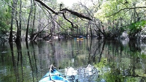
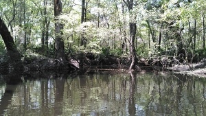
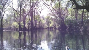
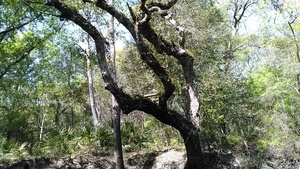
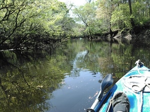
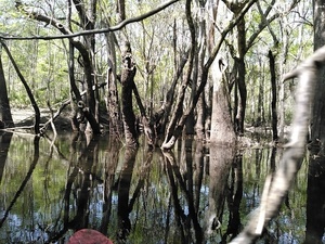
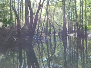
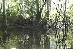
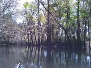
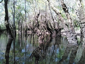
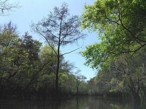
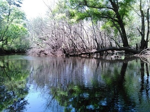
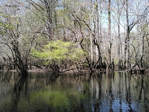
I saw no invasive species, and plenty of cypress, oaks, pines, a really nice holly tree, blooming native wild azalea, resurrection fern on the trees, and palmetto on the ground. A few fish jumped, a few turtles, many birds singing, and a few seen (ducks, woodpecker, buzzards). No gators; seldem do we see those this far up the Withlacoochee River.
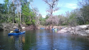
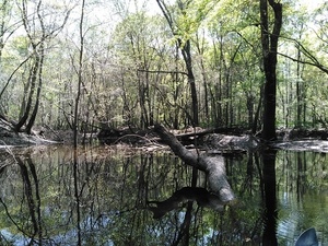
Water levels floated us over most deadfalls.
 They rose during the outing at
Skipper Bridge Road from about
5.25 (125.55 NAVD88) to 5.5 feet (125.80 NAVD88),
and at
US 41 (North Valdosta Road)
from about 8.0 (118.30 NAVD88) to 8.1 feet (118.31 NAVD88).
They rose during the outing at
Skipper Bridge Road from about
5.25 (125.55 NAVD88) to 5.5 feet (125.80 NAVD88),
and at
US 41 (North Valdosta Road)
from about 8.0 (118.30 NAVD88) to 8.1 feet (118.31 NAVD88).
We’re working up an award for Fallers. And I’m worried: I currently hold the record for falling into the most WWALS rivers, but two people have now tied my record for falling twice into the same river on the same outing.
This is part of our ongoing exploration of the new
Withlacoochee and Little River Water Trail.
 Join us
at Reed Bingham State Park,
between Moultrie and Adel,
Join us
at Reed Bingham State Park,
between Moultrie and Adel,
- this weekend, Saturday 26 March 2016, for Little River Fest, and
- Saturday, 21 May 2016, for the and for Fourth Annual BIG Little River Paddle Race.
And we hope to see you at some of the other upcoming WWALS outings and events!
 See also facebook pictures sets by
Gretchen Quarterman (including the one here of the WWALS banner)
and
Julie Bowland.
See also facebook pictures sets by
Gretchen Quarterman (including the one here of the WWALS banner)
and
Julie Bowland.
I took the pictures below. Click on any small picture for a bigger one. Click on any latlong coordinates for a map.
-jsq
You can join this fun and work by becoming a WWALS member today!
Movie: Under the Staten Road Bridge (1.9M)
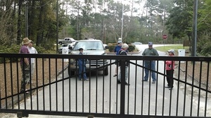
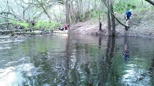
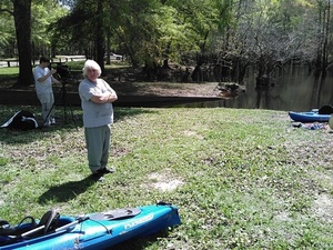
At the gate, Langdale Park 30.8869324, -83.3153076
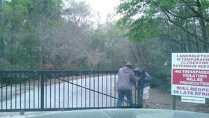
Travis opens the gate
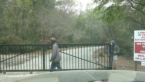
The gate took some shoving 30.8872280, -83.3154221
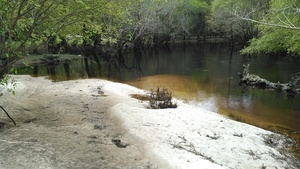
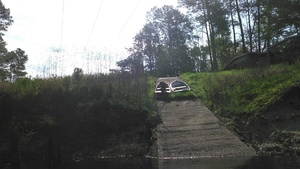
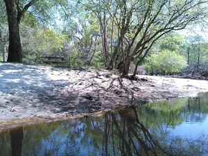
Withlacoochee River sand bar at boat ramp 30.8876972, -83.3238907
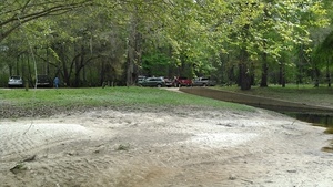
Cars at boat ramp, Langdale Park 30.8876972, -83.3238907
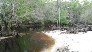
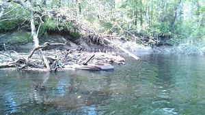
Log jam above boat ramp 30.8876972, -83.3238907
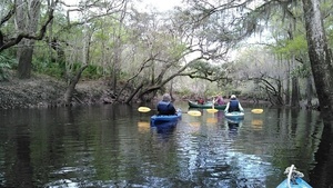
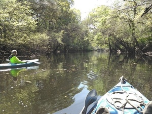
Boarding at Staten Road 30.9328155, -83.2884979
Here we go 30.9328232, -83.2884826
More people 30.9327984, -83.2884979
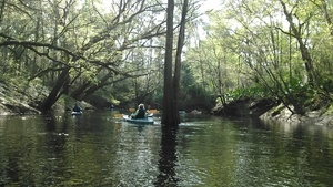
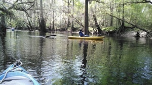
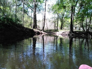
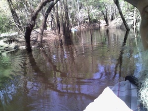
Heading out
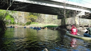
Downstream under the Staten Road Bridge
Movie: Around the first bend (1.2M)

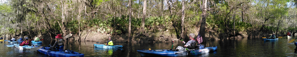
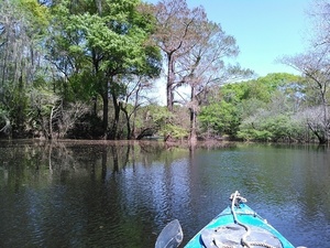
Panorama
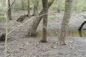
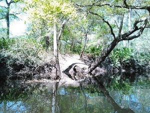
Unnamed tiny creek 30.9325313, -83.2899856
Or is it a tiny branch 30.9322262, -83.2902374
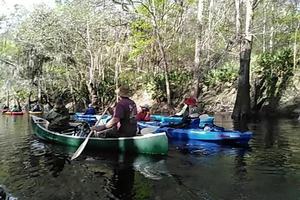
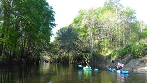
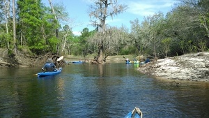
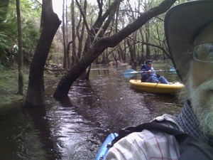
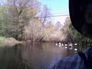
Boat parade! 30.9315739, -83.2905044
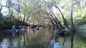
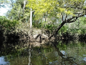
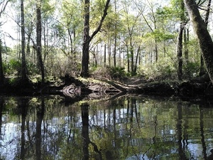
Clump of oaks
Horizontal tree
Holly tree and Dennis Price 30.9308224, -83.2920837
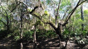
Resurrection fern
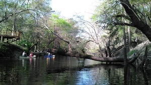
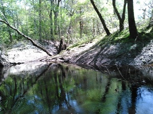
Dividing tree 30.9297161, -83.2929306
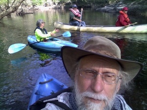
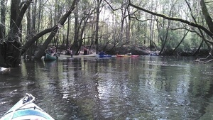
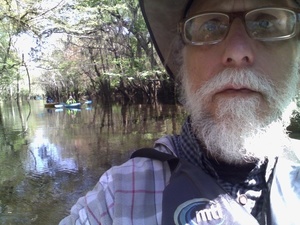
Gretchen Quarterman, a radio personality, and the Red Cross 30.9296436, -83.2928085
Boat ramp on power line right of way (south or left bank)
With boats 30.9288998, -83.2927246
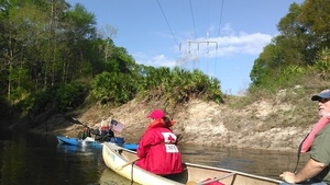
Power line (north or right bank) 30.9288425, -83.2927704
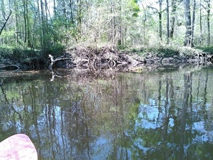
Wrested vegetation 30.9288196, -83.2927933
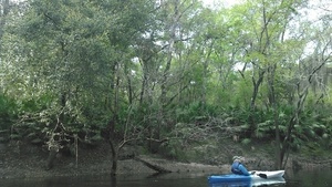
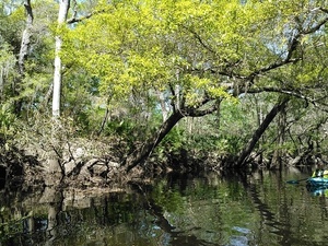
Ferns above, palmettos below 30.9274635, -83.2946854
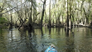
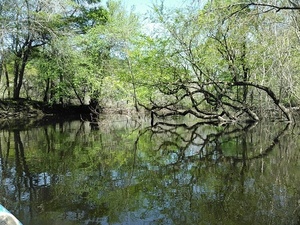
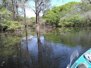
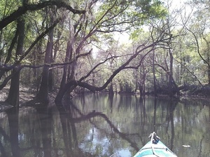
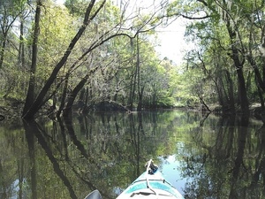
The very picture of a lazy river 30.9274845, -83.2946930
Power line is just behind those trees 30.9288406, -83.2963562
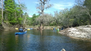
Blue, green, and sun
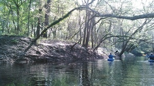
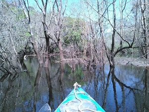
Narrow 30.9258232, -83.3007507
Prof Can Denizman heads for a tight bend
There they go 30.9247742, -83.3020401
Mostly around 30.9247742, -83.3020401
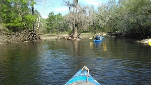
Can is next 30.9247456, -83.3021011
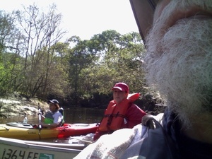
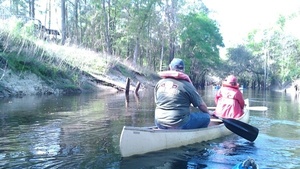
Its the Potter family 30.9248714, -83.3021316
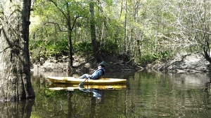
Drying out: the first two to swim! 30.9252319, -83.3027420
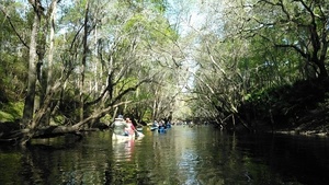
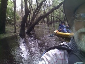
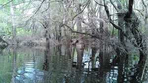
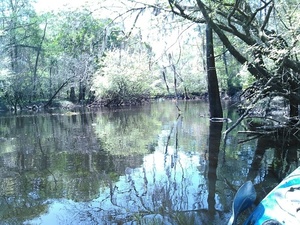
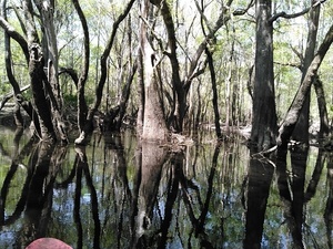
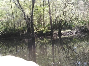
Wide and swampy 30.9236774, -83.3024368
Tire and other trash
Betty Marini, mariner 30.9215317, -83.3025970
Betty paddled right around those trees 30.9215317, -83.3025970
Bay Branch 30.9218769, -83.3037567
Bay Branch 2 30.9218769, -83.3037567
Bay Branch 3 30.9219456, -83.3038177
Gretchen and a log or two 30.9212112, -83.3040085
Betty boating along: she never fell in
Oops; somebody else fell in
Somebody helping 30.9198799, -83.3041305
And Can Denizman is back in his boat 30.9198799, -83.3041305
This looks like a repeat performancy by our first fallers
Onwards
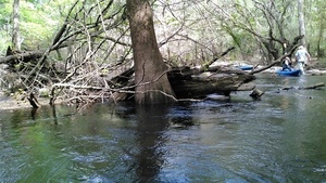
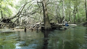
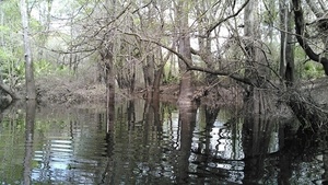
Cypress and oaks just below the end of Sermons Lane 30.9180698, -83.3090057
Sermons Branch 30.9183655, -83.3092956
Sermons Branch 2 30.9183788, -83.3093262
Sermons Branch 3 30.9183807, -83.3093414
Sermons Branch 4 30.9037666, -83.3112030
Turned around to see who was coming 30.9183998, -83.3093643
Gretchen around a narrow spot 30.9161796, -83.3112946
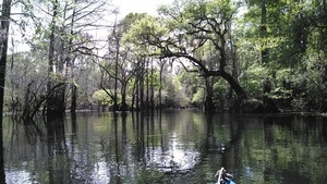
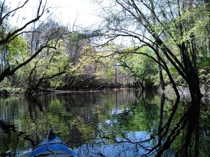
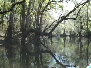
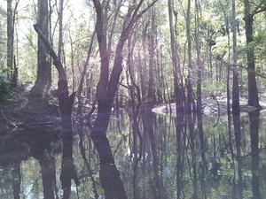
Trees trying to touch across the river
Snaky trees 30.9127579, -83.3125992
Dramatic shadows
Betty paddling below end of River Chase Drive 30.9060707, -83.3113861
A small digression
Gretchen paddling by 30.9049759, -83.3110275
Caught up with Betty and Gretchen 30.9049568, -83.3111725
Shadrick Sink is overland that way 30.9048519, -83.3111114
Withlacoochee River 30.9048519, -83.3111114
Nice tree
Gretchen photographing 30.9037476, -83.3111343
KIMG4009 30.9036865, -83.3110122
A path on the bank 30.9028644, -83.3110122
Path picture 2 30.9028644, -83.3110122
Path picture 3 30.9028644, -83.3110122
A creek?
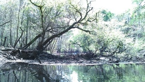
Tangled roots; somewhere around here is Cherry Creek but nobody spotted it
Withlacoochee River slough 30.9016113, -83.3117218
Slough opening out 30.9020367, -83.3117981
Broad and smooth slough 30.9022999, -83.3118362
Gretchen and Betty crossing behind me on the river 30.9023323, -83.3118133
Slough glassy with pollen 30.9025326, -83.3117828
Back to the river 30.9022674, -83.3119888
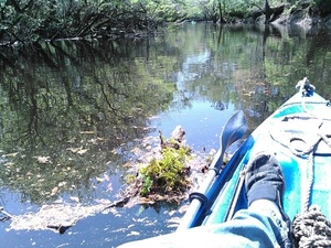
Flotsam, presumably out of Cherry Creek
Theyre ahead of me 30.9021549, -83.3122177
Betty boat beneath the trees
Movie: Under the oaks (1.2M)
Which way? 30.9015426, -83.3123856
Lets go on 30.8995895, -83.3139267
Gretchen and Betty 30.8995361, -83.3139496
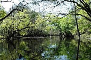
Trees reaching for every sunbeam 30.8983288, -83.3144226
Darker trees reaching 30.8983879, -83.3144226
Access path 30.8980064, -83.3141098
Sun starting to sink a little 30.8979892, -83.3141022
Access path? 30.8965339, -83.3142319
Stillhouse Branch 30.8959427, -83.3147049
Coming out of the Country Club 30.8959427, -83.3147049
Movie: Stillhouse Branch (1.5M)
Looks like you could paddle quite a ways up Stillhouse Branch
Gretchen on the river, seen from Stilhouse Branch 30.8955650, -83.3147964
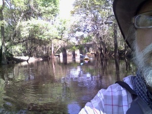
Back to the Withlacoochee River
Betty and Gretchen almost there 30.8938427, -83.3188171
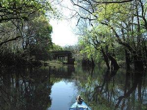
US 41 bridge downstream 30.8932800, -83.3185959
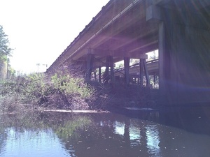
Embankment east, US 41 bridge
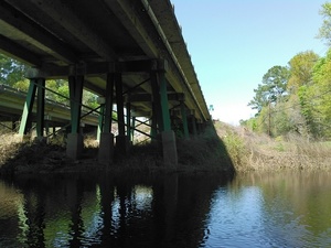
Embankment west, US 41 bridge 30.8927192, -83.3188934
Gretchen and Betty seen from under the US 41 bridge and power line 30.8926811, -83.3188324
USGS gage, between US 41 bridges on west bank 30.8926620, -83.3188476
They made it under the bridge 30.8928051, -83.3188705
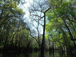
Tree top 30.8911629, -83.3201523
Log in tree
Another interesting tree top 30.8896923, -83.3218612
This was a big obstacle when water was lower
Can hear them from here 30.8883553, -83.3228226
The little creek where we put in on a previous trip
Park bench
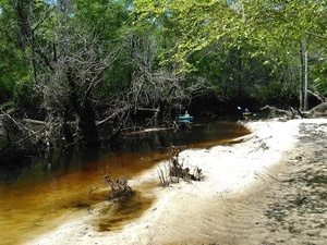
Gretchen and Betty coming around the last log jam 30.8875732, -83.3239441
Boats on the grass 30.8875408, -83.3239441
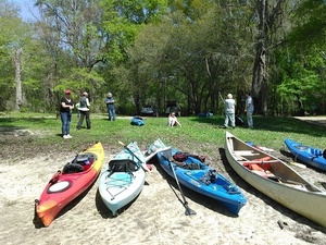
Cameraman setting up
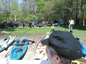
Getting ready for final picture 30.8875599, -83.3239822
Short Link:
Pingback: Withlacoochee River: Langdale Park to Little River Boat Ramp 2016-04-03 | WWALS Watershed Coalition