Category Archives: Blueway

New WWALS water quality tester Renee Kirkland 2020-06-05

Renee Kirkland has a water quality testing kit, thanks to donations to the water quality testing program.

[Trainer, kit, and tester]
Trainer, kit, and tester

Renee already passed the most recent water quality testing training. Trainer Gretchen Quarterman got Renee to review with her new kit. Renee is already on the WWALS Testing Committee, and now she’s ready to test.

She’s going to start on the Alapaha River, with Mayday Landing and Statenville Boat Ramp.

If you want to become a WWALS water quality tester, please Continue reading

Winner: Raptor, flower, paddling organization, tree base: Within These WWALS #6 2020-05-16

The winner of Within These WWALS #6 is…

Emmy Kidder.

She wins a packet of WWALS photo notecards from that watershed, sent via postal mail from WWALS charter board member Bret Wagenhorst.

Swamps and Springs WWALS picture notecards

Here are the answers to Within These WWALS #6.

Name this native raptor that can dive into water and catch live fish, has white under its wings making it easier to identify from below, and builds its nests atop trees over bodies of water, like this one shown atop a cypress at dusk.

Osprey, Pandion haliaetus.

We paddle by this nest most every time on our Banks Lake Full Moon paddles. The next one is coming up Continue reading

Naylor Boat Ramp Out and Back, Alapaha River 2020-06-13

Update 2020-06-19: Pictures.

Update 2020-06-18: Naylor Boat Ramp signs planted 2020-06-13.

Update 2020-06-12: Good to go, so see you there.

Join us for a one-mile paddle upstream and back from the newest boat ramp on the Alapaha River.

There’s plenty of room to stay six feet apart on the ground and ten feet apart on the water.

When: Gather 9:30 AM, launch 10 AM, Saturday, June 13, 2020

Put In: Naylor Boat Ramp, 6955 US 84 E, Naylor, GA 31641, in Lowndes County, Georgia.
From Valdosta go east on US 84, cross the river, make a U-turn when you can, go back west across the river and turn right into the park around the boat ramp. There’s also a nice beach in the park a bit downstream from the boat ramp.

GPS: 30.92507, -83.03867

Take Out: Naylor Boat Ramp

Bring: the usual personal flotation device, boat paddles, food, drinking water, warm clothes, and first aid kit. Also trash pickers and trash bags: every WWALS outing is also a cleanup.

Free: This outing is free to WWALS members, and $10 (ten dollars) for non-members. We recommend you support the work of WWALS by becoming a WWALS member today!

Event: facebook, meetup

[Naylor Boat Ramp, 2020:03:06 16:35:28, 30.9253889, -83.0393611]
Photo: Tasha Ekman Laface, Naylor Boat Ramp, 2020:03:06 16:35:28, 30.9253889, -83.0393611

Continue reading

Banks Lake Full Strawberry Moon Paddle, 2020-06-07

Update 2020-06-06: Gator and bats, sunset, no moon, at Banks Lake 2020-06-05.

Leisurely sunset paddle and watch the June Full Strawberry Moon rise over the lake.

No, there’s no curfew in Lanier County now (confirmed with the Lanier County Sheriff), and since there’s no shuttle on this outing, we can all stay 6 feet apart on land 10 feet apart on the water.

Banks Lake National Wildlife Refuge is in the Grand Bay–Banks Lake ecosystem. We usually see birds, bats and alligators. Sunsets are usually spectacular, and the full moon over the tree tops reflected in the lake is a sight to see.

When: Gather 7:30 PM, launch 7:50 PM, Friday, June 5, 2020

Moon and sun: Sunset 8:33 PM, Moonrise 8:41 PM

Put In: Banks Lake Boat Ramp, 307 Georgia 122, Lakeland, GA 31635, in Lanier County.

GPS: 31.035097, -83.097045

Take Out: Banks Lake Boat Ramp

Bring: the usual personal flotation device, boat paddles, food, drinking water, warm clothes, and first aid kit. Also trash pickers and trash bags: every WWALS outing is also a cleanup.

Boats: Kayaks are available to borrow but please let us know at least 2 days prior to the event. Bring your own if you have it.

Free: This outing is free to WWALS members, and $10 (ten dollars) for non-members, optional during this virus pandemic period. We recommend you support the work of WWALS by becoming a WWALS member today!

Event: facebook, meetup

[Sunset behind cypress]
Sunset behind cypress on Banks Lake Full Storm Moon Paddle 2020-02-09.

Continue reading

Pictures: Stone Bridge paddle from Cook County Boat Ramp (GA 76) 2020-05-16

About thirty paddlers made it upstream to Stone Bridge and back, although few people could paddle up the current under it.

[Helen Chaney: Suwannee Riverkeeper under Stone Bridge]
Photo: Helen Chaney, Suwannee Riverkeeper under Stone Bridge

Starting out at Cook County Boat Ramp, there was plenty of room for everybody to stay six feet apart on land and ten feet apart on water. Continue reading

Three Little River Landings in Swim Guide 2020-05-21

WWALS has added three more “beaches” on Swim Guide, this time on the Little River.

Our 300 closest friends from #PaddleGA2019 will recognize one of these, where they all put in for seven days on the Withlacoochee and Suwannee Rivers last summer: Cook County Boat Ramp (GA 76), Folsom Bridge Landing (GA 122), and Troupville Boat Ramp (GA 133).

[Laptop]
Laptop
In the app, these beaches will appear if you are near.
In the web interface, search for: georgia little river withlacoochee.

All are marked green for “Meets water quality standards” due to the zero (0) E. coli result I got at Cook County Boat Ramp Saturday, which is upstream on the Little River from the other two, combined with the zero result Suzy Hall got downstream on the Withlacoochee River at Knights Ferry Boat Ramp, and very low results a few days earlier from Continue reading

Withlacoochee River Landings on Swim Guide 2020-05-14

Update 2023-05-15: Here’s a live Swim Guide Map.

Update 2023-05-04: Added Franklinville Landing on the Withlacoochee River to Swim Guide.

Update 2021-05-21: Three Little River Landings in Swim Guide 2020-05-21.

Update 2020-12-21: Added Langdale Park Boat Ramp to Swim Guide and GA 133 Withlacoochee River Bridge, which is not actually public access; it’s just in Swim Guide to display water quality results.

All green this week on Swim Guide, eight landings and boat ramps on the Withlacoochee River in Georgia and Florida. There’s an app, or you can use the web interface.

[Florida]
Florida

This current good water quality is according to the results we posted yesterday.

If you’re nearby, these “beaches” (as Swim Guide calls every place somebody might swim) will probably pop up on the app. Continue reading

A clean week, Withlacoochee River 2020-05-08

Update 2020-05-16: Clean Withlacoochee River 2020-05-13.

Update 2020-05-14: Withlacoochee River Landings on Swim Guide 2020-05-14.

Last week was clean for the Withlacoochee River, and with no rain predicted, probably this weekend and the coming week, too.

Don’t forget to send in your comment on the GA-EPD Valdosta Consent Order.

But remember, Valdosta is not the source of the recent contamination. WWALS is talking to some of the agricultural sources. Please be patient: agriculture takes months or years to fix.

You can help.

[Approaching State Line Ramp --Bobby McKenzie]
Approaching State Line RampBobby McKenzie, 2020-05-10

We’ve seldom seen a week this clean. Continue reading

Vickers Branch and Hahira LAS 2020-05-11

How is the mysterious Vickers Branch south of Hahira related to the Hahira Land Application Site? What is that creek the rest of that LAS is on? And what does all this have to do with Lowndes County’s new IMPAIRED WATERS MONITORING AND IMPLEMENTATION PLAN? Why do we care about all this for the Withlacoochee and Little River Water Trail?

About six weeks ago, the bridge on Old US 41 North just south of Hahira broke and Lowndes County fixed it. Revealing that nobody knew a name for it. Except Phillip Williams, who says, “Some maps show it as Vickers Branch. The Vickers family were the ones who owned most of the land in the area back in the 1800s.”

[Map: Vickers Branch, Hahira LAS]
Map: Vickers Branch, Hahira LAS
in the WWALS map of the Withlacoochee and Little River Water Trail (WLRWT).

The Vickers Branch Bridge marker south of Hahira looks slightly too far south, but it’s where google street view and aerials show the bridge. It seems that the USGS stream trace I used in this map is not quite right.

[Photo: Lowndes EMA, of broken Vickers Branch Bridge]
Photo: Lowndes EMA, of broken Vickers Branch Bridge

Upstream of that Vickers Branch US 41 bridge, several branches or runs that drain quite an area. I have named them after Continue reading

Winner and answers: third Within These WWALS contest, 2020-04-25

First, remember the fifth Within These WWALS contest is still in progress, and you have until midnight tonight, May 9, 2020, to answer, to win a set of WWALS picture notecards from that waterbody:
https://forms.gle/Nidt7HnxS91fCPWQ6

Meanwhile, the winner of the third Within These WWALS contest is:

Jennifer Harris, of Parrott, Terrell County, Georgia.

She lives in the Flint River watershed, but she answered all the questions correctly before anybody else did.

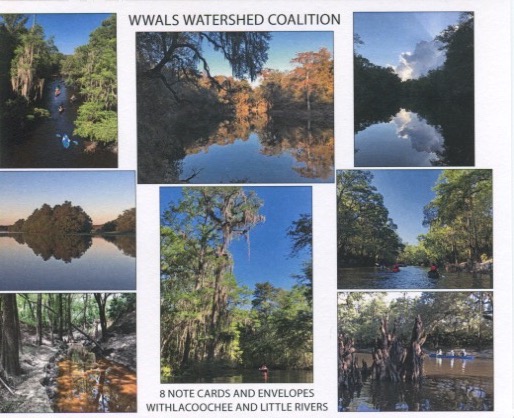
Withlacoochee and Little Rivers note cards

She got a set of Withlacoochee and Little Rivers note cards, sent to her by WWALS charter board member emeritus Bret Wagenhorst. You can get your own from the WWALS online stor for $10.00.

The answers to Within These WWALS #3 are:

Plant: Wild Azalea, Rhododendron canescens.

Blooms February to April, with a sweet jasmine scent. No, not honeysuckle: Continue reading