Update 2025-12-02:
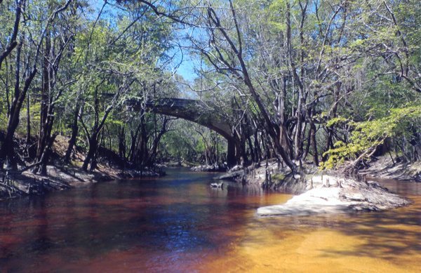
Where does this little creek by Knights Ferry Boat Ramp come from? 2205-11-22.
At
Knights Ferry Boat Ramp
we collected some trash, including three mattresses.
Our shuttle provider was Will Hart’s State Line River Outfitters.
We installed new versions of the signs for the Withlacoochee and Little River Water Trail (WLRWT).
Thanks to Micah Cofield for digging the posthole.
The third try found a spot with no rocks.
These signs were mostly paid for by a generous grant from the Georgia Department of Natural Resources (GA-DNR).
I’ve lost count how many sets of signs we’ve installed at Knights Ferry.
I think this was the fourth set.
Y’all don’t shoot them up this time, eh?
![[Knights Ferry Boat Ramp, Mattresses, signs, and trash, Old Bridge pilings, Canoe on the bottom 2025-11-22]](https://www.wwals.net/pictures/2025-11-22--kf-nankin-cleanup-pictures/fbmany.jpg)
Knights Ferry Boat Ramp, Mattresses, signs, and trash, Old Bridge pilings, Canoe on the bottom 2025-11-22
Thanks to Maya Loizeaux for collecting trash.
Micah and Maya did not paddle, but they helped.
Thanks to Pam Maxwell for coming down to join WWALS.
She did not paddle.
This is part one of the
WWALS cleanup from Knights Ferry to Nankin Boat Ramp, on November 22, 2025,
led by Will Hart and Scotti Jay.
Our seven paddlers saw the pilings of
Old Knights Ferry Bridge sticking out.
Before that bridge was built, there was Knights Ferry.
Now there is no bridge and no ferry, but you still get there on Knights Ferry Road.
Will Hart spotted a boat on the bottom.
We did not raise it.
We did raise a bunch of other things later.
We snaked through a couple of sets of rocks in the first quarter mile downstream.
Here’s a video:
https://www.facebook.com/Wwalswatershed/videos/853304003762459
https://youtu.be/gwKm-c1ObpM Continue reading →

![[Part 3, Knights Ferry to Clyattville-Nankin, Chainsaw Cleanup, Withlacoochee River 2025-11-12]](https://www.wwals.net/pictures/2025-11-12--kf-nankin-chainsaw-cleanup/fbmany.jpg)
![[Suwannee River Sill, Okefenokee Swamp --Shirley Kokidko, Alligator, Second and Third Gates, and Mixons Hammock 2025-11-26]](https://www.wwals.net/pictures/2025-11-26--sill-mixons-hammock/fbmany.jpg)
![[Low water, first gate, Suwannee River Sill, Okefenokee Swamp, Thursday, November 20, 2025]](https://www.wwals.net/pictures/2025-11-20--suwannee-sill-gate-1/fbmany.jpg)
![[Open the Okefenokee Gates, Suwannee River Sill, Actually always open, Since around 2000]](https://www.wwals.net/pictures/2025-11-15--open-the-okefenokee-gates/fbmany.jpg)
![[Turner Bridge to Cone Bridge, Suwannee River 2025-07-05, Thanks to Shirley Kokidko]](https://www.wwals.net/pictures/2025-07-05--turner-to-cone-bridge-pictures/fbmany.jpg)
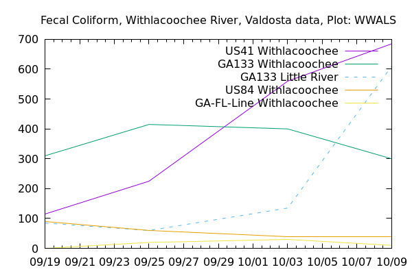
![[Linegraph]](https://www.wwals.net/pictures/2019-12-19--ga-133-wq/linegraph.jpg)