Second magnitude Rock Bluff Springs has been accessible only by boat up its 700-foot run from the Suwannee River, but SRWMD has acquired 175 acres around the spring that is opening as J.H. Anderson Jr. Park, at the end of this month.
When:
10:30 AM to 1:30 PM, Friday, May 31, 2019
10:30 AM – Opening Ceremony & Ribbon Cutting
11:30 AM – Guided Hikes, Swimming, & Plant Walks followed by refreshments
Where: 6560 Co Rd 340, Bell, FL 32619
Event: facebook
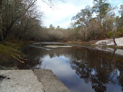
![[Photo: Edwin McCook]](https://www.wwals.net/pictures/2019-05-30--rock-bluff-spring-park/rock-bluff-springs-edwin-mccook.jpg)
Photo: Edwin McCook, of Rock Bluff Springs,
in
SRWMD Tentative Budget, Fiscal Year 2018-2019.
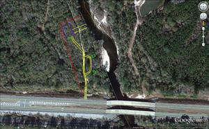
This new park and Rock Bluff Springs are in the Suwannee River Wilderness Trail (SRWT), and the park is now on our WWALS SRWT Map and on our map of all landings in the Suwannee River Basin.
To find maps of this new J.H. Anderson Jr. Memorial Park, I looked in some older working documents, including SRWMD’s 2018-2019 budget, which also says:
1. DEP Springs Protection and Restoration Grants FY 2017-18 Continue reading