Tag Archives: Piscola Creek

Piscola Creek

300x388 Piscola Creek Watersheds, in Piscola Creek, by John S. Quarterman, for WWALS.net, 2013 
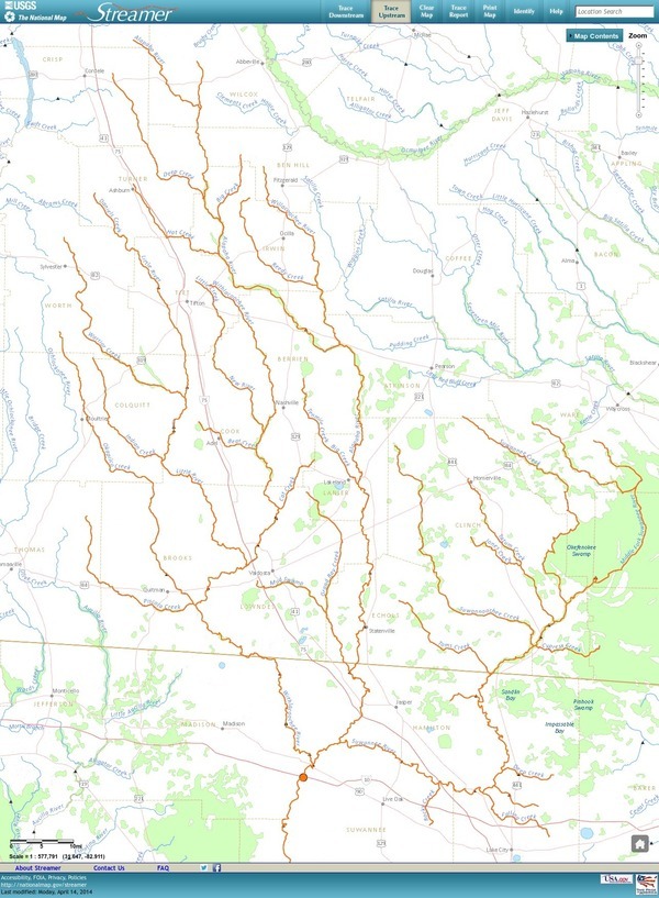
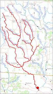
Running through Thomas and Brooks Counties, Georgia to the Withlacoochee River, Piscola Creek is on the USDA National Resources Conservation Service (NRCS) National Water Quality Initiative (NWQI) as two of the three Georgia Priority Watersheds, all of which are in WWALS watersheds.

Upper Piscola Creek Watershed encompasses 25,936 acres of land in the southeast part of Thomas and western part of Brooks Counties in southwest Georgia. The land around the watershed is about 75 percent photo by Georgia NRCS crop, pasture, range and other associated agriculture use. About 20 percent of the watershed is forested. The other five percent is commercial or communities.

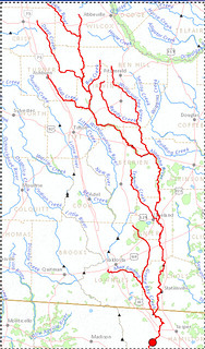
Middle Piscola Creek Watershed encompasses Continue reading

Grants to clean up two creeks in south Georgia

Funds are available for farmers, ranchers, and forest owners to help clean up two creeks in WWALS watersheds: Deep Creek in Turner County, a tributary of the Alapaha River, and Piscola Creek in Thomas and Brooks Counties, a tributary of the Withlacoochee River. The deadline for applications is May 16th.

WCTV via AP 5 April 2104, Georgia to Clean Up Waterways, Continue reading

Streamer on the Suwannee, Alapaha, and Withlacoochee Rivers: ten or more rivers and many creeks, lakes, swamps, and ponds

Update 3 March 2016: Suwannee River, ten rivers, and current location of USGS streamer.

The USGS Streamer interactive map shows all (well, most) tributaries of our two biggest WWALS rivers. Visitors sometimes refer to our “four rivers” since we only originally named four in our WWALS mission: Withlacoochee, Willacoochee, Alapaha, and Little. Yet we added the upper Suwannee, and there always were more than that: from one to ten rivers, depending on how you count them.

600x817 WWALS Rivers, in WWALS Rivers, by John S. Quarterman, for WWALS.net, 25 July 2015

The Withlacoochee River tributary map here shows the New River south of Tifton joining the Withlacoochee between Nashville and Adel.

Withlacoochee River Alapaha River

The New River is rather important, since it forms half of the boundary between Cook and Berrien Counties (the Withlacoochee River forms the other half): Continue reading