Tag Archives: Shirley Kokidko

Pictures: Banks Lake Full Cold Moon paddle 2022-12-07

Quite a few happy boaters, on a balmy weekday at an early start time, saw the sun set and the moon already rising, on the Banks Lake Full Cold Moon Paddle.

Thanks to Shirley Kokidko for leading it.

[Banners, Kayak Raffle Winner, Sunset, Moonrise, Banks Lake 2022-12-07]
Banners, Kayak Raffle Winner, Sunset, Moonrise, Banks Lake 2022-12-07

The next one is Friday, January 6, 2023.

Please make your boat reservations in advance. If we know more boats are wanted than the limited number at Banks Lake Outdoors, we can bring more, but not if we don’t know.

And please get there before the safety lecture. If you show up after that, we don’t like to, but we will turn you away. Gather time and paddle time are posted for each paddle outing. The safety lecture is before we paddle. Continue reading

Banks Lake Full Cold Moon Paddle, 2022-12-07

Update 2022-12-07: Pictures: Banks Lake Full Cold Moon paddle 2022-12-07.

Update 2022-12-07: Video: Kayak raffle winner @ Banks Lake Full Cold Moon paddle 2022-12-07.

Take a mid-week break on Banks Lake, with a leisurely Sunset and Full Moon Paddle.

When: Gather 4 PM, launch 4:30 PM, moonrise 5:07 PM, sunset 5:31 PM, end 6:30 PM, Wednesday, December 7, 2022

Put In: Banks Lake Boat Ramp, 307 Georgia 122, Lakeland, GA 31635, in Lanier County, on the Alapaha River Water Trail (ARWT).

GPS: 31.034824, -83.096725

[Sunset]
Sunset

Continue reading

Tickets: Floyd’s Island Okefenokee Camping, 2022-11-19

Update 2022-11-08: Tickets for the Refuge fee:
https://www.eventbrite.com/e/okefenokee-paddle-and-floyds-island-camping-tickets-464297485277?aff=ebdssbdestsearch
Because of the time change from DST to EST, the sun will set at 5:30 PM, so Shirley has moved the gather and launch times an hour earlier, to “give everyone time to get to Floyd’s and set up camp before it gets dark. Saturday we will be on the water by 9 a.m. so come early enough (8 AM) to have your boat loaded. Remember to have a bow line on your kayak to tie off at Minnie’s Shelter, the only rest stop. It may also come in handy if we have to get out and drag through low spots. If we want a campfire, it helps to carry firewood. I’ll bring some that we can divide up and everyone can carry a piece or two. Sunday will be a leisurely launch time.”

This is primitive, wilderness camping and paddling at its best.

To come on this outing be sure that you are comfortable paddling your loaded boat for 9 miles against a moderate current with only 1 stopping point to get out for a break. Minnie’s Lake platform is the 4 mile lunch stop, then 5 more miles to Floyd’s Island.

Yes, there will be alligators in the heart of the Okefenokee National Wildlife Refuge.

[Gator and kayak]
Gator and kayak

Continue reading

Camp and paddle at Griffis Fish Camp + Cast Iron Cookout, Suwannee River, 2022-12-02

Join us for 2 nights of rustic camping and cooking at Griffis Fish Camp on the Suwannee River downstream from the Okefenokee National Wildlife Refugee. Camping cost is $5.00 per person per night. There is also a $2.00 launch fee for each person. We have the Red Top shelter reserved so you can pitch your tent anywhere in the area. If you need hookup for a camper, you’ll need to reserve your own spot. Bring some firewood if you can. It gets dark early & chilly in December and we’ll enjoy a campfire both nights.

When: Gather 4 PM, launch none, sunset 5:29 PM, end all day, Friday, December 2, 2022
Gather 8:45 AM, launch 9:30 AM, end allday, Saturday, December 3, 2022
Wake up 8 AM, launch whenever you like, end go home, Sunday, December 4, 2022

Put In Friday: Griffis Fish Camp, 10333 Ga Highway 177 Fargo, Georgia 31631. From Fargo, travel south on US 441 to CR 177; turn left and travel 10 miles northeast; Griffis Fish Camp is on left, in Clinch County.

GPS: 30.78246, -82.443594

Take Out Friday: camping

Put In Saturday: Stephen C. Foster State Park Ramp, 17515 GA-177, Fargo, GA 31631. From Fargo, travel south on US 441 to CR 177; turn left and travel to Stephen C. Foster State Park, in Charlton County.

GPS: 30.826833, -82.361333

Saturday we’ll launch from Stephen Foster State Park at 9:30 and paddle 7 miles back to Griffis, with a lunch stop at the Sill where we will probably have to portage over. If the water level continues to be low, be prepared to portage your kayak over low spots and deadfall. If you don’t have a Ga. State Park pass or a National Park Pass, there is a fee for parking at SFSP. Ga. State Park passes are also free to borrow from any public library.

Take Out Saturday: Griffis Fish Camp

Back at camp we’ll get the fires going and start cooking. Show us what you can do with your old cast iron! There is no menu, absolutely anything goes. Bring your own plates/bowls/utensils to help reduce waste.

Put In Sunday: Griffis Fish Camp

GPS: 30.78246, -82.443594

Sunday morning will be a leisurely packing up. There is no check out time. If there is interest (and clean pots) maybe we can cook breakfast too. Everyone is free to go back to explore the Okefenokee further before heading home.

Take Out Sunday: Go home

[Cast Iron Cookout, Suwannee River Sill, Okefenokee National Wildlife Refuge, Griffis Fish Camp Beach]
Cast Iron Cookout, Suwannee River Sill, Okefenokee National Wildlife Refuge, Griffis Fish Camp Beach

Continue reading

Pictures: Alapaha, Dead Rivers, Sink 2022-10-02

Not many miles, but packed with sinks, a beach, two rivers, and the big one: the Dead River Sink, on October 2, 2022. Thanks, Dennis Price, for leading us, and for chainsawing our way in.

[Sasser Landing, Alapaha River, Dead River Sink 2022-10-02]
Sasser Landing, Alapaha River, Dead River Sink 2022-10-02

Thanks to Randy Madison for the ropes that got the boats up the cliff at the Confluence.

Thanks to Phil Royce for helping haul a couple of boats up the Jennings Bluff stairs.

More pictures are below. They’re also in a facebook photoset.

See also facebook photosets by: Continue reading

Floyd’s Island Okefenokee Camping, 2022-11-19

Update 2022-11-09: Refuge fee tickets and start a hour earlier.

This is primitive, wilderness camping and paddling at its best.

To come on this outing be sure that you are comfortable paddling your loaded boat for 9 miles against a moderate current with only 1 stopping point to get out for a break. Minnie’s Lake platform is the 4 mile lunch stop, then 5 more miles to Floyd’s Island.

Yes, there will be alligators in the heart of the Okefenokee National Wildlife Refuge.

[Gator and kayak]
Gator and kayak

Continue reading

Pictures: State Line to Turner Bridge, Suwannee River 2022-03-06

Maybe the most remote section of the Suwannee River, from the GA-FL line to Roline and Turner Bridge: here are pictures of the second day of the WWALS March 5-6, 2022, riverbank camping outing.

[Decamping, GA-FL line, Roline, Turner Bridge]
Decamping, GA-FL line, Roline, Turner Bridge

As usual, expedition leader Shirley Kokidko was worried before we were even on the water. Many thanks for leading this one, Shirley. Continue reading

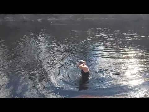
Videos: Intentional swimming, Suwannee River, Echols County, GA, 2022-03-05

Update 2022-09-06: Pictures: State Line to Turner Bridge, Suwannee River 2022-03-06.

The Georgia Environmental Protection Division wants evidence of intentional full-immersion swimming to redesignate river segments from Fishing to Recreational for tighter pollution limits. OK, here are some movies. Plus grandmas in a tree.

[Movie: Full immersion swimming, 16:30:59, 30.6006764, -82.6839565 (161M)]
Movie: Full immersion swimming, 16:30:59, (161M) 30.6006764, -82.6839565

Here is a WWALS video playlist.


Intentional swimming, Suwannee River, Echols County, GA 2022-03-05
30.6006764, -82.6839565
Videos by John S. Quarterman for WWALS Watershed Coalition, Inc.

For more swimming, see the still pictures from the same stretch of the river.

For context, see the WWALS map of the Suwannee River Wilderness Trail. While the SRWT formally runs from White Springs, Florida, to the Gulf, WWALS maps the entire Suwannee River.

For more WWALS outings, see:
https://wwals.net/outings/

 -jsq, John S. Quarterman, Suwannee RIVERKEEPER®

You can join this fun and work by becoming a WWALS member today!
https://wwals.net/donations/

Pictures: Fargo to campsite, Suwannee River 2022-03-05

Update 2022-09-01: Videos: Intentional swimming, Suwannee River, Echols County, GA, 2022-03-05.

Swimming, tree climbing, lunching, and paddling on the first day of a Suwannee River camping trip.

[Paddling, Swimming, Camping]
Paddling, Swimming, Camping

Thanks to Shirley Kokidko for organizing, and to the landowners for permission to camp. Continue reading

Pictures: Sullivan Launch to Madison Blue Spring Withlacoochee River 2015-10-24

A fine day, balmy, breezy, sunny, with springs and rapids and fine company, from Sullivan Launch to Madison Blue Spring on the Withlacoochee River, in the October WWALS Outing, October 24, 2015.

[Onwards from Hardee Spring 30.5444069, -83.2500076]
Onwards from Hardee Spring 30.5444069, -83.2500076

This is part of the Withlacoochee and Little River Water Trail, and you can join the committee!

Below are some pictures. Click on any small picture to see a larger version. Pictured: many shoals and rapids.

[Pinetta Gage steps and old-style measure 30.5957374, -83.2598038]
Pinetta Gage steps and old-style measure 30.5957374, -83.2598038

The Pinetta gage (pictured) read 6.4 feet. Any lower and more dragging boats would have been necessary. Lots of cypress, oaks, pines, and other native species.

Not pictured: a large turtle, numerous birds (heron, ibis, hawk, buzzard, others), and fish (mullet, bass). No gators. Very few invasive species, except the notorious Japanese climbing fern.

Watch the WWALS Outings for more outings and events!
https://wwals.net/outings/

 -jsq, John S. Quarterman, Suwannee RIVERKEEPER®

You can help with clean, swimmable, fishable, drinkable, water in the 10,000-square-mile Suwannee River Basin in Florida and Georgia by becoming a WWALS member today!
https://wwals.net/donations/

After

[WWALS at Madison Blue Spring --Gretchen Quarterman]
WWALS at Madison Blue Spring –Gretchen Quarterman

Before

[Gathering]
Gathering

Pinnetta Gauge

[Pinetta Gage Tower 30.5957374, -83.2598038]
Pinetta Gage Tower 30.5957374, -83.2598038

Old Belleville Bridge

[Belleville Bridge buttress from below 30.5953369, -83.2596130]
Belleville Bridge buttress from below 30.5953369, -83.2596130

On the water

[CR 150 bridge, looking upstream 30.5956955, -83.2594681]
CR 150 bridge, looking upstream 30.5956955, -83.2594681

First Shoals

[Shoals 30.5941982, -83.2590637]
Shoals 30.5941982, -83.2590637

Flotilla

[Gretchen and the boaters 30.5822926, -83.2627106]
Gretchen and the boaters 30.5822926, -83.2627106

Second Shoals

[More shoals 30.5819988, -83.2626953]
More shoals 30.5819988, -83.2626953

First Spring

[Coffee Spring 30.5775184, -83.2618179]
Coffee Spring 30.5775184, -83.2618179

Onwards

[Froth 30.5762119, -83.2609482]
Froth 30.5762119, -83.2609482

Third Shoals

[Sighting the rapids 30.5697098, -83.2624817]
Sighting the rapids 30.5697098, -83.2624817

On down the river

[Two directions 30.5679722, -83.2606277]
Two directions 30.5679722, -83.2606277

Eyott

[Island, or rather eyott? 30.5653133, -83.2575378]
Island, or rather eyott? 30.5653133, -83.2575378

Fossilized

[Fossils for lunch 30.5626812, -83.2563248]
Fossils for lunch 30.5626812, -83.2563248

River House

[House 30.5626812, -83.2563248]
House 30.5626812, -83.2563248

Left bank island

[Island on left 30.5626812, -83.2563248]
Island on left 30.5626812, -83.2563248

Karst

[Confab 30.5626812, -83.2563248]
Confab 30.5626812, -83.2563248

Tiny Fourth Shoals

[White water 30.5529365, -83.2608795]
White water 30.5529365, -83.2608795

Soon Spring

[Spring coming up 30.5446434, -83.2505264]
Spring coming up 30.5446434, -83.2505264

Hardee (Rossetter) Spring

[Hardee Spring dam 30.5446434, -83.2505264]
Hardee Spring dam 30.5446434, -83.2505264

After Hardee

[Onwards from Hardee Spring 30.5444069, -83.2500076]
Onwards from Hardee Spring 30.5444069, -83.2500076

Rock Tree

[Dan and the rock tree 30.5336761, -83.2483062]
Dan and the rock tree 30.5336761, -83.2483062

Balcones

[Undercut caves 30.5118561, -83.2455368]
Undercut caves 30.5118561, -83.2455368

PBR

[A boat ramp 30.5118217, -83.2455063]
A boat ramp 30.5118217, -83.2455063

Black Rocks

[Interesting black rocks 30.4932423, -83.2414474]
Interesting black rocks 30.4932423, -83.2414474

Fifth Shoals

[Rapids 30.4910717, -83.2443161]
Rapids 30.4910717, -83.2443161

Karst Tree

[Karst tree 30.4899406, -83.2438965]
Karst tree 30.4899406, -83.2438965

Egret

[Green bank, white bird 30.4822121, -83.2433777]
Green bank, white bird 30.4822121, -83.2433777

FL 6 Bridge

[FL 6 bridge from downstream 30.4812660, -83.2434616]
FL 6 bridge from downstream 30.4812660, -83.2434616

MBS

[Just around those logs 30.4810009, -83.2436981]
Just around those logs 30.4810009, -83.2436981

 -jsq, John S. Quarterman, Suwannee RIVERKEEPER®

You can help with clean, swimmable, fishable, drinkable, water in the 10,000-square-mile Suwannee River Basin in Florida and Georgia by becoming a WWALS member today!
https://wwals.net/donations/