Tag Archives: watershed

Deadline today: tell FERC hands off solar net metering

A New England group has asked FERC to revoke solar reimbursement plans (“net metering”). This affects all the U.S. If the Federal Energy Regulatory Commission (FERC) agrees, what would affect every rooftop and community solar installation, treating them all like large-scale industrial solar plants. FERC would be in charge of what, if anything, solar panel owners get reimbursed for electricity beyond what they use locally.

You can comment through this convenient web form.

Or use FERC’s efiling system, for FERC Docket No. EL20-42.

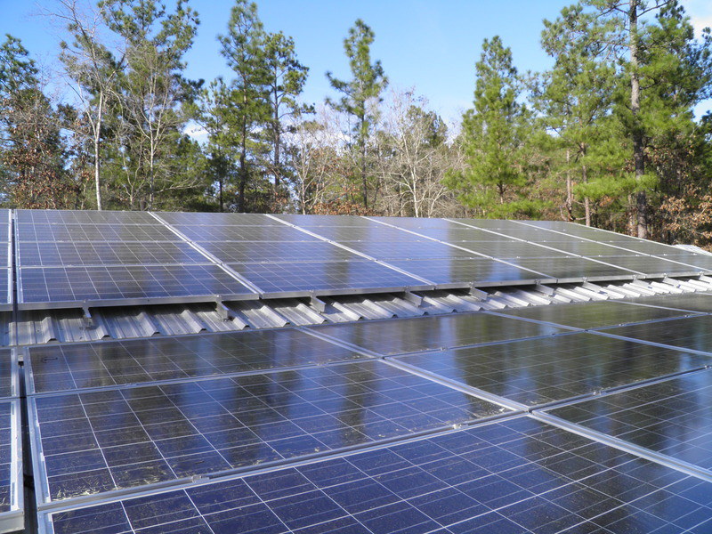
Old and new panels
Photo: John S. Quarterman, 2012-01-29.

More information:

Thanks to WWALS member Maxine Connor for the heads-up.

 -jsq, John S. Quarterman, Suwannee RIVERKEEPER®

You can join this fun and work by becoming a WWALS member today!

Florida lifts Withlacoochee River advisory; more rain could mean more contamination 2020-06-11

Update 2020-06-16: All eight Withlacoochee River landings green 2020-06-14

Valdosta’s Wednesday Knights Ferry result is not pretty: 2,300 cfu/100 mL E. coli, far over the 1,000 alert limit. Previously, I said we wouldn’t turn Swim Guide green until we saw that result. Plus, much more rain fell Friday on Lowndes and Brooks Counties, Georgia. Also, Valdosta got 1,500 on Okapilco Creek at US 84, even worse than the 833 I got there that same Wednesday (see yellow highlighted area).

So, Swim Guide stays red for the Withlacoochee River in Georgia. But Swim Guide goes green for Florida; see below. See also below for the Little and Alapaha Rivers.

WWALS will test tomorrow. You can help.

[More rain means...?]
More rain means…?
For context and links to the WWALS composite spreadsheet and all its sources, see https://wwals.net/issues/testing/.

After two consecutive days of good results from the state line downstream (see green highlighted area), the Florida Department of Health lifted yesterday, June 12, 2020, the Advisory they issued June 9, 2020. Continue reading

Good to go: Naylor Boat Ramp upstream Alapaha River paddle 2020-06-13

It’s a go on water quality and quantity for tomorrow morning at Naylor Boat Ramp on the Alapaha River. For outing details, see the original post.

[Naylor Boat Ramp (portrait)]
Photo: Bobby McKenzie, Naylor Boat Ramp (portrait), 2020-06-10.

Sure, the afternoon thunderstorms could happen earlier, but so far the weather ereports indicate they’ll start after we’ve paddled upstream and back. For further updates, see the facebook event or the meetup.

WWALS water quality tester Tasha Ekman LaFace reports her sample from Thursday resulted in 33 cfu/100 mL E. coli, which is quite clean, so no worries about bacteria. The kinds of contamination we’ve been seeing on the Withlacoochee River are apparently not happening on the Alapaha River, which has much less animal agriculture next to it. For context, see wwals.net/issues/testing/.

She also says there is plenty of trash to pick up before we paddle, so bring a bag, some gloves, and a trash picker if you’ve got it.

WWALS Outings Committee Chair and the leader of this expedition, Bobby McKenzie, reports:

I started paddling it today after work but it was raining, which I didn’t mind. I didn’t continue due to the lightning. But I’m pretty confident that there is enough water to paddle a mile based on the previous levels I’ve seen there using visual indicators.

The gauge at Statenville shows 82.5 currently and the lowest paddling level indicated on the WWALS Alapaha River Water Trail for Naylor Boat Ramp is 78.1.

Statenville gauge, Alapaha River

See you at Naylor Boat Ramp tomorrow morning. For outing details, see the original post.

 -jsq, John S. Quarterman, Suwannee RIVERKEEPER®

You can join this fun and work by becoming a WWALS member today!

Intro to Kayak and Canoe Camping at Dowling Park River Camp, Suwannee River, 2020-07-18

As an introduction to Kayak and Canoe camping, we will visit the Dowling Park River Camp on the Suwannee River Wilderness Trail.

[Ramp]
Photo: John S. Quarterman, Ramp to bathrooms at Dowling Park River Camp, 2019-06-20.

We will do a short paddle across from Dowling Park Boat Ramp in Suwannee County to the River Camp in Lafayette County. We will check in with the camp host, set up camp and continue our paddle upstream for 1 mile.

We will use Dowling Park Rivercamp as a base camp while having an intimate outing on the Suwannee River. You will have the comfort of having the boat ramp right across the river in case you forgot something or its just not working out.

Dowling Park River Camp is the model for the Troupville River Camp WWALS is proposing at the confluence of the Little River with the Withlacoochee River just west of Valdosta. Come see it for yourself!

Plus, there’s even a rope swing! There 5 are screened in platforms with fan, lighting and electrical outlets as well as multiple primitive camping sites. Along with a communal pavilion, there are also hot and cold showers and air conditioned bathrooms. There is a Camp Host that you can get firewood ($6 a bundle) and ice ($2 bag) to help lighten you load.

Platforms are available for families first until 6 July, 2020. After that platforms will be available to everyone on a first come basis. To maintain physical distancing, we recommend only families or already closely-associated groups stay in a platform. Everyone else, please bring a tent: primitive Camping is open to all. Message us with any questions/reservations and we will help you get setup.

Also there is no shuttle for this trip.

Dowling Park River Camp is the model for the Troupville River Camp WWALS is proposing at the confluence of the Little River with the Withlacoochee River just west of Valdosta. Come see it for yourself!

When: Gather 11:30 AM, launch 12 PM, Saturday, July 18, 2020

Put In: Dowling Park Boat Ramp. The boat ramp is on the north side of CR 250 at the Suwannee River, in Suwannee County, Florida.
That’s an hour south of Valdosta, GA, an hour west of Lake City, a little more than an hour east of Tallahassee, and an hour and a half northwest of Gainesville, FL. It’s only about half an hour from Live Oak, Madison, or Mayo.

GPS: 30.244833, -83.249

Take Out: Dowling Park Boat Ramp

Bring: a tent, plus the usual personal flotation device, boat paddles, food, drinking water, warm clothes, and first aid kit. Also trash pickers and trash bags: every WWALS outing is also a cleanup.

Boats: Kayaks and maybe canoes are available to borrow but please let us know at least 2 days prior to the event. Bring your own if you have it.

Free: This outing is free to WWALS members, and $10 (ten dollars) for non-members. We recommend you support the work of WWALS by becoming a WWALS member today!

Event: facebook, meetup

[Elevated]
Photo: John S. Quarterman, Elevated sleeping platform at Dowling Park River Camp, 2019-06-20.

Continue reading

Florida, and Upstream water quality tests for Lowndes and Brooks Counties, GA 2020-06-10

Update 2020-06-13: Florida lifts Withlacoochee River advisory; more rain could mean more contamination 2020-06-11.

The Withlacoochee River from the state line to the Suwannee River looked much better Wednesday, according to FDEP results.

Upstream on the Withlacoochee and Little Rivers and two out of three creeks in Brooks County, not so good, according to samples I took Wednesday.

Valdosta’s Wednesday results fill in US 41 (North Valdosta Road), GA 133, and US 84 on the Withlacoochee River. We await Valdosta’s Knights Ferry and Nankin Boat Ramp results.

Meanwhile, you can help.

[Withlacoochee R. @ GA 122 to Suwannee R. @ US 90]
Withlacoochee R. @ GA 122 to Suwannee R. @ US 90
For context and links to the WWALS composite spreadsheet and all its sources, see https://wwals.net/issues/testing/.

Thanks to the Florida Department of Environmental Protection (FDEP) for testing from GA 31 as far downstream as US 90.

[Horn Bridge, GA 31, Withlacoochee River]
Horn Bridge, GA 31, Withlacoochee River

But where did the contamination go? Did it get diluted? Or did it just wash farther downstream? Continue reading

Contamination moving downstream in Florida 2020-06-09

Update 2020-06-12: Florida, and, Upstream water quality tests for Lowndes and Brooks Counties, GA 2020-06-10.

Tuesday data from Madison Health shows the contamination had moved downstream, with 1,585 cfu/100 mL E. coli at FL 6, just above Madison Blue Spring.

By now it’s probably downstream from there. Nobody knows, because nobody is testing down there. Floridians, maybe you’d like to point this out to your elected and appointed state officials. If Valdosta, GA, can test three times a week 40 miles to the state line, the state of Florida could do the rest all the way to the Gulf.

[At least as far as FL 6 downstream]
At least as far as FL 6 downstream
For context and links to the WWALS composite spreadsheet and all its sources, see https://wwals.net/issues/testing/.

I hope SRWMD is modeling flow and dilution and making a prediction for how far downstream the problem may travel on the Withlacoochee or even the Suwannee Rivers.

I collected samples from seven upstream locations yesterday (Wednesday), on the Withlacoochee and Little Rivers in Lowndes County and three creeks in Brooks County. Results on those should be ready late today. You can help.

[State Line Boat Ramp, Withlacoochee River]
State Line Boat Ramp, Withlacoochee River

Also yesterday I put out yellow Caution sign back up at State Line Boat Ramp. Continue reading

Online MFL meeting, Santa Fe, Ichetucknee, and Springs 2020-06-16

Online, so you don’t have to travel, you can ask why SRWMD is proposing reductions in the minimum flows of the Santa Fe and Ichetucknee Rivers:

[Entry]
Entry

In Lower Santa Fe and Ichetucknee Minimum Flow and Minimum Water Level (MFL) Frequently Asked Questions (FAQs),

What is the new, proposed MFL?

A minimum flow and minimum water level (MFL) evaluation was used to determine the quantity of water needed to ensure the safety and health of the Lower Santa Fe and Ichetucknee (LSFI) Rivers and associated springs. The new LSFI MFL evaluation has determined that median Santa Fe River flows should be 91.9%near Ft. White and 91% near US Hwy 441 gaging stations, and that median Ichetucknee River flows should be 97.2% at the US Hwy 27 gaging station.To review the 2019 LSFI Technical Document, visit the LSFI webpage.

How does the new, proposed MFL differ from the 2015 LSFI MFL evaluation? Continue reading

Banks Lake Buck Moon Paddle, 2020-07-05

Update 2020-07-07: Rained out.

The July Full Buck Moon will rise over Banks Lake a few minutes before three quarters of an hour after the sun sets, as we paddle leisurely on the lake.

Since there’s no shuttle on this outing, we can all stay 6 feet apart on land 10 feet apart on the water.

Banks Lake National Wildlife Refuge is in the Grand Bay–Banks Lake ecosystem. We usually see birds, bats and alligators. Sunsets are usually spectacular, and the full moon over the tree tops reflected in the lake is a sight to see.

When: Gather 7:30 PM, launch 7:50 PM, Sunday, July 5, 2020.

Moon and sun: Sunset 8:40 PM, Moonrise 8:31 PM
Sunset 8:39 PM, Moonrise 9:26 PM

Put In: Banks Lake Boat Ramp, 307 Georgia 122, Lakeland, GA 31635, in Lanier County.

GPS: 31.035097, -83.097045

Take Out: Banks Lake Boat Ramp

Bring: the usual personal flotation device, boat paddles, food, drinking water, warm clothes, and first aid kit. Also trash pickers and trash bags: every WWALS outing is also a cleanup.

Boats: Kayaks are available to borrow but please let us know at least 2 days prior to the event. Bring your own if you have it.

Free: This outing is free to WWALS members, and $10 (ten dollars) for non-members, optional during this virus pandemic period. We recommend you support the work of WWALS by becoming a WWALS member today!

Event: facebook, meetup

[Cypress and boats]
Cypress and boats on Banks Lake Flower Storm Moon Paddle 2020-06-05.

Continue reading

Additional: Filthy Withlacoochee River Monday after Sunday rain 2020-06-08

Update 2020-06-11: Contamination moving downstream in Florida 2020-06-09.

The E. coli numbers jump up from US 84 to Knights Ferry in additional data from Valdosta for Monday. In between is Okapilco Creek coming out of Brooks County, with many beef and dairy cow pastures upstream.

[Additional Valdosta data]
Additional Valdosta data
For context and links to the WWALS composite spreadsheet and all its sources, see https://wwals.net/issues/testing/.

Valdosta’s 1,600 cfu/100 mL at the state line is nowhere near Madison Health’s 24,196, but still higher than the 1,000 alert limit.

It’s a good guess that Madison and Hamilton County Health Departments are putting up signs in Florida after their Withlacoochee River Advisory of yesterday.

I hope some Florida state agency is testing downstream from FL 6, because by now the contamination may well have moved down that way.

I am heading out to collect samples for WWALS and to put our yellow diamond Caution signs back up at State Line and Nankin Boat Ramps. The Knights Ferry access road is washed out so that one will have to go up later. You can help.

Yesterday I set all eight Withlacoochee River Boat Ramps and Launches in Swim Guide to show red for failed water quality.

[Swim Guide red from US 84 to Madison Boat Ramp]
Swim Guide red from US 84 to Madison Boat Ramp

Thanks to Valdosta PIO Ashlyn Johnson for Continue reading

Filthy Withlacoochee River Monday after Sunday rain 2020-06-08

Update 2020-06-10: Additional: Filthy Withlacoochee River Monday after Sunday rain 2020-06-08

Yes, again there’s a Withlacoochee River Advisory from the Hamilton and Madison County, Florida, Health Departments. But it’s not what many people automatically assume.

WWALS is putting its yellow diamond Caution signs back up. All eight Withlacoochee River Boat Ramps and Launces in Swim Guide should shortly show red for failed water quality.

[06.09.20-Withlacoochee-River-Advisory-Madison-Hamilton-0001]
06.09.20-Withlacoochee-River-Advisory-Madison-Hamilton-0001
PDF

Notice the high E. coli at US 41 (North Valdosta Road), twice the high alert limit of 1,000. That is north of almost all of Valdosta. The numbers are still above alert limit but somewhat lower at GA 133 and US 84.

The really high numbers start at GA 31, at State Line Boat Ramp. And 24,196 is extremely high. See What do these numbers mean?

So the main contamination seems to be coming into the Withlacoochee River downstream from US 84. That very likely means down Okapilco Creek from Brooks County, Georgia. Which fits with 4.75 inches of rain at Dixie, GA, in the west of Brooks County and 4.7 inches at the east edge of the county on the Withlacoochee River at US 84. Since that storm, as most do, moved from east to west west to east, we can guess similar amounts of rain fell right across Brooks County. What does that spell? Cows.

Not just from one location; probably from cow pastures all over Brooks County. And maybe upstream, since more than two inches of rain fell on Moultrie.

And of course the higher-than-alert results from US 84 north are not from Brooks County. There are horse farms and cows and hogs up there, too, as well as septic tanks, domsetic pets, and wildlife in the woods. And yes, runoff from city streets. But no sewage spills have been reported. Continue reading