Monthly Archives: July 2015

Please join the opposition to the Sabal Trail watershed invader –WWALS to SSRWPC

This letter is for today’s Monday 20 July 2015 SSRWPC meeting, at Aniston’s Restaurant, 1404 W. Baker Highway, Douglas, GA. See also the LAKE videos of last month’s SSRWPC meeting. -jsq

PDF

Dear Suwannee-Satilla Regional Water Planning Council,

WWALS Watershed Coalition is the WATERKEEPER® Affiliate 
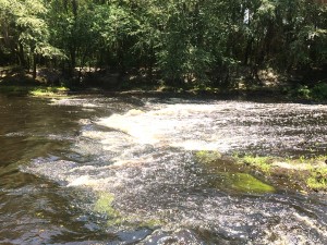
representing the watersheds of the Withlacoochee and Little Rivers, which are in the proposed paths of the Sabal Trail natural gas pipeline through Lowndes, Brooks, and Colquitt Counties Georgia.

WWALS has long opposed that pipeline from Alabama to Florida, which is funded by NextEra Energy of Florida and Duke Energy of North Carolina for construction by Spectra Energy of Houston, Texas. WWALS is an intervenor against it with the Federal Energy Regulatory Commission (FERC) on docket CP15-17.

Please ask FERC to deny a permit for Sabal Trail

Continue reading

Two GA-EPD water advisories about US 84 widening project

Thirty-day comment periods closing 12 August 2015 to comment on the US 84 widening project, say 300x175 Greasy Branch, CSX Railroad, Upper Suwannee River Watershed, in Two GA-EPD water advisories about US 84 widening project, by John S. Quarterman, for WWALS.net, 13 July 2015 two Public Advisories from GA-EPD Watershed Protection Branch. One is in the Satilla River watershed, about “two existing open water ponds (outflowing into jusrisdictional[sic] wetlands associated with Lees Branch)”: those ponds are next to the groundwater-contaminating CSX railyard in Waycross. One is in the Upper Suwannee River watershed, about “three existing open water ponds (outflowing into jusrisdictional[sic] waters associated with Greasy Creek and the CSX railroad)”. Maybe the Southern Environmental Law Center letter to GDOT and the U.S. Army Corps of Engineers got some results, although these advisories are from a different state agency.

The Upper Suwannee one starts at Continue reading

Sullivan Launch to Blue Spring, Withlacoochee River Outing 2015-10-24

Update 2022-07-20: Better picture labels and access.

Update 2015-10-29: Pictures: Sullivan Launch to Madison Blue Spring Withlacoochee River 2015-10-24.

Downstream on our tea-colored Withlacoochee River to the Blue Spring, it’s the October WWALS Outing!

When: 9AM Saturday October 24th 2015

Where: Sullivan Launch to Madison Blue Springs State Park.

Distance: 10.2 miles, about 5 hours, after a shuttle of about 40 minutes.

Facebook: event.

This outing is Free! But we encourage you to join WWALS today to support our fun outings and important work: /donations/. See our newsletters, and the press Releases and news. And consider joining the new Withlacoochee and Little River Water Trail Committee.

Directions: Continue reading

GA 135 Alapaha River Cleanup 2015-09-26

It’s the annual WWALS Adopt-A-Stream cleanup, this time at GA 135 on the Atkinson County side of the Alapaha River, plus if there’s time, the Berrien County side.

When: 9AM Saturday September 26th 2015

Where: Continue reading

Lakeland To Hotchkiss Rd. Landing Paddle

It was hot Saturday morning. The water level was perfect (2.2 feet on the Statenville gage),  IMG_0892 a nice current to help push us to our destination 14 miles away. As the Alapaha River meanders through the wilderness of South Georgia it erodes the banks on the outside of the curves forming tall bluffs and on the inside of the curve the slow water drops sand to form beautiful white sand beaches that beckoned us to stop for a swim, so we did.

The canopy at times covered the river completely. It is very Continue reading

WWALS Water Trails at Southern Georgia Regional Commission Council 2015-07-23

WWALS Ambassador Dave Hetzel will speak about the Alapaha River Water Trail (now looking to place signs) and the Withlacoochee and Little River Water Trail (Committee just formed and looking for more members) at the Southern Georgia Regional Commission Council meeting 11AM July 23rd in Pearson, GA 31642.

Update 2015-07-23: Civic Center, 786 Austin Ave. East, Pearson, GA

According to New Georgia Encyclopedia, Continue reading

Typical USGS streamgage costs with example near Okapilco Creek

Update 2021-03-09: The funding cost per gauge has gone up, to $22,500, of which usually the USGS contributes about $900.

How much would it cost to fund the Okapilco Creek gage so it won’t go offline July 31st? 300x342 Pie: Percentages of funding in various activities, in Streamgage Operation and Maintenance Cost Evaluation, by U.S. Geological Survey, for WWALS.net, 1 June 2010 About $13,600/year, more or less, mostly for field and office labor and administration, with only 10% for the field equipment. Since this gage is located in Brooks County, Georgia, the most likely funding body (after USGS itself) would be the Brooks County Commission. Yes, it’s in WWALS watersheds; no, WWALS doesn’t plan to take on funding streamgages. If some funding organization appeared that wanted to pass the funds through WWALS, which is a 501(c)(3) educational institution, that would be possible. But this seems more like a government issue.

Costs

Continue reading