Update 2016-12-08: Complaint filed with GA-EPD, USACE, FERC:
PDF.
More pictures below of GA 333 and Coffee Road, Okapilco Creek, and Little Creek (click on any small picture for a bigger one), a Google Map with all these pictures linked in, and
here’s a
WWALS video playlist:
-jsq
You can join this fun and work by becoming a WWALS member today!
Sabal Trail alignment map, courtesy of Lowndes Area Knowledge Exchange (LAKE):
Sabal Trail alignment map, courtesy of Lowndes Area Knowledge Exchange (LAKE):
These pictures are linked into the
Crowdsourced google map,
which is also embedded below.
Short Link: We didn’t see any silt fences where Sabal Trail has red pipe laid out across Okapilco Creek and Little Creek,
north of Coffee Road, west of GA 333 in Brooks County, Georgia, between Barwick and Barney.
We didn’t see any silt fences where Sabal Trail has red pipe laid out across Okapilco Creek and Little Creek,
north of Coffee Road, west of GA 333 in Brooks County, Georgia, between Barwick and Barney.

Red pipe, Okapilco Creek Middle Bridge, Sabal Trail, 30.9174160, -83.5892520

Digging under Coffee Road, Sabal Trail, 30.9162200, -83.5822560
GA 333


Pipe across a field, GA 333, 30.9116590, -83.5825830

Pipe through the trees, GA 333, 30.9122160, -83.5820180

Movie: GA 333, 9443 Moultrie Rd, Morven, GA 31638, 30.9136020, -83.5809370

Four-wheeler guarding Sabal Trail GA 333, 30.9136970, -83.5807550
Coffee Road, Okapilco Creek, Little Creek


Hooded road work sign, 624 Coffee Rd, Quitman, GA 31643, 30.9172940, -83.5792320

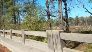
Okapilco Creek Bridge, Coffee Road, 30.9167190, -83.5871370

Pipe north of Coffee Road, 30.9169890, -83.5874890
Red pipe, Okapilco Creek Middle Bridge, Sabal Trail, 30.9174160, -83.5892520
Movie: Red pipe, Okapilco Creek, Little Creek, Coffee Road, w. of GA 333, 30.9182490, -83.5904850

Movie: heading east, Little Creek, Okapilco Creek, under Coffee Road, 30.9162820, -83.5821020

S. from Little Creek Bridge, Coffee Road, 30.9189600, -83.5949850

Troy Access, Sabal Trail, Coffee Road, 30.9161020, -83.5829540

Digging under Coffee Road, Sabal Trail, 30.9162200, -83.5822560

No Trespassing, Sabal Trail, Coffee Road, 30.9163010, -83.5819350
Google Map
One thought on “Sabal Trail at Okapilco Creek 2016-12-06”
WWALS Watershed Coalition (WWALS) is Suwannee RIVERKEEPER®
A healthy watershed with clean, swimmable, fishable, drinkable water.

Pingback: GA-EPD found Sabal Trail right of way violation 2016-12-14 | WWALS Watershed Coalition