Update 2016-11-29: Added to this google map: WWALS aerials of Gilchrist County, and Sabal Trail alignment maps localized by LAKE for Mitchell, Colquitt, Brooks, and Lowndes Counties, Georgia, and Hamilton, Suwannee, and Gilchrist Counties, Florida to just north of Bell, FL.
Update 2016-11-04: Now with Sabal Trail route digitized through Gilchrist, Alachua, and part of Levy Counties, plus part of the Citrus County line.
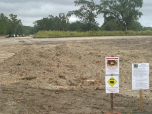
Signs, silt fences, backhoes in wetlands: you can log pictures on a map of anything going on at a Sabal Trail construction site from your mobile phone, tablet, or laptop. Already posted your pictures on the web? Link them into the map. Here’s how.
 You’ve seen many pictures posted by WWALS, taken on the ground and in the air, and linked into a google map (which also has Sabal Trail’s alignment maps linked in).
Here’s another google map, to which more people can add pictures.
If you want to add pictures to this new crowdsourcing google map, you need to:
- Be a WWALS member: it’s easy to join. OK, we’re not actually requiring this, but very strongly recommending it.
- Ask to be an editor of this map; send email to wwalswatershed@gmail.com. If you’ve got a gmail.com address, please use that.
- Stick to pictures of the pipeline path, facilities such as pipe yards, immediate surroundings, or related locations such as pipeline offices, or related events such as demonstrations. No spam, no intrusions into unrelated properties, and nothing illegal.
- Read google’s writeup on how to add placemarks, text, and pictures.
- Accept that this crowdsourced map and your participation in it is an experiment, either of which can be discontinued at any time for any reason.
- Accept that WWALS Watershed Coalition, Inc. has no responsibility or liability for the content of any picture or other content you or anyone else may post.
This is just one way to crowdsource pictures, offered because there’s a need for it. Nothing stops anybody from making their own google mymap or using some other method to collect pictures. If you don’t like google, please: don’t spend time telling us that. If you know a better way, show us.
Meanwhile, here’s one way. You can search for an address, or pan and zoom and click on the teardrop “add marker” icon. And googlemap tells you the GPS coordinates. Google’s writeup explains how to add placemarks, text, and pictures.
If you’ve got questions, please post them as comments. But read google’s how-to first.
And if you see something that looks like an environmental or other code violation, here are some addresses to report them to.
-jsq
You can join this fun and work by becoming a WWALS member today!
Crowdsourcing Google Map
Follow this link for the google map. It’s also embedded below.
You can join this fun and work by becoming a WWALS member today!
Short Link:

Pingback: Aerials: Suwannee, Ocholockonee, Withlacoochee, Santa Fe Rivers, Okapilco Creek, Sabal Trail Moultrie CY3-6 @ WWALS Southwings 2016-10-22 | WWALS Watershed Coalition
Pingback: Suwannee River HDD, Sabal Trail, SRSP, Withlacoochee River, Pilgrim’s Pride | WWALS Watershed Coalition
Pingback: Water Is Life Camp protecting Santa Fe River against Sabal Trail | WWALS Watershed Coalition