Update 2019-05-02: Please remember to send your letter to FL Gov. DeSantis.
SB 7068 passed today, 76 to 36. Please call or write Florida Governor DeSantis.
Sierra Club has already published a call urging Gov. DeSantis to veto this “Roads to Ruin” toll expressway bill. WWALS is a signatory, among the six Florida Waterkeepers signed on, with 90 total organizations.
Why is Florida even considering building more toll roads while the Panhandle’s homes, businesses, and agriculture are still in ruins after Hurricane Michael?
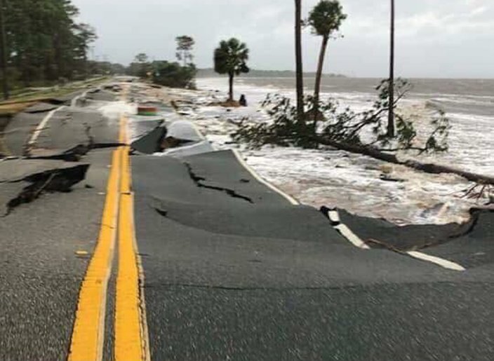
Photo:
PORT ST. JOE RESIDENT FOR PHILLYVOICE,
The destruction of Hurricane Michael on Florida’s Mexico Beach.
As the letter to Gov. DeSantis says: “Providing safe shelters for evacuees is a more practical and affordable response to extreme weather events than new toll expressways.”
For Immediate Release
May 1, 2019Contact: Frank Jackalone, frank.jackalone@sierraclub.org, 727-824-8813, x302; 727-804-1317
Paul Owens, powens@1000fof.org, 850-222-6277 x102, 407-222-2301STATEWIDE ALLIANCE URGES GOVERNOR DESANTIS TO VETO “ROADS TO RUIN” TOLL EXPRESSWAY BILL
Florida taxpayers, rural communities, the Everglades, and water quality are at riskTallahassee —Today 90 conservation organizations, civic groups, and businesses representing the Panhandle to the Keys sent a letter to Governor Ron DeSantis urging him to veto the Transportation Corridor bill, SB 7068, when it arrives on his desk.
The letter to the Governor follows similar letters sent to the Senate and House last week and will test the Governor’s post-inaugural declarations of dedication to protecting the Everglades, the springs, and the state’s water quality.
The letter:
Continue reading

![[2019-04-15--WWALS-to-EPA-0001]](https://www.wwals.net/pictures/2019-04-15--epa-rule-deadline/2019-04-15--WWALS-to-EPA-0001.jpg)
![[WKA FL Chair, Governor, Cabinet]](https://www.wwals.net/pictures/2019-04-02--fl-water-conservation-month/56161722_10157635950051162_4954783867346092032_n.jpg)
![[Miami Waterkeeper attorney Kelly Cox]](https://www.wwals.net/pictures/2019-02-08--piec-wka-fl/20190208_142126.jpg)

![[All Georgia Riverkeepers]](https://www.wwals.net/pictures/2019-02-06--ga-afs-riverkeepers/99-panel.jpg)