Pictures: Woods Ferry Tract to Suwannee Springs 2017-05-20

Springs and sand like snow, red and yellow water, chatting as we go, Woods Ferry to Suwannee Springs on the Suwannee River, May 20, 2017, with Hands Across the Sand at noon. Even though everyone had a trash bag, there was surprisingly almost no trash to pick up until we got to Suwannee Springs. Here are some pictures, a few videos, and a google map showing the locations.

Update 2021-09-23: Water levels were 36.34′ on the Suwannee Springs USGS gauge and 49.47′ on the White Springs gauge.

What is the name of this spring?
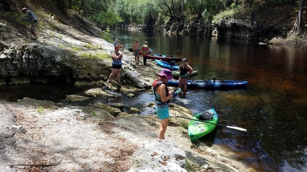
Upriver across the spring, Upriver across the spring, 30.3695100, -82.8887100

It’s in SRWMD’s Continue reading

Sabal Trail asks FERC to authorize turning on gas 2017-05-17

Sabal Trail has discovered the southeast has drought! That’s its excuse for not greening up its gouge across what it calls its “greenfield” route. Sabal Trail “will continue to be available” to address landowner concerns, as if they have addressed destroying Randy Dowdy’s world-record soybean fields. They claim they’ve resolved 271 of 279 landowner issues: as near as I can tell mostly by suing the landowners, like they did the Bell Brothers.

Revegetation and drought

Pipeline company chutzpah! Solar power would do this faster, cheaper, and cleaner: “Granting Sabal Trail’s request by May 26 will allow Sabal Trail to commence service promptly to FPL and will significantly increase the available supply of natural gas to the Southeastern United States during the heart of the peak summer cooling season.” More likely Sabal Trail wants to be in-service by the end of May to avoid forfeiting that $200 million bond required by FPL’s RFP.

Sabal Trail’s list of karst features doesn’t match its own Continue reading

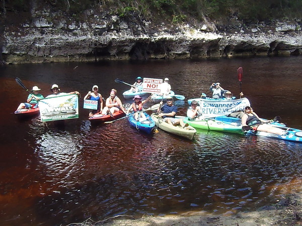
Hands Across the Sand on the Suwannee, 2017-05-20

Here’s Hands Across the Sand on the Suwannee River, with boats, during the WWALS outing from Woods Ferry Tract to Suwannee Springs Saturday.

And tie-dye
Picture by Gretchen Quarterman for WWALS.

Here’s an out-take from the making of, as Gretchen attempted to Continue reading

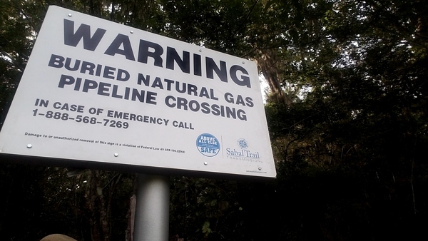
Sabal Trail signs at Suwannee River, 2017-05-20

Here are the signs Sabal Trail planted Friday at the Suwannee River.

WARNING, BURIED NATURAL GAS PIPELINE CROSSING, IN CASE OF EMERGENCY CALL 1-888-568-7269, Sabal Trail Transmission,

Updated 2017-05-23: Clarify what the google map is about.

See the Continue reading

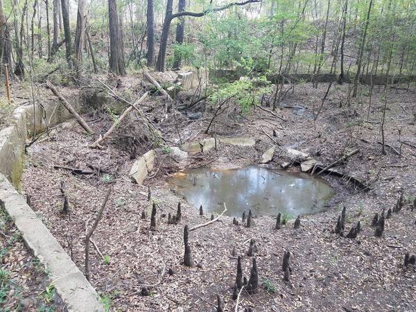
Suwannee County HDD, Sabal Trail, 2017-05-20

Sabal Trail has hidden the “depressions” they admitted to recently.

Evidence all buried at HDD site,

Updated 2017-05-23: Clarify what the google map is about.

See the Continue reading

Sabal Trail sign installation at SRSP, 2017-05-19

Received Friday:

Today Sabal Trail workers were clearing underbrush and small trees on the bank of the Suwannee River where the pipeline is installed under the river to install a sign. I could not see what the sign said, the sign was on the ground with the words facing down.

Sign

Correct me if I am wrong, but didn’t STT say Continue reading

Here

Lots more pictures now posted of this sunny Suwannee River outing past springs and sand like snow, plus Hands Across the Sand.

 -jsq, John S. Quarterman, Suwannee RIVERKEEPER®

You can join this fun and work by becoming a WWALS member today!

Wade Spring, 7 miles east of Quitman, GA, May 2017

Local cave diver Aaron Sirmons took these pictures and videos of the formerly famous Wade Springs of Brooks County, Georgia, between Blue Springs Road and the railroad, west of the Withlacoochee River. He has a letter of permission from the landowner.

Concentric circles, late March 2017

Concentric circles, late March 2017

Almost dry, May 2017

Continue reading

Revised Hydrogeologic Framework of the Floridan Aquifer System 2016-03

Salt water intrusion inland is worse than you think, including the “Apalachicola salinity feature” up to the GA-FL line and east through Lowndes County, with a special additional brackish Valdosta feature. Central north Florida is an island of fresh groundwater surrounded by entire saline Florida coast around from Alabama plus across to Brunswick, GA, then again from Savannah up past Charleston. South of Lakeland, FL the map is all red for saline.

Figure 53. Estimated altitude of the 10,000-milligrams-per-liter (mg/L) total dissolved solids boundary, southeastern United States.

Apparently using the data preliminarily mapped earlier in the Florida Well Salinity Study, geologists from three states connected the dots in Revised Hydrogeologic Framework of the Floridan Aquifer System in Florida and Parts of Georgia, Alabama, and South Carolina, By Continue reading

Aerials: Woods Ferry Tract to Suwannee Springs 2016-11-23

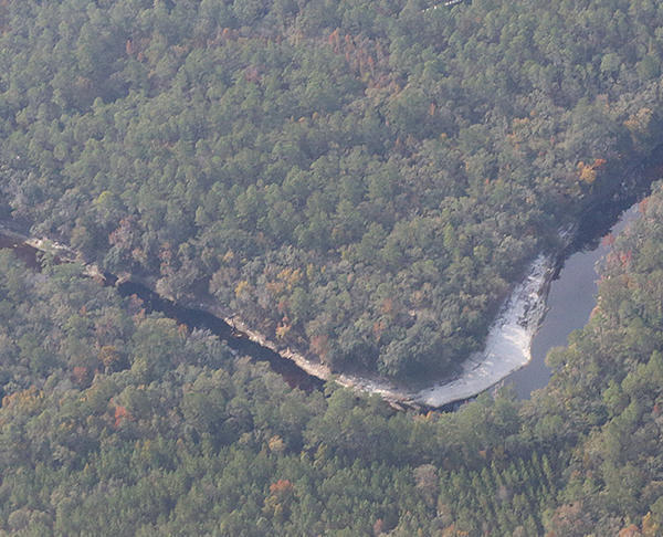
These aerial photographs by Beth Gammie cover the route of the Saturady 20 May 2017 WWALS Outing down the Suwannee River from Woods Ferry Tract Launch to Suwannee Springs. She took them for WWALS 23 November 2016, on a Southwings flight piloted by Roy Zimmer. They’re all looking from Hamilton County south (or west) across the Suwannee River into Suwannee County.

Woods Ferry Tract Launch

Woods Ferry Tract Launch

I have pulled out a few detail shots, of Woods Ferry Tract Launch and of Suwannee Springs.

Suwannee Springs bathhouse

Continue reading