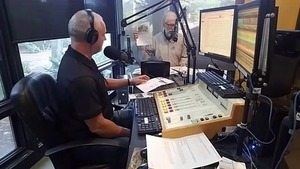
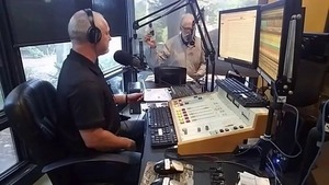
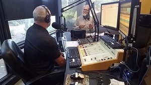
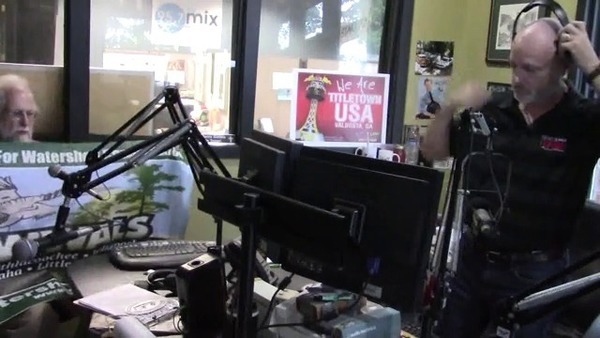
Revised Hydrogeologic Framework of the Floridan Aquifer System 2016-03

Salt water intrusion inland is worse than you think, including the “Apalachicola salinity feature” up to the GA-FL line and east through Lowndes County, with a special additional brackish Valdosta feature. Central north Florida is an island of fresh groundwater surrounded by entire saline Florida coast around from Alabama plus across to Brunswick, GA, then again from Savannah up past Charleston. South of Lakeland, FL the map is all red for saline.

Figure 53. Estimated altitude of the 10,000-milligrams-per-liter (mg/L) total dissolved solids boundary, southeastern United States.

Apparently using the data preliminarily mapped earlier in the Florida Well Salinity Study, geologists from three states connected the dots in Revised Hydrogeologic Framework of the Floridan Aquifer System in Florida and Parts of Georgia, Alabama, and South Carolina, By Continue reading

Aerials: Woods Ferry Tract to Suwannee Springs 2016-11-23

These aerial photographs by Beth Gammie cover the route of the Saturady 20 May 2017 WWALS Outing down the Suwannee River from Woods Ferry Tract Launch to Suwannee Springs. She took them for WWALS 23 November 2016, on a Southwings flight piloted by Roy Zimmer. They’re all looking from Hamilton County south (or west) across the Suwannee River into Suwannee County.

Woods Ferry Tract Launch

Woods Ferry Tract Launch

I have pulled out a few detail shots, of Woods Ferry Tract Launch and of Suwannee Springs.

Suwannee Springs bathhouse

Continue reading

Woods Ferry to Suwannee Springs, Outing and Hands Across the Sands, Suwannee River 2017-05-20

Update 2023-04-13: Pictures.

Due to low water, we’re moving the May 20th outing downstream! With lunch, swim stops, and bon-bons, of course. Bring bug spray and the usual personal flotation device, boat paddles, food, drinking water, warm clothes, and first aid kit. If you don’t have a boat, there are many outfitters, or let us know and many of us have spare boats.

Two outfitters advise there should be enough water on this route to avoid much boat dragging. There is a slight 30% possibility of afternoon thunder showers. Same date, same time, same river: just a bit downstream.

When: 9AM Saturday May 20, 2017, meet to shuttle
10AM: Start paddling
12PM noon: Stop for Hands Across the Sand
   “Say NO to dirty fuels and YES to clean energy”
2-3PM: Finish some time around then

Put In: Mile 158.0, Woods Ferry Tract Launch, in Suwannee County, Florida

GPS of Entrance: to Woods Ferry Tract 30.343508, -82.855187

Paddle Distance: 8.0 river miles

Paddle Duration: 4 hours

Event: facebook, meetup

Shuttle route

Directions to Put In: From Live Oak, travel north on Continue reading

VDT corrects Valdosta drinking water story 2017-05-17

Congratulations City of Valdosta! You got the VDT to issue a correction for that one sentence a week ago, even though the VDT blamed it on “a source cited in the article”, and came up with yet another number of violations that doesn’t match what NRDC says nor what Valdosta says, with still no specific comparisons to other local governments. So it’s a correction that doesn’t resolve anything. And you’re not helping your credibility problem, Valdosta, by quibbling over a single digit while neglecting to mention an entire year in which you did have drinking water violations that match what’s in NRDC’s map.

Correction, red faced non-admission
Valdosta Daily Times, page 3A, 17 May 2017

CORRECTION

An article headlined “Report. Georgia 5th in drinking water violations,” published 1n the May 10 edition of The Valdosta Daily Times contained an error that originated from a source cited in the article.

The Georgia Environmental Protection Division said in an email, “Valdosta had six violations: two total coliform violations (one monitoring violation and one MCL exceedance) and four haloacetic acid violations (four consecutive quarters of a running annual average MCL exceedance from one sample location). These violations have all been resolved in an old database that preceded our current database. This actual violation was resolved in 1998.”

This correction is on page 3A, below the Crime Report. It does have a big red CORRECTION header, but Continue reading

People before profits: call your Senators today against S. 951 and for EPA

Please call your U.S. Senators today and ask them to oppose Senate Bill 951, the so-called Regulatory Accountability Act, which would actually obstruct enforcing regulations that protect our clean air and water. As Suwannee Riverkeeper among 121 U.S. Waterkeeper Members and Affiliates told the EPA yesterday, we need stronger protections against coal ash, unnecessary pipelines, and fracking, not less. Solar and wind power already employ more people than coal, oil, and gas combined, so there’s no economic reason to let the failing fossil fuel industry crimp our regulatory system like this, and every reason of drinking water, industry, recreation, and wildlife to keep it clean.

That’s 202-224-3121
Georgia: David Perdue and Johnny Isakson
Florida: Bill Nelson and Marco Rubio

S.951 Dont let Industry Hijack our Regulatory Process

Larissa Liebmann, Waterkeeper Alliance, 15 May 2017, Don’t let Industry Hijack our Regulatory Process! Continue reading

Water low but passable, White Springs to Swift Creek, Suwannee River 2017-05-20

Update 2017-05-17: OK, the water’s gotten too low at the original location, so we’re moving downstream to Woods Ferry Tract Launch to Suwannee Springs.

Hands Across the Sand on the Suwannee Saturday! The river is quite low (48.78 feet NAVD on the White Springs gage), but it looks doable from the put-in and take-out. A ranger at Stephen Foster State Park told me paddling from White Springs to Swift Creek would be doable, perhaps with a few dry spots. I’ll also call a local outfitter or two for their opinions.

White Springs down from ramp

White Springs down from ramp

Meanwhile, bring bug spray (gnats) and a rope (to pull your boat over sand bars), and we’re still on for 9AM Saturday 20 May 2017. See the outing announcement for more details.

Plus: that’s the day of Hands Across the Sand, “Say NO to dirty fuels and YES to clean energy”. WWALS has been saying that for years, so somewhere on the Suwannee we will stop and do Hands Across the Sand against the Sabal Trail fracked methane pipeline and for solar power.

White Springs low spot

Continue reading

SDWA Health Violations: Valdosta, Lowndes County, and beyond 2017-05-02

The VDT and the City of Valdosta are feuding again about water quality, this time about drinking water (not sewage). Lowndes County They’re both wrong and both right, and neither named any of the other poor local water sources. The VDT didn’t make this story easy to follow by omitting the key piece from its first online story and not quoting its source, and the city didn’t acknowledge some main points the VDT made.

Kimberly Cannon, Valdosta Daily Times, 10 May 2017, City celebrates water: Mayor refutes water quality report, Continue reading

Valdosta and Lowndes County water treatment quality compared to region

Valdosta indeed didn’t have the worst water treatment violations in Lowndes County, Georgia, but it was worse than any nearby city in Georgia or Florida (and Lowndes County was worse than any nearby county). Once again, the Valdosta Daily Times said (twice) that Valdosta “is now in full compliance”. This is about drinking water treatment; sewage is another story. But in both cases, if Valdosta doesn’t want the local newspaper to treat the city as the villain of the piece, maybe it should stop reacting like one.

Georgia and Florida

The above screenshot from Threats on Tap: Widespread Violations Highlight Need for Investment in Water Infrastructure and Protections shows Georgia has been pretty bad, but Florida was much worse.

Let’s look at the area around Valdosta. Continue reading

Where nobody lives in the Suwannee River Basin

Obviously nobody lives in most of the Okefenokee Swamp or the Osceola National Forest, but also most of Clinch County is unpopulated west of the Swamp, as is much of the Gulf coast along the Suwannee River Estuary, from Cedar Key north to Horsehoe Bay, plus large parts of Dixie and Lafayette Counties west of the Suwannee River.

Screenshot 2017-05-12 13-15-46
Nobody Lives Here: Unpopulated U.S. Census Blocks, screenshot by jsq from interactive map by mapsbynik.

Update 2017-06-20: As someone pointed out, rangers do live in the Okefenokee Swamp, presumably in the white area along the access road.

Cedar Key is the island at the bottom of the map, and from a bit north on the Gulf Coast you can follow Continue reading