Tag Archives: Folsom Bridge

Clean Withlacoochee River; dubious Okapilco Creek; and rain 2020-02-05

Update 2020-02-12: Madison Co., FL Withlacoochee River Bacterial Advisory 2020-02-11.

Good another Wednesday: Lowndes County water quality results for the Withlacoochee River. Meanwhile, about an inch of rain registered upstream Thursday. We will have more WWALS results in a day or so. The only way to tell what is in our waterways is regular, frequent, closely-spaced testing. You can help.

[Good Withlacoochee]
Good Withlacoochee
Thanks to Lowndes County Chairman Bill Slaughter for these Lowndes County results.
Along with the WWALS composite results spreadsheet, they are on the WWALS website.
There are no new Florida results; the Florida agencies stopped testing after Continue reading

Video: River Gauges @ Lowndes County Commission 2019-10-21

Flood Inundation Maps (FIM) are related to Lowndes County taking over funding from Valdosta of the Skipper Bridge Withlacoochee River gauge, said EMA Director Ashley Tye.

[19.7feet]
19.7feet

Joint funding of $135,000 from Valdosta and Lowndes County started work on FIM for Skipper Bridge in 2016, with completion announced 22 May 2018.

The item about joint funding with USGS and SRWMD to fund the Skipper Bridge Withlacoochee River Gauge, in addition to the Folsom Bridge Little River Gauge, was the longest item at five minutes yesterday morning. Continue reading

Lowndes County takes over Skipper Bridge Withlacoochee River Gauges with help from SRWMD 2019-10-21

Funding is shifting from Valdosta to Lowndes County for the Skipper Bridge Road Withlacoochee River gauge, adding to the county’s traditional since 2009 funding of the Folsom Bridge GA 122 Little River gauge. That’s $8,300 and $14,200, respectively, with another $5,900 for the Skipper Bridge Gauge from the Suwannee River Water Management District (SRWMD). The U.S. Geological Survey (USGS) puts in $900 towards each gauge, or $1800 total. SRWMD and USGS previously assisted Valdosta in funding the Skipper Bridge Road gauge.

Skipper Bridge Road Withlacoochee River Gauge NWS graph

This change will be discussed this morning at 8:30 AM and voted on at 5:30 PM Tuesday, October 22, 2019, by the Lowndes County Commission. The reason for this change is: Continue reading

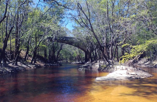
Stone Bridge, Little River, by Dan Phillips 2016-08-01

Here’s a piece of south Georgia history, Stone Bridge, on the Little River, between Adel in Cook County and Barney in Brooks County, on the Withlacoochee and Little River Water Trail (WLRWT).

On a summer day, Stone Bridge

Dan Phillips wrote about this picture he took: Continue reading

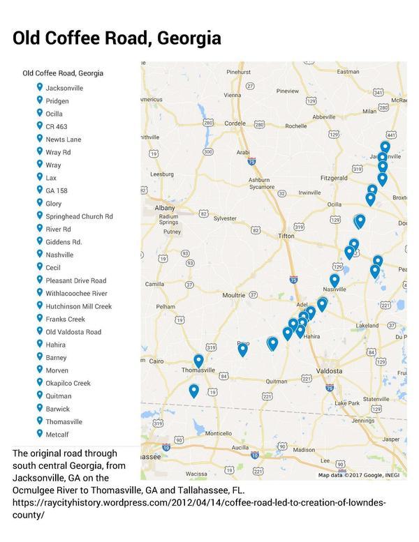
Old Coffee Road, Georgia

The Google map of locations on Old Coffee Road was used by many of the early settlers of south central Georgia, including in the watersheds of the Willacoochee, Alapaha, Withlacoochee, and Little Rivers and Okapilco Creek. It crossed all those and other waterways by ford or private ferry: there were no bridges back then.

Old Coffee Road map, WWALS.net
Follow this link for the interactive google map.

The Georgia Historical Commission erected markers at half a dozen locations in the 1950s and 1960, reading: Continue reading