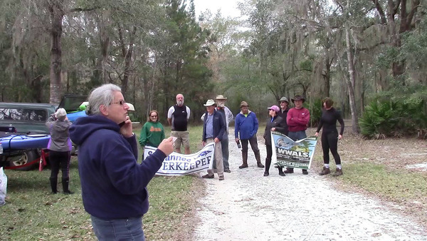
Tag Archives: Shirley Kokidko

Before the day 1 route of Paddle Georgia 2019-06-14

Down at the Little River Confluence, Troupville Boat Ramp, and downstream to Spook Bridge. Before #PaddleGA2019.

[Downstream Withlacoochee River, 10:48:15, 30.846955, -83.347810]
Downstream Withlacoochee River, 10:48:15, 30.8469550, -83.3478100

While WWALS was welcoming Paddle Georgia boats and boaters, Emma Wheeler of WCTV came to visit, greeted by Shirley Kokidko of WWALS. Continue reading

Banks Lake Full July Moon Paddle, 2019-06-17

Leisurely sunset paddle and watch the full moon rise over the Banks Lake, our mini-Okefenokee in Lanier County, Georgia, with ospreys, fish, turtles, birds, and bats in the cypress trees. Remember to BRING A LIGHT for your boat or some type of light to have on yourself (glow stick, head lamp, or flashlight) so other boaters can see you in the dark.

When: Gather 7:30 PM, Launch 8:00 PM, Monday, July 17, 2019
Sunset: 8:38 p.m.; moonrise: 9:06 p.m.

Put In: Banks Lake Boat Ramp, 307 Georgia 122, Lakeland, GA 31635.

GPS: 31.034824, -83.096725

Take Out: Banks Lake Boat Ramp

Bring: the usual personal flotation device, boat paddles, food, drinking water, warm clothes, and first aid kit. Also trash pickers and trash bags: every WWALS outing is also a cleanup. And a a light! It’s going to be dark.

Free: This outing is free to WWALS members, and $10 (ten dollars) for non-members. We recommend you support the work of WWALS by becoming a WWALS member today!

Event: facebook, meetup

Moon and boat light
Photo: John S. Quarterman, May 2019 Banks Lake Full Moon Paddle.

Continue reading

Pictures: Troupville to Spook Bridge, Withlacoochee River 2019-02-03

WWALS paddled from Troupville Boat Ramp to Spook Bridge (thanks to The Langdale Company for access to take out there) on February 3, 2019. That’s the path planned for Paddle Georgia Day 1, coming up two weeks from now.

[Catching up, 11:08:10, 30.85035, -83.34855]
Catching up, 11:08:10, 30.8503500, -83.3485500

If the rivers rise; they’re much lower now than they were in February.

[Every outing is a cleanup, 10:50:14, 30.8516814, -83.3469376]
Every outing is a cleanup, 10:50:14, 30.8516814, -83.3469376

We passed the famous Mayor John Gayle Withlacoochee Wastewater Treatment Plant Outfall: Continue reading

Shoals and Springs, Allen Ramp to SRSP, Withlacoochee River 2019-06-01

This Saturday, four shoals (Battery, Wipe-Out, Deer, and Melvin) and four springs (Powerline, Fairy, Corbett, and second-magnitude Suwannacoochee), all on the Withlacoochee River, from Allen Ramp to Suwannee River State Park.

[Shoals and springs]
Shoals and springs

Location of shoals from Chris Mericle, Blackwater River Guide. River mile calculations for them by Shirley Kokidko, both in the interactive map of the Withlacoochee and Little River Water Trail.

For outing details, see: Continue reading

Pictures: Banks Lake Full Flower and Osprey Moon Paddle 2019-05-18

We saw the pair of nesting ospreys at their nest, on the Banks Lake Full Flower Moon Paddle.

[Osprey, nest, bird watcher]
Osprey, nest, bird watcher

The sunset was impressive.

[Among paddlers]
Among paddlers

The moon came out from behind the clouds.

[Luna paddler]
Luna paddler

Paddlers of all Continue reading

Allen Ramp to SRSP, Withlacoochee River: Paddle Georgia Preview, 2019-06-01

Update 2019-05-30: Map of shoals and springs along the way.

Wild and beautiful Withlacoochee River to the Confluence. We will pass numerous rocky shoals requiring some skills so this outing may not be appropriate for beginners and young children. There are clear springs to explore, such as Suwannacoochee Spring at Ellaville. This is a preview of part of Paddle Georgia 2019. #PaddleGA2019

When: Gather 8:00 AM, launch 9:30 AM, Saturday, June 1, 2019

Put In: Allen Ramp, From Jasper, travel north on US 41 to SR 6; turn left; travel south on SW CR 141 to SW CR 143; turn right and follow SW CR 143 to SW 64 Way and follow to ramp. Also known as CR 143 ramp (SRWMD).

GPS: 30.449167, -83.221333

Take Out: Suwannee River State Park Ramp, 3631 201st Path, Live Oak, FL 32060, in Suwannee County.
Taking out requires a very brief paddle upstream on the Suwannee River.

Bring: the usual personal flotation device, boat paddles, food, drinking water, warm clothes, and first aid kit. Don’t forget a rope in case you need to drag your boat across shoals. Also trash pickers and trash bags: every WWALS outing is also a cleanup.

Free: This outing is free to WWALS members, and $10 (ten dollars) for non-members. We recommend you support the work of WWALS by becoming a WWALS member today!

Park: Remember to have $5 cash for the state park fee, for each vehicle that will be shuttled to the take out at Suwannee River State Park.

Event: facebook, meetup

Photo: Gretchen Quarterman, Allen Ramp, 2014-09-21
Photo: Gretchen Quarterman, Allen Ramp, 2014-09-21.

Continue reading

Banks Lake Full Flower Moon Paddle, 2019-05-18

Join us for our monthly Full Moon paddle and star gazing at Banks Lake. The sun will set at 8:23 p.m. Come early enough to prep your boat so that we are on the lake by 7:30 p.m. We will have plenty of time to enjoy a beautiful sunset, the moon rise and watch the stars come out. Sunsets are usually spectacular. The moon will rise at 8:20 p.m. We will enjoy the view while leisurely paddling through the cypress trees before it gets dark while we look for birds, alligators and bats.

Sunset, Cypress
Photo: Gretchen Quarterman, Banks Lake, 2019-04-20

When: Gather 7:00 PM, launch 7:30 PM, Saturday, May 18, 2019

Put In: Banks Lake Boat Ramp, 307 Georgia 122, Lakeland, GA 31635, in Lanier County.

GPS: 31.034824, -83.096725

Take Out: Banks Lake Boat Ramp

Bring: the a light for your boat or some type of light to have on yourself (glow stick, head lamp, or flashlight), and bring a rope for your boat. You must wear a Personal Flotation Device (PFD). A whistle is not required, but it’s a good idea in the dark. Dress for cold weather, the temperature drops quickly after the sun sets. Also trash pickers and trash bags: every WWALS outing is also a cleanup. Mosquitoes can be bad at the boat ramp but are not a problem on the water. We recommend beautyberry: works just as good as commercial repellant.

Free: This outing is free to WWALS members, and $10 (ten dollars) for non-members. We recommend you support the work of WWALS by becoming a WWALS member today!

Event: facebook, meetup Continue reading

Rescheduled: Banks Lake Full Pink Moon Paddle, 2019-04-20

Rescheduled from Friday to Saturday due to weather.

Chair, Blown over
Photo: Gretchen Quarterman, of windstorm damage, 2019-04-19

Outings leader Dan Phillips decided, due to another line of weather coming in this evening, that it would be safest to reschedule to the next day, so he did.

Join us on a leisurely sunset paddle to watch the sun set and the full moon rise over the Banks Lake, a mini-Okefenokee near Lakeland, Georgia.

When: Gather 7:00 PM, launch 7:30 PM, Saturday, April 20, 2019

Put In: Banks Lake Boat Ramp, 307 Georgia 122, Lakeland, GA 31635, in Lanier County.

GPS: 31.034824, -83.096725

Take Out: Banks Lake Boat Ramp

Bring: the a light for your boat or some type of light to have on yourself (glow stick, head lamp, or flashlight), and bring a rope for your boat. You must wear a Personal Flotation Device (PFD). A whistle is not required, but it’s a good idea in the dark. Dress for cold weather, the temperature drops quickly after the sun sets. Also trash pickers and trash bags: every WWALS outing is also a cleanup.

Free: This outing is free to WWALS members, and $10 (ten dollars) for non-members. We recommend you support the work of WWALS by becoming a WWALS member today!

Event: facebook, meetup Continue reading

Cypress Creek South (CR 6) to Cone Bridge, Suwannee River, 2019-05-04

Update 2024-05-14: Pictures: Cypress Creek South (CR 6) to Cone Bridge, Suwannee River 2019-05-04.

Rescheduled due to low water. Now we’re starting at Cypress Creek Launch on CR 6, and paddling to Cone Bridge Ramp.

A quiet, tranquil 9.4 mile section of the Suwannee River on a paddle appropriate for paddlers of any level.

When: Gather 9:00 AM, Launch 9:30 AM, Saturday, May 4, 2019

Put In: Cypress Creek South Launch @ CR 6. From White Springs, Travel north on CR 135 to SR 6, turn right; travel east to the bridge. At the foot of the bridge, turn left onto road shoulder and follow the road to the river.
From Valdosta, GA, travel south on I-75 to exit 460 for FL-6 toward Jasper, FL; travel east 11.4 miles, turn right to stay on FL 6. Continue through Jasper onto Hatley Street, which becomes CR 6. Continue 14.5 miles to the left turnoff just before the Suwannee River.

GPS: 30.50737, -82.71711

Take Out: Cone Bridge Ramp. From Lake City, travel north on US 441 to NW Cone Bridge Road; turn left and follow road to ramp.

Bring: a rope to drag your boat, the usual personal flotation device, boat paddles, food, drinking water, warm clothes, and first aid kit.

Also trash pickers and trash bags: every WWALS outing is also a cleanup.

Free: This outing is free to WWALS members, and $10 (ten dollars) for non-members. We recommend you support the work of WWALS by becoming a WWALS member today!

Event: facebook, meetup

Photo: John S. Quarterman, Cypress Creek South Launch, 2016-09-05
Photo: John S. Quarterman, Cypress Creek South Launch, 2016-09-05.

This paddle is on the Suwannee River Wilderness Trail (SRWT). Continue reading

Deese-Howard Ramp to Gibson County Park, Suwannee River, 2019-06-01

Update 2019-05-22: Moved by the Outings Committee to Allen Ramp on the Withlacoochee River to Suwannee River State Park.

This is a 12 mile paddle on the Suwannee River. We will meet at Deese-Howard Public Boat Ramp at 8:30 to unload kayaks and gear before the 12 mile shuttle to Gibson County Park begins at 9 a.m. You will probably need to use the Lat/Long coordinates with your GPS to find the ramp easier.

We will pass Holton Creek River Camp, where we will stop for a break and a swim.

Just before the takeout this section of the river also includes the Alapaha Rise, an interesting natural feature that is worth the short side trip.

When: Gather 8:30 AM, Launch 10AM, Saturday, June 1, 2019

Put In: Deese Howard Boat Ramp, 107th Road, Live Oak, FL 32060, Suwannee County.

GPS: 30.41439, -82.96292

Take Out: Gibson Park Ramp, 6844 SW CR 751, Jasper, FL 32052. From Jasper, Hamilton County, FL, travel southwest on SW CR 249 to SW CR 751; turn left and boat ramp is on the right in Gibson County Park, in Hamilton County.

Bring: the usual personal flotation device, boat paddles, food, drinking water, warm clothes, and first aid kit. Also trash pickers and trash bags: every WWALS outing is also a cleanup.

Free: This outing is free to WWALS members, and $10 (ten dollars) for non-members. We recommend you support the work of WWALS by becoming a WWALS member today!

Event: facebook, meetup

Alapaha Rise,
Photo: Beth Gammie, of Alapaha River Rise, on Southwings flight for WWALS with pilot E.M. Beck, 2016-11-23.

Continue reading