Tag Archives: Blue Hole

Reroute: New Year Ichetucknee Upstream Paddle 2021-01-02

Update 2020-01-05 TV coverage.

Different entrance (South), different landing (Dampier’s)!

We’re going to paddle upstream and back, on this first paddle of 2021, all on the Ichetucknee River, within the Park. This is because we’re not doing a shuttle due to the COVID-19 virus pandemic spike, We will be checking temperatures with an infrared thermometer. If you feel at all sick with anything, please stay home. Wear masks on land (we will have extras) and keep your distance.

When: Gather 10:00 AM, Launch 10:30 AM, End 4:00 PM, Saturday, January 2, 2021

Put In: Dampier’s Landing, About a 10 minute walk from parking lot at South Entrance, 11627 SW Us Highway 27, Fort White, Florida 32071, in Columbia County.

GPS of South Entrance to Ichetucknee Springs S.P.: 29.9519915, -82.7753791

Bring boat wheels: otherwise that’s a long carry for a boat from parking to the landing.

Upstream: It’s only two miles up to the top spring. Ichetucknee Springs State Park tells us no Ichy Nippy Dip Day for 2021, also due to the virus pandemic. However, anybody who paddles all the way up can dip in the spring.
There will be current, but nobody has to paddle up any farther than they want to. There’s a good rest stop at Midpoint Landing, less than a mile up.

Take Out: Dampier’s Landing.
If you feel adventurous, you could paddle a mile farther downstrearm, all the way to the last takeout, South Landing. But if you do that, you need to get back more than half a mile by foot to your car. You’ll really need your boat wheels.

Bring: boat wheels and warm clothes! And the usual personal flotation device, boat paddles, food, drinking water, warm clothes, and first aid kit. Also trash pickers and trash bags: every WWALS outing is also a cleanup.

NOTE: The Ichetucknee is a non-disposable river; do not have any food or drinks in disposable packaging. All liquids and foods should be in reusable type containers. This helps keep litter out of our rivers.

Free: This outing is free to WWALS members, and $10 (ten dollars) for non-members. We recommend you support the work of WWALS by becoming a WWALS member today!

Fee: There is a $5.00 park fee.

Event: facebook, meetup

[Map: Dampier's Landing in Ichetucknee Springs State Park]
Map: Dampier’s Landing in Ichetucknee Springs State Park,
in the WWALS map of the Suwannee River Wilderness Trail.

Continue reading

New Year Ichetucknee to Santa Fe River Paddle 2021-01-02

Reroute: Different entrance (South), different landing (Dampier’s), and upstream paddle.

First paddle of 2021, from Ichetucknee to Santa Fe Rivers.

Ichetucknee Springs State Park tells us no Ichy Nippy Dip Day for 2021, due to the virus pandemic, but the North Entrance will be open. So see you there, but keep your distance. Then WWALS will paddle downstream. We will also paddle past the notorious Sabal Trail fracked methane pipeline.

When: Gather 9:00 AM, Launch 10:30 AM, End 4:00 PM, Saturday, January 4, 2020

Put In: Ichetucknee S.P. North Entrance, 8294 SW Elim Church Rd, Fort White, FL 32038.

GPS: 29.9859, -82.7602

Take Out: Hwy 129 Boat Ramp, William Guy Lemmons Memorial Park Ramp @ 296th St. Ramp, From Branford, travel east on US 27; turn right on US 129; travel south to 296th Street; turn right and William Guy Lemons Memorial Park is on the left, in Suwannee County. 29.912717, -82.860514

Bring: the usual personal flotation device, boat paddles, food, drinking water, warm clothes, and first aid kit. Also trash pickers and trash bags: every WWALS outing is also a cleanup.

NOTE: The Ichetucknee is a non-disposable river; do not have any food or drinks in disposable packaging. All liquids and foods should be in reusable type containers. This helps keep litter out of our rivers.

Free: Free: This outing is free to WWALS members, and $10 (ten dollars) for non-members. You can pay at the event or online.
https://wwals.net/donations/#outings

We recommend you support the work of WWALS by becoming a WWALS member today!
https://wwals.net/donations/#join

Fee: There is a $5.00 park fee.

Event: facebook, meetup

[Start]
Start, 2020-01-20.

Continue reading

Ichetucknee State Park 2020-01-04

When WWALS first paddled from Ichetucknee Springs in January, it happened to be both Ichy Nippy Dip Day and anniversaries of both Ichetucknee State Park and of Florida State Parks.

Here are some pictures from the shore.

We did it again two weeks later, and we’re doing it again in January 2021. Stay tuned.

Ichetucknee Spring

[No people yet]
No people yet

Continue reading

Redo: Ichetucknee and Sante Fe River Paddle 2020-01-20

Leisurely paddle on the newest river additions to WWALS and Suwannee Riverkeeper, round 2. It was such a great time, we had to do it again, on the Ichetucknee and Santa Fe Rivers. We will also paddle past the notorious Sabal Trail fracked methane pipeline.

When: Gather 9 AM, launch 10:30 AM, Saturday, January 4, 2020

Put In: Ichetucknee S.P. North Entrance, 8294 SW Elim Church Rd, Fort White, FL 32038.

GPS: 29.9859, -82.7602

Take Out: Hwy 129 Boat Ramp, William Guy Lemmons Memorial Park Ramp @ 296th St. Ramp, From Branford, travel east on US 27; turn right on US 129; travel south to 296th Street; turn right and William Guy Lemons Memorial Park is on the left, in Suwannee County. 29.912717, -82.860514

Bring: the usual personal flotation device, boat paddles, food, drinking water, warm clothes, and first aid kit. Also trash pickers and trash bags: every WWALS outing is also a cleanup.

NOTE: The Ichetucknee is a non-disposable river; do not have any food or drinks in disposable packaging. All liquids and foods should be in reusable type containers. This helps keep litter out of our rivers.

Free: This outing is free to WWALS members, and $10 (ten dollars) for non-members. We recommend you support the work of WWALS by becoming a WWALS member today!

Fee: There is a $5.00 park fee.

Event: facebook, meetup

[Boards and boats]
Photo: John S. Quarterman, Boards and boats, 2020-01-04.

Continue reading

Ichetucknee and Santa Fe River New Year Outing 2020-01-04

Update 2020-11-02: Pictures from 2020-01-04.

Update 2020-01-11: Redo: Ichetucknee and Sante Fe River Paddle 2020-01-20.

Leisurely paddle on two of the newest additions to WWALS and Suwannee Riverkeeper: the Ichetucknee and Santa Fe Rivers. We will also paddle past the notorious Sabal Trail fracked methane pipeline.

When: Gather 9 AM, launch 10:30 AM, Saturday, January 4, 2020

Put In: Ichetucknee S.P. North Entrance, 8294 SW Elim Church Rd, Fort White, FL 32038.

GPS: 29.9859, -82.7602

Take Out: Hwy 129 Boat Ramp, William Guy Lemmons Memorial Park Ramp @ 296th St. Ramp, From Branford, travel east on US 27; turn right on US 129; travel south to 296th Street; turn right and William Guy Lemmons Memorial Park is on the left, in Suwannee County. 29.912717, -82.860514

Bring: the usual personal flotation device, boat paddles, food, drinking water, warm clothes, and first aid kit. Also trash pickers and trash bags: every WWALS outing is also a cleanup.

Free: This outing is free to WWALS members, and $10 (ten dollars) for non-members. We recommend you support the work of WWALS by becoming a WWALS member today!

Fee: There is a $5.00 $6.00 park fee.

Event: facebook, meetup

[384A3916]
Ichetucknee Confluence with Santa Fe River.
Photo: Beth Gammie for WWALS, Southwings Flight, November 23, 2016.

Continue reading

Sabal Trail maps digitized

Update 2019-03-19: The google map now includes Florida Southeast Connection (FSC) and FPL’s Martin County to Riviera Beach (MR-RV) pipeline to the sea, which FPL in 2018 got FPSC and FERC to roll into FSC. See also Stop FERC Shirking LNG Oversight.

South Georgia and north Florida Update 2016-12-13: The google map now includes the Sabal Trail path digitized for all of Georgia and to the end of the line in Florida south of Orlando.

Update 2016-11-29: In the google map, extended the Sabal Trail alignment maps localized by LAKE for Mitchell, Colquitt, Brooks, and Lowndes Counties, Georgia, and Hamilton, Suwannee, and Gilchrist Counties, Florida to just north of Bell, FL, plus on the crowdsourcing map, WWALS aerials of Gilchrist County.

Update 2016-11-03: Added to the google map digitized path and maps for Gilchrist, Alachua, and part of Levy Counties, FL.

Update 2016-10-31: Added to the google map: Aerials: Suwannee, Ocholockonee, Withlacoochee, Santa Fe Rivers, Okapilco Creek, Sabal Trail Moultrie CY3-6 @ WWALS Southwings 2016-10-22.

Update 2016-10-30: The google map now has all Sabal Trail’s alignment maps from 7 April 2016 linked in for (part of Gilchrist 2016-11-29), Suwannee and Hamilton Counties, FL and Lowndes, Brooks, Colquitt, and Mitchell Counties, GA. Aerial pictures from the WWALS Southwings flight of October 22nd 2016 are also linked in, starting with US 84 HDD Withlacoochee River and US 129 HDD Santa Fe River.

Update 2016-09-14: All 527 alignment maps Sabal Trail filed with FERC in April 2016, in small, big, huge, and PDF formats, courtesy of Lowndes Area Knowledge Exchange (LAKE).

Update 2016-09-23: Added Depressions within 1 mile of Sabal Trail in Hamilton, Madison, and Suwannee Counties, Florida. The pipeline path doesn’t go through Madison County, but it comes closer than a mile, and not even two miles from Madison Blue Spring.

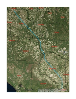
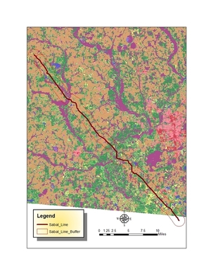
These maps show the path Sabal Trail is gouging its fracked methane pipeline through south Georgia and north Florida, with comparisons to some geological features, including Okapilco Creek, Withlacoochee River, Suwannee River, Suwannacoochee Spring, Falmouth Spring, the Cathedral Cave System, and numerous karstic features, some of them sinkholes.

Brooks and Lowndes Counties, GA This digitizaiton is thanks to Continue reading