Tag Archives: Skipper Bridge Road

Lowndes County takes over Skipper Bridge Withlacoochee River Gauges with help from SRWMD 2019-10-21

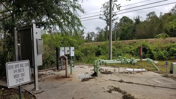
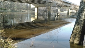
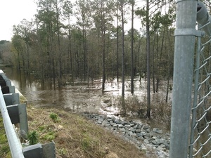
Funding is shifting from Valdosta to Lowndes County for the Skipper Bridge Road Withlacoochee River gauge, adding to the county’s traditional since 2009 funding of the Folsom Bridge GA 122 Little River gauge. That’s $8,300 and $14,200, respectively, with another $5,900 for the Skipper Bridge Gauge from the Suwannee River Water Management District (SRWMD). The U.S. Geological Survey (USGS) puts in $900 towards each gauge, or $1800 total. SRWMD and USGS previously assisted Valdosta in funding the Skipper Bridge Road gauge.

Skipper Bridge Road Withlacoochee River Gauge NWS graph

This change will be discussed this morning at 8:30 AM and voted on at 5:30 PM Tuesday, October 22, 2019, by the Lowndes County Commission. The reason for this change is: Continue reading

Valdosta report of spill at Cherry Creek Lift Station 2017-09-12

City Council Tim Carroll forwarded me the appended press release yesterday. I assumed it would be on Valdosta’s News page, but it is not.

Goodyear (Skipper Bridge) Station

Also, despite assurances back in January that Continue reading

Cherry Creek Lift Station Spill, Bemiss Road, Valdosta, GA

Valdosta had one spill at a lift station that lost power during Tropical Storm Irma, said David Frost, Interim Utilities Director, City of Valdosta, when I called him just now. I asked him if there were any others, and he said there was just that one.

Parcel 0146A-094G
Parcel 0146A 094G

He said it was a small spill. I asked how small. He said Continue reading

GA 122 @ Withlacoochee River 2017-05-17

A clearcut near the Withlacoochee River at GA 122 in Lowndes County, Georgia, led to some visual observations.

School bus heading west
School bus westbound on Hagan Bridge over the Withlacoochee River.

The clearcut starts east of the river and west of Hambrick Road. Here you can see the entrance to it from GA 122: Continue reading

Lowndes County to match Valdosta funding for LiDAR flood mapping? 2016-07-11

Valdosta already had an airplane fly over Lowndes County and collect Light Detection and Ranging (LiDAR) data for flood mapping. Will Lowndes County step up and match Valdosta on this project that affects everybody in the county (and downstream into Florida)? Valdosta started this LiDAR project in March 2015, and Valdosta fronted the entire cost to get it done, we know because Valdosta Assistant Director of Utilities Emily Davenport and Valdosta City Council Tim Carroll told us at a meeting Valdosta held at the request of WWALS for interested parties downstream in Florida and from as far away as Atlanta.

On the agenda for the 8:30 AM Monday morning Lowndes County Commission Work Session, item 7.d. Continue reading

Come on down to Staten Road Bridge and paddle the Withlacoochee River to Langdale Park 2016-03-20

Update 2016-03-24: Pictures.

A few potholes never stopped us from paddling! Because potholes Come on down to Staten Road Bridge 9AM tomorrow, Sunday 20 March 2016; follow this link for details. Yes, Langdale Park will be closed, but VLPRA has made arrangements for us to get in. (facebook event, meetup)

Panorama

Staten Road has always been a put-in for carrying boats Continue reading

Staten Road, Withlacoochee River, water levels, outing 2016-03-20

This Sunday, 9AM March 20th 2016, come paddle from Staten Road Bridge From high water put-in to bridge past Shadrick Sink and under the North Valdosta Road Bridge to Langdale Park! Follow this link for details. Although Langdale Park will be closed, Parks and Rec. will let us in for this event. (facebook event, meetup) Continue reading

Skipper Bridge, 17.66 feet, flood level 15 feet

The water level continued up from yesterday, when it was Downstream 31.0116939, -83.2915878 17.66 feet on the USGS guage at Skipper Bridge in Lowndes County, Georgia at 9:46 AM when I took these pictures. Flood stage is 15 feet. It was so high you could have floated over the chain link fence the county put in when it replaced the bridge, thus preventing normal use of this bridge as a Withlacoochee River access point on the Withlacoochee and Little River Water Trail.

-jsq

You can join this fun and work by becoming a WWALS member today!

Downstream panorama 30.9016667, 83.2930556

Continue reading