Tag Archives: watershed

WWALS Trivia Online 2020-05-19

Update 2020-05-18: facebook event.

Tuesday at 7PM, May 19, 2020, you can join new WWALS board member Shelby Miller for a half hour of fun online, as she conducts the first-ever WWALS Trivia Online!

Shelby will introduce each multiple-choice question about rivers, shoals, and other things in the WWALS Watersheds, which include the entire Suwannee River Basin. You get 20 seconds to answer. Fastest right answer wins that question.

[Yay winner!]
Photo: John S. Quarterman, Yay winner! Shelby Miller drawing the winning WWALS kayak raffle ticket, at Griffis Fish Camp, Suwannee River 2019-12-07

Follow this link to Register for WWALS Trivia Online.

Yes, this is different from Continue reading

Withlacoochee River Landings on Swim Guide 2020-05-14

Update 2023-05-15: Here’s a live Swim Guide Map.

Update 2023-05-04: Added Franklinville Landing on the Withlacoochee River to Swim Guide.

Update 2021-05-21: Three Little River Landings in Swim Guide 2020-05-21.

Update 2020-12-21: Added Langdale Park Boat Ramp to Swim Guide and GA 133 Withlacoochee River Bridge, which is not actually public access; it’s just in Swim Guide to display water quality results.

All green this week on Swim Guide, eight landings and boat ramps on the Withlacoochee River in Georgia and Florida. There’s an app, or you can use the web interface.

[Florida]
Florida

This current good water quality is according to the results we posted yesterday.

If you’re nearby, these “beaches” (as Swim Guide calls every place somebody might swim) will probably pop up on the app. Continue reading

A clean week, Withlacoochee River 2020-05-08

Update 2020-05-16: Clean Withlacoochee River 2020-05-13.

Update 2020-05-14: Withlacoochee River Landings on Swim Guide 2020-05-14.

Last week was clean for the Withlacoochee River, and with no rain predicted, probably this weekend and the coming week, too.

Don’t forget to send in your comment on the GA-EPD Valdosta Consent Order.

But remember, Valdosta is not the source of the recent contamination. WWALS is talking to some of the agricultural sources. Please be patient: agriculture takes months or years to fix.

You can help.

[Approaching State Line Ramp --Bobby McKenzie]
Approaching State Line RampBobby McKenzie, 2020-05-10

We’ve seldom seen a week this clean. Continue reading

Raptor, flower, paddling organization, tree base: Within These WWALS #6

Update 2020-05-30: The winner.

Many of you saw many of these things just a few days ago, or saw pictures of them taken by those who were there.

So you can answer Within These WWALS #6, using this form:

https://forms.gle/BQgTiRRThpBgWLZN8

[Bird, flower, org, base]
Bird, flower, org, base

Please answer by midnight at the end of Saturday, May 16, 2020.

Please identify (by scientific or common name) each of the items highlighted in a set of photos and then come up with the name of the WWALS waterway where all the photos were taken. The first correct set of answers wins a packet of WWALS photo notecards from that watershed, sent via postal mail from WWALS charter board member Bret Wagenhorst.

 -jsq, John S. Quarterman, Suwannee RIVERKEEPER®

You can join this fun and work by becoming a WWALS member today!

Video: Save the Okefenokee; Stop the Mine!

Great video by Georgia River Network asking you to help save the Okefenokee Swamp from a proposed strip mine:

[Jobs]
Jobs

Here’s the video:


Video: Save the Okefenokee; Stop the Mine!
Video by Georgia River Network, thanks to GRN E.D. Rena Peck Stricker.

Gators need water. Continue reading

Vickers Branch and Hahira LAS 2020-05-11

How is the mysterious Vickers Branch south of Hahira related to the Hahira Land Application Site? What is that creek the rest of that LAS is on? And what does all this have to do with Lowndes County’s new IMPAIRED WATERS MONITORING AND IMPLEMENTATION PLAN? Why do we care about all this for the Withlacoochee and Little River Water Trail?

About six weeks ago, the bridge on Old US 41 North just south of Hahira broke and Lowndes County fixed it. Revealing that nobody knew a name for it. Except Phillip Williams, who says, “Some maps show it as Vickers Branch. The Vickers family were the ones who owned most of the land in the area back in the 1800s.”

[Map: Vickers Branch, Hahira LAS]
Map: Vickers Branch, Hahira LAS
in the WWALS map of the Withlacoochee and Little River Water Trail (WLRWT).

The Vickers Branch Bridge marker south of Hahira looks slightly too far south, but it’s where google street view and aerials show the bridge. It seems that the USGS stream trace I used in this map is not quite right.

[Photo: Lowndes EMA, of broken Vickers Branch Bridge]
Photo: Lowndes EMA, of broken Vickers Branch Bridge

Upstream of that Vickers Branch US 41 bridge, several branches or runs that drain quite an area. I have named them after Continue reading

Send your comment on GA-EPD Valdosta wastewater Consent Order –Albany Herald

Update 2024-02-22: Slight update on this Consent Order in Valdosta Boone Drive and Knob Hill small sewage spills 2024-02-20.

Update 2023-11-09: GA-EPD Consent Order on Valdosta for One Mile Branch fish kill and sewage spills 2023-09-15.

In the Albany Herald, May 9, 2020, Deadline set to comment on Valdosta EPD Enforcement Order,

The Enforcement Order includes a fine, plus many requirements for management and technology.

“Well, I’m glad they are doing the enforcement order, requiring them to get the fixes in place,” said Deanna Mericle of Hamilton County, Fla., who was among the WWALS members who met with the city of Valdosta back in 2015 about these same sewage issues. “I’m not sure what the $122,000 will be used for, but the fine seems small. I just want the problem fixed for good if possible.”

The rest of the article is from the WWALS press release.

Send your comments by Wednesday, May 27, 2020, to:
   Mr. Lewis Hays
   Manager, Watershed Compliance
   Environmental Protection Division
   2 Martin Luther King Jr. Drive SE, Suite 1152 East
   Atlanta, GA 30334
   Lewis.Hays@dnr.ga.gov
   404-463-4953

This is not the kind of black water we want:

[Photo 4: Confluence of Sugar Creek and Withlacoochee River.]
Photo 4: Confluence of Sugar Creek and Withlacoochee River. By Tim Bonvechio.

The entire 93-page Order is on the WWALS website, here:
https://wwals.net/pictures/2020-04-13–ga-epd-vld-enforcement-order

“This Order has been a long time coming. It includes an outline of a sad history of mistakes and neglect. I hope the Order Continue reading

Winner and answers: third Within These WWALS contest, 2020-04-25

First, remember the fifth Within These WWALS contest is still in progress, and you have until midnight tonight, May 9, 2020, to answer, to win a set of WWALS picture notecards from that waterbody:
https://forms.gle/Nidt7HnxS91fCPWQ6

Meanwhile, the winner of the third Within These WWALS contest is:

Jennifer Harris, of Parrott, Terrell County, Georgia.

She lives in the Flint River watershed, but she answered all the questions correctly before anybody else did.

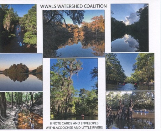
Withlacoochee and Little Rivers note cards

She got a set of Withlacoochee and Little Rivers note cards, sent to her by WWALS charter board member emeritus Bret Wagenhorst. You can get your own from the WWALS online stor for $10.00.

The answers to Within These WWALS #3 are:

Plant: Wild Azalea, Rhododendron canescens.

Blooms February to April, with a sweet jasmine scent. No, not honeysuckle: Continue reading

Clean Withlacoochee River until next big rain 2020-05-05

2020-05-13: A clean week, Withlacoochee River 2020-05-08.

More good news! The Withlacoochee River is still clean. Of course, all these posts are advisory, because conditions can change at any time, it takes 24 hours to process a sample, and everyone’s reactions are different to E. coli and other pollution.

We can guess the Suwannee River is clean, although nobody is testing it, and it seems to have its own sources of contamination.

This clean spell will probably last until the next big rain, which may be some weeks away. So now’s a good time to get out there on our rivers, where you can easily stay 50 feet apart on the water and six feet on land.

WWALS continues water quality testing, and you can help.

[State Line Boat Ramp]
State Line Boat Ramp Photos: Suzy Hall, downstream, John S. Quarterman of 2019 WWALS Boomerang paddle race, and of Waterkeepers Florida toast to Earth Day, all at State Line Boat Ramp.

We’re even thinking of taking down our yellow diamond Caution signs for now.

[Clean with no rain]
Clean with no rain
For context see wwals.net/issues/testing/.

Thanks to Madison Health for the most recent results, from Continue reading

Unprecedented Army Corps virtual Public Meeting about strip mine application near Okefenokee Swamp 2020-05-13

FOR IMMEDIATE RELEASE

May 7, 2020, Hahira, Georgia — In an apparently unprecedented move, the U.S. Army Corps of Engineers is holding a “virtual Public Meeting” about a mining application. Suwannee Riverkeeper calls on everyone who can to join this online Public Meeting, for at least a few minutes between 2 and 5 PM on Wednesday, May 13, 2020. This will help show there is substantial controversy about the proposed titanium mine on the doorstep of the Okefenokee National Wildlife Refuge. That could cause the Corps to at least require an Environmental Impact Statement (EIS), or maybe even to deny the permit.

“The Corps needs to know people consider the beauty of the Okefenokee Swamp, and the birding, boating, fishing, and hunting nearby that it provides, to be too important to risk with a strip mine far too close to the Swamp,” said Suwannee Riverkeeper John S. Quarterman. “Everyone down to the Gulf of Mexico should be concerned about this strip mine at the headwaters of the the Suwannee River, and east on the St. Marys River to the Atlantic. Way west at Valdosta, Georgia, exits from I-75 say Okefenokee Swamp this way, so the economic benefits of the Swamp are widespread. People visit the Swamp and the Suwannee from all over the world, and the public outcry needs to be just as widespread.”

[Mine to Gulf and Ocean]
Mine to Gulf and Ocean in the WWALS map of all public landings and boat ramps in the Suwannee River Basin.

Social media event: facebook, meetup. But remember to sign up for the actual Army Corps virtual Public Meeting (see below).

To attend the virtual Public Meeting, first you must RSVP by emailing:
To: CESAS-SpecialProjects@usace.army.mil
Subject: “RSVP for 13 MAY Public Meeting TPM”

Make sure that you include your full name, email address, and contact phone number with area code.

Before the meeting, you will receive the meeting link and security code. Just click the link and follow the prompts.

The meeting will use the WebEx platform, so go ahead and pick up an app for that, or try out the web interface on your laptop or desktop computer.

All participant lines will be muted in order to maintain audio quality. Moderators will direct questions to the appropriate person during the question and answer session.

Simply joining the meeting will be significant. You can ask your question the WebEx chat, by voice if they call on you. Please at least ask the Corps for an EIS, or to deny the permit application.

You can ask anything, or just say you oppose the mine. If you have a specific logistical or scientific question, please ask it, in such a way that it requires a specific answer. For example: Continue reading