Tag Archives: Withlacoochee

Pictures of all the BLRPR paddlers 2018-04-28

You’ve seen who won the eleven awards. Now here are the rest of the paddlers in the 6th Annual BIG Little River Paddle Race, from more counties, states, and watersheds than ever before. Also more Solo Female Kayaks than Solo Male Kayaks, and several whole families of paddlers.

[Finish]
Finish

Statistics: 2018 BIG Little River Paddle Race

43 Boats 
37 kayaks
6 canoes

49 Paddlers
29 male
20 female Continue reading

GWC DD#9: Sabal Trail pipeline threatens Withlacoochee River and Floridan Aquifer

300x388 DD#9 2014 Page 1 of 2, in GWC DD#9: Sabal Trail pipeline threatens Withlacoochee River and Floridan Aquifer, by Georgia Water Coalition, for WWALS.net, 22 October 2014 Here is the WWALS item #9 in the Georgia Water Coalition Dirty Dozen 2014; I added the links and the illustrations. -jsq

2014’s
Worst Offenses Against 
GEORGIA’S WATER

WITHLACOOCHEE RIVER & FLORIDAN AQUIFER

Gas Pipeline Threatens Southwest Georgia Water, Way of Life

INTRODUCTION:

Southwest Georgians are fighting an invader—one every bit

as worrisome as the boll weevil that destroyed cotton harvests in the 1900s, except this one takes farmers’ land as well as crops. Continue reading

Georgia Rivers Environment Issues.

20140202-215732.jpg

Georgia’s environment regulators urged keep hog waste out rivers.This article is by Jennette Gayer who work with Environment Georgia Advocate. Georgia’s Environmental Regulators have proposed serious rollbacks to existing rules that protect Georgia’s waterways from pollution created at large industrial hog operations. At a public hearing held by the Enviornmental Protection Division on October 25th, 2013 Environment Georgia’s State Advocate Jennette Gayer offered the following as public testimony. “Water quality in Georgia will continue to suffer if the swine and hog threshold is increased from 3000 to 5000 animal units as proposed, and those facilities are not required to obtain individual National Pollution Discharge Elimination System permits (NPDES). If we know – and we do know based on historic examples – that these operations can discharge to and impair waters, why is the state making it easier for these operations to function with less oversight? In addition to being charged with regulating CAFOs, EPD is also charged with assessing the water quality of our state’s waterways, identifying the impairments, and where impairments exist – addressing those problems to clean up the streams and creeks Georgians fish in, swim in and drink from. I want to provide a few quick examples of water segments and reaches where permitted swine operations have been determined by EPD studies to be negatively affected by animal production facilities. I’ve pulled this information from Georgia EPD’s 2012 305(b)/303(d) List Documents, Total Maximum Daily Load (TMDL) Implementation Plans, and permitting data.[1] Seven swine operations that had individual NPDES permits were immediately upstream or adjacent to state waters in the Savannah, Withlacoochee, Alapaha, Ogeechee, Canoochee, Oconee and Ocmulgee basins that do not support their designated use. The designated uses of these streams is fishing, and the primary reason for impaired waters is fecal coliform contamination, low dissolved oxygen levels, or non-point sources. In these watersheds, that fecal coliform and non-point sources are typically associated with agricultural operations. Rather than rolling back safeguards for Georgia’s waterways we should be investigating these examples of pollution near existing Hog CAFO’s and working to solve them. I urge you to act in the best interest of Georgia’s waterways and not move forward with this rule change.” [1] Georgia Water Quality Standards are connected by three components. Every water body in Georgia has one of six designated uses: fishing, drinking water supply, recreation, coastal fishing, wild river, and scenic river. And each of those designated uses must meet specific water quality criteria (such as dissolved oxygen or bacterial levels). Finally, the Clean Water Act has an anti-degradation component which is designed to protect existing designated uses and water quality. In other words, water quality is not allowed to degrade and threaten the designated use. And a downgrade in designated use “is prohibited if it would remove protection from any existing use.” (River Network) EPD is required by the Clean Water Act to assemble a list of creeks, streams, rivers and lakes that do not meet water quality standards. EPD uses the list – which is created every two years – to target areas for restoration and to remove water bodies from the list (de-list) where water quality has improved. If a water body is impaired and the designated use is threatened, EPD can place the water body on the 305b/303d list of waters. EPD can develop plans – such as a Total Maximum Daily Load (TMDL) – to improve water quality. Furthermore, the data can help EPD assess the state of a specific water body that is or might be affected by a new or renewed National Pollutant Discharge Elimination System (NPDES) permit, water withdrawal permit, or other permit that might affect designated uses and water quality standards. -CLG

Ichetucknee Alliance thinks it got the pipeline to move

According to their facebook page today, a conservation group in Florida convinced Sabal Trail to steer clear of their springs. Or did they? The “written assurances” they they got from Spectra’s Andrea Grover say “preferred” and “currently”. In any case, some of Ichetucknee Alliance’s positions are just as valid in WWALS’ watersheds.

Here’s an excerpt from their position, Ichetucknee Alliance Pipeline Position Paper, 21 August 2013, Continue reading

Pipeline would cross Withlacoochee River twice

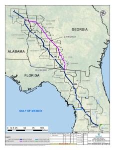
The detail maps in the General Project Description in the 15 November 2013 update to FERC by Sabal Trail Transmission reveal that the proposed path would cross the Withlacoochee River both where the river is the border of Brooks and Lowndes County and where it is the border between Hamilton and Madison County near Ellaville. In between, the pipeline would run through many wetlands near the river and through quite a few recharge zones for our drinking water source, the Floridan Aquifer. Then it crosses our downstream river, the Suwannee, into Suwannee County, Florida.

Continue reading

Pipeline alternate route still in WWALS watersheds, plus Tifton and Valdosta

The Hillabee alternative route runs right down the middle of the WWALS watersheds, through Worth County, Turner County, Tift County, Colquitt County, Cook County, and Lowndes County in Georgia, and Hamilton County, Madison County, and Suwannee County in Florida. This puts it not only still in the Withlacoochee River watershed, but also in the Little River and Alapaha River watersheds. This route by the pipeline company Sabal Trail Transmission (owned and managed by Spectra Energy) avoids Albany but apparently goes through Tifton and Valdosta and still through Lowndes County before entering Florida in Hamilton County much like Spectra’s preferred route.

Hillabee (Valdosta and Tift County) Route Alternative, Georgia

This alternate route is the rest of the Option B that was first proposed to Lowndes County residents back in June: Continue reading

WWALS files as intervenor to oppose the Sabal Trail Transmission gas pipeline

Approved by the WWALS Board 13 November 2013. PDF.

From:
WWALS Watershed Coalition
3338 Country Club Road #L336
Valdosta, GA 31605
www.wwals.net
wwalswatershed@gmail.com
18 October 2013

To:
Secretary Sarah McKinley
The Federal Energy Regulatory Commission
888 First Street N.E
Washington, DC 20426

Re: Pre-filing Docket PF14-1 Sabal Trail Transmission

Cc:
Georgia Public Service Commission
Florida Public Service Commission

WWALS Watershed Coalition, Inc. opposes the proposed Sabal Trail Transmission gas pipeline that would cut a 100 foot wide gash across our Withlacoochee River and through many wetlands in south Georgia and north Florida, including recharge zones for the Floridan Aquifer that provides our drinking water.

Sabal’s parent company, Spectra Energy, has a safety record that gives no comfort Continue reading

Waycross Superfund site in Georgia’s Dirty Dozen

EPA will be in Waycross 24 November 2013 to meet about this contamination, which has also been shipped over into WWALS watersheds. -jsq

Satilla River: Toxic Legacy in Waycross Needs Further Investigations, Cleanups, in Georgia Water Coalition’s Dirty Dozen 2013,

Satilla River

Toxic legacy in Waycross Needs Further Investigations, Cleanups

Introduction:

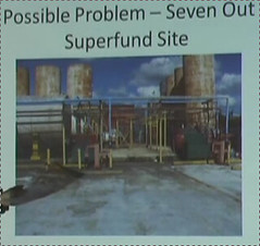
Lurking within Mary Street Park, a tree-lined neighborhood park in Waycross, is a silent killer—toxic pollutants from a defunct industrial wastewater treatment facility known as Seven Out Tank. Opened in 2002, the industrial waste handler operated only two years before multiple environmental violations led to the facility’s closure. Now, after Continue reading

Aquifer storage meeting in Newton, GA 7 November 2013

It looks like SB 213 is being resurrected after falling in the Georgia House in March. This GEFA ASR meeting is in Newton, which is not far west of Tifton. When will they be coming for the waters of the Little River, too?

Jim West in the Albany Herald 29 March 2013, Flint River bill fails in the House, quoted Gordon Rogers, Flint Riverkeeper, and then referred to Georgia Water Coalition:

One aspect of the bill river advocates found objectionable was the concept of “stream flow augmentation,” including aquifer storage and recovery, or ASR, which Coalition officials define as “the injection of ground water into the aquifer, which would be extracted later and sent downstream.” According to the Coalition, the process could cause irreversible contamination of the aquifer.

GEFA News 30 October 2013, Aquifer Storage Project Public Meeting Scheduled, Continue reading

Videos: Aquifers, sinkholes, and groundscans –Prof. Don Thieme

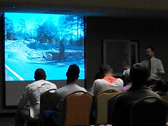
We had to move to a larger room, so many attended this groundwater talk at VSU (about 90). Plus a guest appearance by SAVE.

Crowded small room Larger Magnolia Room

Coastal Plain Surficial Deposits, Groundwater Resources, and Recent Subsidence in south Georgia by Prof. Donald M. Thieme @ VSU for WWALS 2013-10-09 Here are Dr. Donald M. Thieme‘s slides in PDF, with his longer title:

Coastal Plain Surficial Deposits, Groundwater Resources, and Recent Subsidence in south Georgia

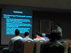
While we are lucky to have abundant groundwater, both from the Upper Floridan Aquifer 100 feet below us trapped in Eocene limestones and from shallow groundwater with its karst features, nonetheless overpumping has caused falls in the level of the aquifer (about 0.6 feet a year at Valdosta), resulting in rapid loss of shallow groundwater, plus surface water that enters and often contaminates the aquifer through those karst features.

Summary: abundant groundwater from Upper Floridan aquifer and shallow groundwater Summary: Fall in level of upper Floridan aquifer is primary cause for....

Sometimes those karst features subside and manifest as sinkholes like the one that ate Snake Nation Road in Lowndes County and others that can develop slow (many years) or fast (weeks or minutes).

Subsidence Problems in south Georgia and north Florida Snake Nation Road sinkhole

There were also many questions, starting with what water do personal wells reach? Also including a brief history of Valdosta well drilling from artesian to hundreds of feet down, and a sinkhole in a garage in Lowndes County, should local governments require sinkhole insurance (including mention of Moody AFB subsidence and Florida citrus growers pumping so much water it causes sinkholes). I also introduced the WWALS board members present: Gretchen Quarterman (Treasurer and videoing), Bret Wagenhorst (Outings), Heather Brasell (Secretary), Dave Hetzel (President), April Huntley (Director), me (Vice President), and Chris Graham (Member); plus a brief summary of WWALS events and outings. Here’s a video playlist:

Continue reading