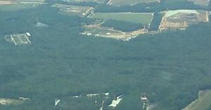
Tag Archives: Withlacoochee Wastewater Treatment Plant

What Valdosta is doing about its wastewater problem

Update 2016-04-05: Actually, force main and new WWTP on line by May.

Frances Adams asked:

I just want to know when will this be fixed, I can’t even drink my water for it having ecoli in it. Someone needs to do something now!!!

The two biggest pieces are scheduled to be finished this summer and next summer: the force main project in July 2016, and the new Withlacoochee Wastewater Treatment Plant relocated uphill by August 2017. Valdosta is spending upwards of $300 million to fix the problem.

As I point out every time I post about new spills, there are still open questions and, as your Waterkeeper® Affiliate for the upper Suwannee River and the Withlacoochee and Alapaha Rivers, WWALS Watershed Coalition will keep after Valdosta until we get the answers. See also the slides and videos from the meeting Valdosta held for us a year ago about this.

Here’s what Valdosta’s Sewer System Improvements web page says today: Continue reading

More Valdosta wastewater spills over the weekend; stay tuned 2016-04-04

Update 2016-04-05: Here are the details, and force main and new WWTP on line by May.

Valdosta spilled more wastewater over the weekend, according to Valdosta City Council Tim Carroll, who called just now. The Withlacoochee River is out of its banks, actually up on the property containing the Withlacoochee Wastewater Treatment Plant (WWTP), but “according to the experts” not going to threaten the plant. “But lines are underwater”.

Water is not even close to the new WWTP currently under construction, according to Carroll. And the new force main project should deal with much of the manhole overflow problem on the west side of Valdosta in the Withlacoochee basin, for example into Sugar Creek.

On the east and southeast, in the Alapaha basin, Continue reading

Yet more Valdosta wastewater spills

Maybe soon this February baker’s dozen of wastewater spills will be a thing of the past, but for now it’s deja vu similar to but worse than last February.

300x388 Figure 2.2.5. Sub-basins Areas, in Section 2 Methodology, by City of Valdosta, for WWALS.net, 14 January 2011 It looks like Valdosta has updated, as repeatedly asked, its schedule for wastewater project completion, with the force main project now aimed at July 2016 and relocation of the Withlacoochee WasteWater Treatment Plant (WWTP) for August 2017. See also Valdosta PR 22 January 2016, Withlacoochee Aerial Sewer Mains Replacement Project.

Those schedule changes are mentioned in the most recent Valdosta News. It does not, however, say which watersheds the various spills affect. I have added * for Alapaha River watershed and ** for Withlacoochee River watershed. It’s not that hard, and Valdosta has a water management plan that spells this all out, with maps. One Mile Branch** and Two Mile Branch** flow into Sugar Creek**, which goes into the Withlacoochee River**. Knights Creek* goes into Mud Creek* which goes into the Alapahoochee* River and then the Alapaha River*, eventually joining the Suwannee River in Florida, as does the Withlacoochee. Valdosta Utilities and Public Relations know all that. But why should every citizen, Continue reading

Suwannee Bioregion Coalition?

Related to population centers in the Suwannee River watershed, someone asked, “Do we need an interstate Suwannee Bioregion Coalition to guard the waters that feed into the Suwannee River?” We’ve got pieces of it already cooperating to some extent in opposing the Sabal Trail pipeline. There are many other even larger issues that everyone in the Suwannee River basin faces.

In south Georgia and north Florida we have Continue reading

Flooding charts: Withlacoochee and Little Rivers

Related to the Withlacoochee and Little River Water Trail and the double USACE flooding study presentation tonight in Valdosta, here are river level charts upstream and down on the Little River, Okapilco Creek, and the Withlacoochee River related to a new USGS flood-tracking chart. In the example charts on the right, you can see the Little River peaked days ago at Tifton and yesterday at Hahira.

The Withlacoochee River peaked yesterday at US 41. while downstream it’s going up at US 84, and barely starting up at Pinetta (click on the above chart example for the rest). Right now you can see all that in the charts below. If this works, you’ll see something different later, because you’ll see current charts whenever you refresh this page.

Update 2016-05-31: See sea level gage reports.

Update 2016-04-27: graphs from water.weather.gov and some WRWT Safe Water Levels.

Update 2014-11-04: Simplified gage formatting.

Update 2014-11-03: That works, and see also Alapaha River water levels.


Tifton Gauge, Little River at Upper Ty Ty Road, near Tifton, GA, Tift County, GA (02317797)

Highest safe 3.9 feet, 271 NAVD. Lowest boatable 0.1 feet, 267.2 NAVD.

Adel Gauge, Little River near Adel, GA, Cook County, GA (02318000)

Highest safe 7.9 feet, 181 NAVD. Lowest boatable 2.2 feet, 175.3 NAVD.

Hahira Gauge, Little River at GA 122, near Hahira, GA, Lowndes County, GA (02318380)

Highest safe 11 feet, 144 NAVD. Lowest boatable 4.25 feet, 137 NAVD.

Skipper Bridge Gauge, Withlacoochee River at Skipper Bridge Road, near Bemiss, GA, Lowndes County, GA (023177483)

Highest safe 10.7 feet, 131 NAVD. Lowest boatable 2.3 feet, 122.6 NAVD.

Valdosta Gauge, Withlacoochee River at US 41 near Valdosta, GA, Lowndes County, GA (02317755)

Highest safe 12.7 feet, 123′ NAVD. Lowest boatable 5.7 feet, 116′ NAVD.

Okapilco Creek Gauge, Okapilco Creek at GA 333, near Quitman, GA, Brooks County, GA (02318700)


Quitman Gauge, Withlacoochee River at US 84, near Quitman, GA, Brooks County, GA (02318500)

Highest safe 10.5 feet, 94 NAVD. Lowest boatable 2.0 feet, 85.5 NAVD.

Pinetta Gauge, Withlacoochee River near Pinetta, FL., Madison County, FL (02319000)

Highest safe 12.5 feet, 59 NAVD. Lowest boatable 6.0 feet, 52.5 NAVD.

Madison Gauge, Withlacoochee River near Madison, FL , Madison County, FL (02319300)

Highest safe 10.0 feet, 50 NAVD. Lowest boatable 0.1 feet, 40.1 NAVD.

Lee Gauge, Withlacoochee River near Lee, FL, Madison County, FL (02319394)

Highest safe 44.0 feet, 44 NAVD. Lowest boatable 29.5 feet, 29.5 NAVD.

315x535 WRWT, in Withlacoochee River Water Trail gauges, by John S. Quarterman, for WWALS.net, 8 June 2015

 -jsq, John S. Quarterman, Suwannee RIVERKEEPER®

You can join this fun and work by becoming a WWALS member today!