Category Archives: Blueway

Video: River etiquette and invitation to the Alapaha River Water Trail Conference and outing

WWALS Treasurer Gretchen Quarterman invited everyone to discuss river etiquette and private property and to see the prizes awarded to the high school logo contest winners at the Alapaha River Water Trail Conference tomorrow, and to go on the river outing afterwards.

She spoke in Citizens Wishing to Be Heard at the Regular Session, Lowndes County Commission (LCC), Valdosta, Lowndes County, Georgia, 10 March 2015.

Here’s the video:

Continue reading

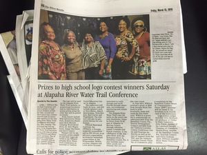
Prizes to high school logo contest winners Saturday at Alapaha River Water Trail Conference

Update 2015-03-16: South Georgia talent won the Alapaha River Water Trail Logo Contest.

FOR IMMEDIATE RELEASE

Prizes to high school logo contest winners Saturday at Alapaha River Water Trail Conference

Adel, March 10th 2015 — WWALS Watershed Coalition will award prizes to high school student artists for first, second, and third place logo contest winners and an honorable mention at the Alapaha River Water Trail Conference this Saturday March 14th, near Alapaha, Georgia. The winning logo will appear in an Alapaha River Water Trail brochure along with lists of prize contributors and Water Trail sponsors. The afternoon’s festivities will conclude with an easy paddle outing on the Alapaha River. facebook event.

The logo will be used on the Alapaha River Water Trail website, on promotional brochures, and on information at access points along the river that will be posted on kiosks.

Many thanks to the prize donors: Wild Adventures Theme Park, Hometown Handyman Chris Mericle, Camping World Retail Store, Dr. Bret Wagenhorst, Jasper Hardware, and Garry Gentry.

Winners will be announced, prizes awarded, and their logos unveiled at the

WWALS Alapaha River Water Trail Conference Continue reading

Updated WWALS Brochure with Alapaha River Water Trail

Plus Chris Mericle has joined the WWALS Board, the board now meets quarterly, and much of the work is done through Committees, but the big addition is a map and access points for the Alapaha River Water Trail. Here’s PDF for printing, and images are below, all thanks to Karan Rawlins.

Update: 2015-06-08: See the new Alapaha River Water Trail Brochure, Map, and Card all in one!

300x232 Cover, Donations, SEEDN, in WWALS Brochure, by John S. Quarterman, for WWALS.net, 12 February 2015 300x232 Alapaha River Water Trail, FAQ, in WWALS Brochure, by John S. Quarterman, for WWALS.net, 12 February 2015 Continue reading

Naylor Park and Boat Ramp aerial plan map

300x186 Naylor Boat Ramp aerial, in Maps from board packet, by John S. Quarterman, 10 February 2015 Thanks to the Lowndes County Commission and staff, here’s a look at what they’re planning for the new boat ramp and park on the Alapaha River just north of US 84. Below are videos of discussion about these plans in several recent Commission meetings. This boat ramp and park is already on the map for the Alapaha River Water Trail, and I have thanked the Commission for moving along to get it established; see below. Continue reading

WWALS Goals for 2014

A surprising number of the Board’s nine goals for 2014 have been accomplished, and some new ones have already been added. What goals should WWALS have for 2015?

Goals accomplished include becoming an IRS 501(c)(3) and raising money for and purchasing insurance. Some we’ve been doing right along: cleanups, including Rivers Alive. Some are so much the core of what WWALS does that we didn’t even list them as goals, but we’ve been doing them anyway: monthly outings and indoor events.

The later-added goal of the Alapaha River Water Trail is Continue reading

Pictures Upstream on the Alapaha River from Statenville Boat Ramp 2014-01-18

A nice day for a paddle upstream, in these pictures and videos by Gretchen Quarterman of the 18 January 2014 WWALS Outing at the Statenville Boat Ramp on the Alapaha River. Continue reading

Statenville to Sasser Landing on the Alapaha River, WWALS Outing, 2015-02-15

Expert Paddle on the Alapaha River Sunday, February,15th 12:00pm. facebook event

Update 2015-03-06: Summary and pictures.

Launch site: Statenville boat ramp on HWY 94 just west of Statenville, GA, 30°42’15.3″N 83°01’57.9″W 30.704260, -83.032750.
Take out:Alapahoochee boat ramp (Sasser Landing) HWY 150 a few miles east of Jennings, FL, 30°36’02.6″N 83°04’23.7″W 30.600710, -83.073260.


Picture by Michael Rivera,
used with permission.

We will meet at launch site at noon, unload boats and shuttle vehicles to the take out (25 miles Round trip), on the water by 1:00.

This event is FREE! All we ask is that Continue reading