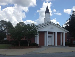
 Nine miles south of Willacoochee on GA 135 and twelve miles east of Nashville on GA 76, which turns into Riverside Road as it crosses GA 135,
is this traditional put-in for the Alapaha River.
However, it is not clear that access is public, so we can’t recommend it unless that is clarified. Continue reading
Category Archives: Blueway
Canoeing Guide to the Withlacoochee River c. 1979
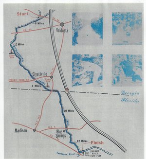 Including both Florida and Georgia,
a second river got map and guide attention back in the 1970s.
To be updated in the Withlacoochee River Water Trail.
This Withlacoochee River guide is courtesy of John Leonard, Executive Director of the Southern Georgia Regional Commission (SGRC).
I would speculate that it is the most recent of the three guides posted thus far, because the Continue reading
Cleanup on Alapaha River near Jasper, FL: WWALS Outing 2014-12-20
The December WWALS Outing is a cleanup on the Alapaha River on private land near Jasper, Hamilton County, Florida, at 10AM Saturday December 20th 2014. This is an area of the river people boat past on the Alapaha River Water Trail.
Update 2015-01-26: Some pictures.
 Most WWALS outings are open to the public.
However, since this one is on private land, WWALS membership is required,
and please contact wwalswatershed@gmail.com for directions.
Also please bring gloves, bags, and warm clothes. The landowner will provide lunch.
If you’re not a WWALS member, you can join online or mail in a membership form with a check.
-jsq
Alapaha River rainy season?
Veteran boater Bret Wagenhorst asked:
Is there a defined “rainy season” on the Alapaha? I have seen the water high in December, March, July, and once even in September.
Good question!
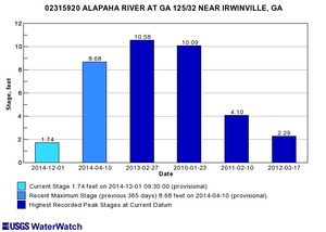 Looking at the record high water levels for
the gauges,
they’re all in April, March, February, or January.
Also, the only January one is for Irwinville, the farthest upstream, which also had its highest ever in February with that January high only slightly lower.
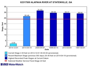 Downstream, Continue reading
Canoeing Guide to the Alapaha River c. 1979
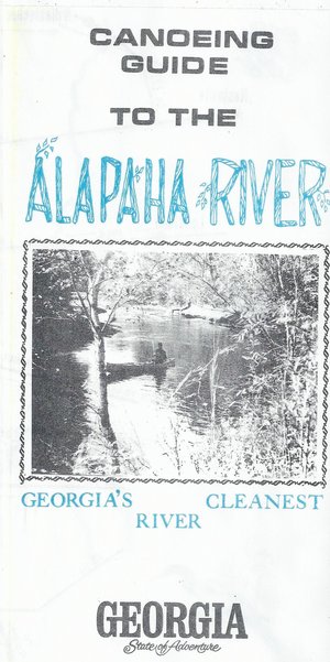 Here’s a different guide to the Alapaha River from the
one WWALS previously received; this one is
courtesy of John Leonard, Executive Director of the
Southern Georgia Regional Commission (SGRC).
The
Alapaha River Water Trail WWALS is currently developing
is merely a continuation of this more than three decade old
Alapaha Canoe Trail.
John Leonard said that when he started at the predecessor of the SGRC in 1980, calls came in frequently asking about water levels on the Alapaha River. It took him a while to realize why: the Alapaha River Trail had been written up in Southern Living! He did not have Continue reading
TDC Letter of support for Alapaha River Water Trail from Hamilton County, FL
 First a $250 check, then a letter of support, from the Hamilton County, Florida
Tourist Development Council (TDC).
WWALS thanks TDC!
In this picture taken at the 26 October 2014 Dead River Sink Outing Continue reading
Organizational Meeting for Alapaha River Water Trail 2014-12-13
 WWALS Watershed
Coalition, Inc.
a 501(c)(3) nonprofit corporation
3338 Country Club Road #L336
Valdosta, GA 31605
17 November 2014
Re: Alapaha River Water Trail
Dear Neighbor,
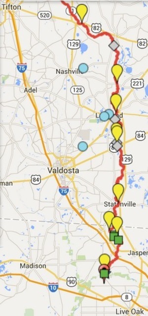
You are invited to an organizational meeting for the Alapaha River Water Trail by WWALS Watershed Coalition (WWALS). This updates and slightly extends the old Alapaha Canoe Trail from the 1970s, with new map, brochure, and website in the making.
When: 1-4PM
Saturday December 13th 2014
Where: Continue reading
Thank you for your efforts on behalf of the Alapaha River Water Trail –Valdosta-Lowndes County Chamber of Commerce
The Chamber of Commerce in the center of the Alapaha River Water Trail sent a very nice letter of support that connects the dots between water recreation, education, and economy.
VALDOSTA – LOWNDES COUNTY
CHAMBER OF COMMERCE
Leading Businesses.
Leading Communities.November 5, 2014 Continue reading
Alapaha River water levels
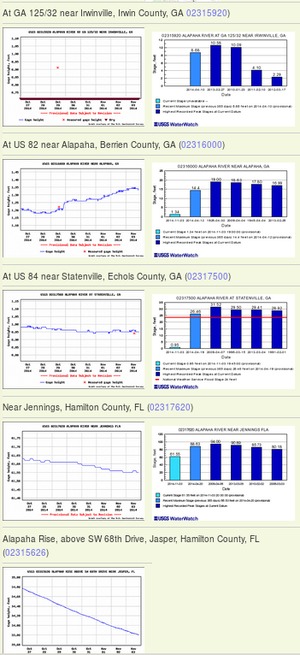 Update 2016-12-23: graphs from water.weather.gov.
Update 2016-05-31: See sea level gage reports.
Update 2015-04-28: Added flood stages and tentative highest safe and lowest boatable water levels, both above the charts for each gauge and in a summary table. If you have data, please let us know.
Here are water level gauges for the Alapaha River in Georgia and Florida, north to south. The graphs should show the current levels at this time, in feet, plus for most of the gauges a bar graph of selected historic levels.
This is a draft of a concept for use with the Alapaha River Water Trail. See also Alapaha River Rainy Season.
It is also a companion to the similar set of graphs for the Withlacoochee and Little Rivers.
See below for the current Alapaha River water level graphs. Continue reading
Video: Alapaha River Water Trail –Dave Hetzel
 WWALS Ambassador Dave Hetzel explains the
Alapaha River Water Trail: recreation through fishing, swimming, boating,
conservation, and economic benefits through heads on beds, restaurant
customers, gas, and outfitters. Continue reading

