Category Archives: River

State geologist Greenhalgh says BMPs don’t work to solve BMAPs

Someone inside FDEP has been brave enough for years to say the emperor has no clothes regarding contamination in the Suwannee River Basin.

Suiting up, Thomas Greenhalgh
Photo: John S. Quarterman for WWALS, of Thomas Greenhalgh suiting up at the Alapaha Dye Test, 2016-06-22.

Dinah Voyles Pulver, The Daytona-Beach News-Journal, 24 November 2018, State geologist challenging springs action plan raised questions before, Continue reading

FPL Columbia County Solar Farm, fall 2018

East on I-10 just before I-75 southbound crosses: a 74.5 MW FPL solar farm in Columbia County, Florida, well along in construction. I don’t think any newspaper ever called the Sabal Trail fracked methane pipeline a windfall:

Continued, Newspaper
Solar photos: Carl McKinney, Lake City Reporter. Sorry I forgot who sent me this picture of the newspaper front page.

FPL PR 31 July 2018, Construction begins on FPL’s four newest solar power plants, Continue reading

Hike to Dead River Sink, Alapaha River, Jennings Bluff Launch, 2019-01-19

Update 2019-01-16: Due to high water on the Alapaha River, moved to Hike at Little Shoals, Suwannee River.

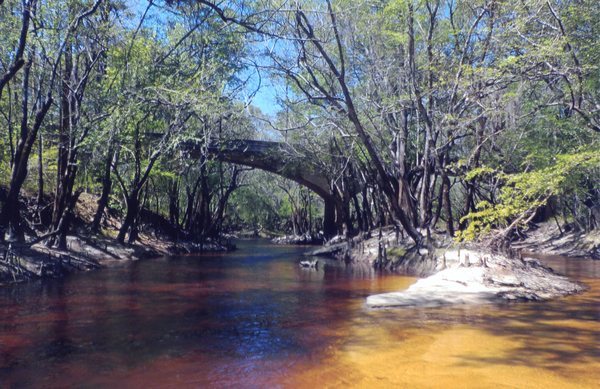
There’s nothing else like it in Florida (or Georgia), so come along on the traditional winter WWALS three-mile hike to the Dead River Sink! No boat required to see the Alapaha River run up this distributary and disappear into the ground, not coming back up for 20 miles and three days.

This impressive geological phenomenon is an eye opener that perfectly illustrates the karst topography containing our drinking water in the Floridan Aquifer underneath our rivers. You often see exposed porous limestone along our river banks. However when you see a hole that is capable of swallowing the entire Alapaha for most of the year…. it’s impressive.

When: 12 noon PM, January 19, 2019

Put In: Meet at Jennings Bluff Launch. From Jennings, Hamilton County, FL, travel south on US 41 to NW 25 Lane; turn left; travel east to NW 82 Court and the entrance into the Suwannee River Water Management District’s Jennings Bluff tract; turn left and follow road to canoe launch.

GPS: 30.567172, -83.039189 (for the entrance to Jennings Bluff Tract)

Take Out: Same.

Bring: Cold weather gear, hiking shoes, and clothes resistant to thorny bushes. No boat needed. Also trash pickers and trash bags: every WWALS outing is also a cleanup.

Free: This outing is free to WWALS members, and $10 (ten dollars) for non-members. We recommend you support the work of WWALS by becoming a WWALS member today!

Event: facebook, meetup

[Right down there, 13:33:30, 30.57888, -83.05025]
Photo: John S. Quarterman, Right down there, 13:33:30, 2018-01-27.

Continue reading

Pictures: Hike to the Dead River Sink 2018-01-27

It was a nice day for a Hike to the Dead River Sink in the Alapaha Quest on the Alapaha River Water Trail, with Practicing Geologist Dennis J. Price of Hamilton County, Florida. Here are some pictures and a Google map from Saturday, January 27, 2018.

[Almost there, 13:16:34, 30.5837666, -83.0535975]
Almost there, 13:16:34, 30.5837666, -83.0535975

You can come along when we do it again in January 2019. Continue reading

What happened on the Alapahoochee River? 2018-11-14

Twenty five times the state limit for Fecal coliform could be a problem. What got into the Alapahoochee River last week?

Graph, Alapaha Basin

GA 135, Alapahoochee River, Alapaha Basin

If you want to help find out what’s getting into our rivers, you can Continue reading

Alapaha Station Celebration 2018-11-10

Update 2019-10-24: pictures.

Join us at the WWALS booth for fun, food, and a parade at the Alapaha Station Celebration, this Saturday, November 10, 2018, for the firth year running.

When: 9AM – 5PM, Saturday, November 10, 2017

Where: Alapaha Station, 245 NE Railroad St, Alapaha, Georgia

Event: facebook

[Dave Hetzel and people]
Dave Hetzel and people; pictures by Gretchen Quarterman for WWALS at Alapaha Station Celebration 2017-11-11.

The station is only a few miles from Continue reading

Pictures: Alapaha Station Celebration 2017-11-11

Fun last year at the Alapaha Station Celebration, coming up again tomorrow.

[Shirley Kokidko]
Shirley Kokidko; pictures by Gretchen Quarterman for WWALS.

There are many more pictures on the WWALS website.

More: For more WWALS outings and events as they are posted, see Continue reading

Stone Bridge, Little River, by Dan Phillips 2016-08-01

Here’s a piece of south Georgia history, Stone Bridge, on the Little River, between Adel in Cook County and Barney in Brooks County, on the Withlacoochee and Little River Water Trail (WLRWT).

On a summer day, Stone Bridge

Dan Phillips wrote about this picture he took: Continue reading

First flush 2018-10-31

Was there rain Wednesday? That might explain the sudden spikes at US 41 on the Withlacoochee River, at GA 133 on the Little River, and at State Line on the Withlacoochee River. We can guess that the rains Thursday and Friday (today) have washed away whatever that very odd spike was at the state line.

Graph, Withlacoochee Basin

Thanks to Valdosta Utilities and Valdosta City Clerk Teresa Bolden for sending this Wednesday’s Valdosta water quality testing data before the end of Friday. For more contact, see https://wwals.net/issues/vww/.

State Line, Withlacoochee River, Withlacoochee Basin

It’s a very odd spike, because Continue reading

Boomerang Banner 2018-11-03

The WWALS Boomerang banner shows the sponsors and vendors for 11AM tomorrow morning, Saturday, November 3, 2018, at State Line Ramp (Mozell Spells, 6461 Madison Hwy, Valdosta, GA 31601). Paddle with us from Georgia into Florida, and back again!

at UPS Store, Banner

 -jsq, John S. Quarterman, Suwannee RIVERKEEPER®

You can join this fun and work by becoming a WWALS member today!