Received April 21, 2018. I’ve added some links. -jsq
Seven of us drove down from north Georgia to the Alapaha for a long weekend paddling trip starting April 12. I had long thought of making this trip, especially because the Canoeing and Kayaking Guide to Georgia rated it as one of the state’s most scenic rivers, “A+.”
We chose the upper stretches, between Willacoochee and Lakeland. One of our group arranged, through extended family, to “camp” the night before putting in, at a house in Lax, just a few miles from the GA-135 bridge where we we started out the next day.
We launched with four boats, three canoes and a kayak, and found the river every bit as scenic as the guide described. We enjoyed the forests of cypress, tupelo, pine, oaks, maples, birch and willow. And the wildlife was equally magnificent: ibis, geese, egrets, herons, buzzards, woodpeckers, beavers (evident through their marks on the trees), and deer and raccoon tracks on the beaches.
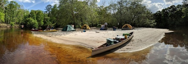
First Camp: a beach on a point
The paddling was nice and easy, making about 3 mph without breaking a sweat. We had a few tight spots, including Continue reading