Tag Archives: Alapahoochee River

Three more Valdosta wastewater overflows 2016-03-28

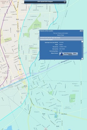
Who thought it was a good idea for stormwater to go into Valdosta’s sanitary sewer system? 700 Cypress Street, Valdosta, GA Whoever it was, the current Valdosta Utilities, Engineering, and especially Stormwater Director have to deal with it, frequently. Maybe some of the upwards of $300 million Valdosta is spending on force main, new Withlacoochee Wastewater Treatment Plant, etc., will help with this problem. But none of that will stop rain from falling on Valdosta, and little of it is directed at the Alapaha River watershed in Valdosta, where one of this week’s three spills went.

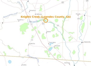
Come see for yourself where Sugar Creek flows into the Withlacoochee River, this Sunday morning, April 3rd, on the extra WWALS Outing from Langdale Park to the Little River Boat Ramp. And come paddle with us on the Alapaha River Saturday morning April 23rd, from Hotchkiss Road in Lanier County to Mayday in Echols County, upstream from where Knights Creek flows into Mud Swamp Creek, which joins Grand Bay Creek to form the Alapahoochee River, which joins the Alapaha River in Florida. And of course both the Withlacoochee and the Alapaha join the Suwannee River. Valdosta says there’s no significant vestige of its wastewater that far downstream. It would be good to have some independent water quality monitoring to be sure.

I notice Section 5 Mud Swamp Creek Basin of Valdosta’s Master Stormwater Management Plan says: Continue reading

Agricultural land bought by west coast investors

Investment firms owned by Bill Gates have bought thousands of acress of agricultural land in counties in or near WWALS watersheds in south Georgia and north Florida, all above the Floridan Aquifer, near the Alapaha, Alapahoochee, Withlacoochee, and Suwannee Rivers, as part of a nationwide buying spree of a quarter million acres.

Here’s a summary of what we’ve found thus far. Any more recent posts should be found through this search.

These purchases of hundreds and thousands of contiguous acres are all after Bill Gates announced in 2012 he was going to “fix” agriculture in conjunction with Monsanto and Syngenta.

And it’s not just Bill Gates. Continue reading

Statenville to Sasser Landing with Turket Creek Waterfall -jsq @ WWALS 2015-02-15

It was a nice day with current on the Alapaha River from 300x180 Selfie Turket, in Statenville to Sasser Landing on the Alapaha River, by John S. Quarterman, for WWALS.net, 15 February 2015 Statenville to Sasser Landing 15 February 2015, with a side trip up the Alapahoochee River to the famous Turket Creek Waterfall. This morning WWALS continues from Sasser Landing to Jennings Bluff, plus a walk up the Dead River to the sink where the Alapaha River goes underground. Continue reading

Tannin tea color of blackwater rivers

A major feature of coastal plain blackwater rivers is their tea color, ranging from yellow to red, from tannins from oak trees. Pretty close to it is the background color of this paragraph, RGB #FF9933, or 0 40 80 0 CMYK, or Pantone Solid Coated 1375 C. Here are some examples from three of WWALS’ rivers.

Come see for yourself at upcoming WWALS outings, such as:

How many Valdosta overflows into Knights Creek and the Alapaha River watershed?

And how many into Dukes Bay Canal, which also flows into Mud Creek, to the Alapahoochee River, to the Alapaha River, to the Suwannee River, to the Gulf? It’s great the Valdosta City Council Thursday will consider more fixes to wastewater problems in the Withlacoochee River watershed. But what is Valdosta doing about problems in the Alapaha River watershed?

The three Valdosta overflows into the Alapaha River watershed in February 2015 weren’t the first. How many others have there been?

This report is from 19 March 2014: Continue reading

Summary of Statenville to Sasser Landing WWALS Outing –Bret Wagenhorst 2015-02-15

Saw: tupelo, cypress, maple, river birch, pine, live oak, titi, mayhaw, native blueberries, palmetto; only maple in bloom. Not much wildlife.

300x225 WWALS At Sasser Landing, in Sasser deanna, by Deanna Mericle, for WWALS.net, 15 February 2015 River: several small streams entered river through breaks in the bank, winding course, couple of bluffs and some exposed karst

Comments: a good level to run this section, saw 2 other canoes with a family of campers, and a fisherman in a john boat skinning a catfish, 2 rope swings, the side trip up the Alapahoochee River to the waterfall just up from the take out was worth the effort.

Pictures: see separate post by Bret Wagenhorst. And pictures by John S. Quarterman.

Ten of us met at 12 noon Sunday afternoon, February 15th 2015, continuing our exploration of the Alapaha River Water Trail, as announced.

The shuttle took Continue reading

Valdosta spilled into Alapaha as well as Withlacoochee watersheds in February

Spilling sewage into the Withlacoochee River apparently wasn’t enough 300x388 Figure 2.2.5. Sub-basins Areas, in Section 2 Methodology, by City of Valdosta, for WWALS.net, 14 January 2011 for Valdosta: in February it also spilled three times into the Alapaha River watershed. At least once this was due to rains directly on Valdosta, for which the levee proposed by the Army Corps of Engineers on Sugar Creek at the Withlacoochee River wouldn’t help. It’s time for Valdosta to move along with fixing its wastewater problems. More transparency from Valdosta would also help. And I, for one, would like to see that promised Corps flooding study of the entire Suwannee River Basin.

In three different reports in February, Valdosta mentioned sewage overflows into either Knights Creek or Dukes Bay Canal, without mentioning that those flow into Mud Swamp Creek, which joins with Grand Bay Creek to form the Alapahoochee River, which joins the Alapaha River, which flows into the Suwannee River. The Florida Department of Health apparently didn’t know that, since it didn’t mention the Alapaha River in its advisories for counties downstream. But Valdosta should know, according to its own SWMP Update Phase 1 Final Report, Section 2 Methodology, 2011-01-14, that about half of Valdosta is drained by Knights Creek and Dukes Bay Canal: Continue reading