Tag Archives: Jennings

Sabal Trail through Lowndes past Clyattville Elementary School

The invading pipeline would pass within about one mile of Clyattville Elementary School Railroad Ave. to Clattville Elementary School where it would cross Clyatt Mill Creek and then Railroad Avenue, at about 30.680638, -83.326501.

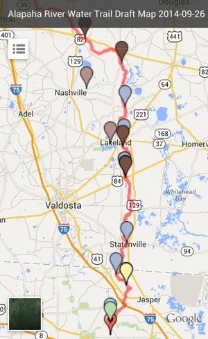
This would be after crossing the Withlacoochee River from Brooks into Lowndes Counties just north of US 84, and before crossing Jumping Gulley Creek and the state line into Hamilton County Florida, where the hearing was held in Jennings for WWALS v. Sabal Trail & FDEP.

You can see the general route in the Cover Map. After crossing the Withlacoochee River, Sabal Trail would cross Martin Lane and Tiger Creek, then Continue reading

Statenville to Sasser Landing with Turket Creek Waterfall -jsq @ WWALS 2015-02-15

It was a nice day with current on the Alapaha River from 300x180 Selfie Turket, in Statenville to Sasser Landing on the Alapaha River, by John S. Quarterman, for WWALS.net, 15 February 2015 Statenville to Sasser Landing 15 February 2015, with a side trip up the Alapahoochee River to the famous Turket Creek Waterfall. This morning WWALS continues from Sasser Landing to Jennings Bluff, plus a walk up the Dead River to the sink where the Alapaha River goes underground. Continue reading

Summary of Statenville to Sasser Landing WWALS Outing –Bret Wagenhorst 2015-02-15

Saw: tupelo, cypress, maple, river birch, pine, live oak, titi, mayhaw, native blueberries, palmetto; only maple in bloom. Not much wildlife.

300x225 WWALS At Sasser Landing, in Sasser deanna, by Deanna Mericle, for WWALS.net, 15 February 2015 River: several small streams entered river through breaks in the bank, winding course, couple of bluffs and some exposed karst

Comments: a good level to run this section, saw 2 other canoes with a family of campers, and a fisherman in a john boat skinning a catfish, 2 rope swings, the side trip up the Alapahoochee River to the waterfall just up from the take out was worth the effort.

Pictures: see separate post by Bret Wagenhorst. And pictures by John S. Quarterman.

Ten of us met at 12 noon Sunday afternoon, February 15th 2015, continuing our exploration of the Alapaha River Water Trail, as announced.

The shuttle took Continue reading

Statenville to Sasser Landing on the Alapaha River, WWALS Outing, 2015-02-15

Expert Paddle on the Alapaha River Sunday, February,15th 12:00pm. facebook event

Update 2015-03-06: Summary and pictures.

Launch site: Statenville boat ramp on HWY 94 just west of Statenville, GA, 30°42’15.3″N 83°01’57.9″W 30.704260, -83.032750.
Take out:Alapahoochee boat ramp (Sasser Landing) HWY 150 a few miles east of Jennings, FL, 30°36’02.6″N 83°04’23.7″W 30.600710, -83.073260.


Picture by Michael Rivera,
used with permission.

We will meet at launch site at noon, unload boats and shuttle vehicles to the take out (25 miles Round trip), on the water by 1:00.

This event is FREE! All we ask is that Continue reading

Alapaha River rainy season?

Veteran boater Bret Wagenhorst asked:

300x214 Alapaha, GA 02316000, in Alapaha River gauge heights over time, by John S. Quarterman, for WWALS.net, 1 December 2014 Is there a defined “rainy season” on the Alapaha? I have seen the water high in December, March, July, and once even in September.

Good question!

300x214 Irwinville, GA 02315920, in Alapaha River gauge heights over time, by John S. Quarterman, for WWALS.net, 1 December 2014 Looking at the record high water levels for the gauges, they’re all in April, March, February, or January.

Also, the only January one is for Irwinville, the farthest upstream, which also had its highest ever in February with that January high only slightly lower.

300x214 Statenville, GA 02317500, in Alapaha River gauge heights over time, by John S. Quarterman, for WWALS.net, 1 December 2014 Downstream, Continue reading

Alapaha River Sink 2014-11-11

Deanna Mericle posted on facebook 11 November 2014,

Chris and I hiked the riverbed of the Alapaha River and found the other sink!

Other as in different from the Dead River Sink. Continue reading

Dead River Sink, Alapaha River, WWALS Outing, 2PM 26 Oct 2014

This Sunday afternoon, Oct 26th at 2PM: where the Dead River meets the Alapaha River and goes underground at the Dead River Sink, aka the Alapaha Sink. 300x149 Dead River Sink, in Jennings Bluff Tract, by SRWMD, 24 October 2014 Park on SRWMD’s Jennings Bluff Tract and walk in with WWALS to see what Samuel Taylor Coleridge dreamed as “Where Alph, the sacred river, ran Through caverns measureless to man Down to a sunless sea.” No boat required: this is a walking outing.

It’s an adventure, as Deanna Mericle reported recently:

300x225 Red with human for scale, in Alapaha Sink, by Chris Mericle, 16 September 2014 …the hike to the sink does have some steep parts, especially if you go the scenic route, which I recommend. The area around the sink itself is kind of steep with slick mud/clay. So wear good shoes for hiking. There were only a few Mosquitos. The area is beautiful and worth the effort.

This event is FREE! All we ask is Continue reading

Conservation

There’s are a reason the WWALS Mission says “conservation”. It’s pithily summed up by Prof. Rahul Mehrotra.

Elizabeth Gudrais wrote for Harvard Magazine May-June 2012, Engaging Students with Conservation,

PROFESSOR OF URBAN DESIGN and planning Rahul Mehrotra has been involved with restoring historic palaces, writing a law on historic preservation in Mumbai, and crafting a conservation master plan for the Taj Mahal. Harvard recruited him in part for this expertise, and this academic year, with Noyes professor in architectural theory Michael Hays, he has launched a conservation track for Graduate School of Design (GSD) master’s students.

Conservation, he says, is not the same as preservation, which focuses on protection and repair. Conservation is broader and richer, combining historical integrity and creativity to develop narratives connecting the present with the past.

Historical narratives like connecting Continue reading

Alapaha Sink: WWALS Outing 2PM 26 Oct 2014

300x225 Red with human for scale, in Alapaha Sink, by Chris Mericle, 16 September 2014 Update 24 October 2014: Map, directions, and how to join WWALS.

Come see where the Alapaha River goes underground, near Jennings, in Hamilton County, Florida, 2PM, Sunday, October 26th, 2014. This is a walking outing; no boats required.

Directions to the parking area: Take I-75 south to State Road 6 in Florida. Go east (left) to US 41. Go north (left) about one mile. Turn right on NW 76th Terrace and go a mile. Turn right on NW 25th Lane and go about a mile. 300x489 Zoom, in Alapaha River Water Trail Draft Map, by John S. Quarterman, for WWALS.net, 26 September 2014 Turn left at the Jennings Bluff Tract sign and go .9 mile. It dead ends at the parking area. That road is gravel and dirt and kinda bumpy. The parking area can probably hold ten vehicles at least.

The location for the Sink on the draft Alapaha River Water Trail map apparently Continue reading