Update 2021-03-06:
Added some more river size comparisons, and see also
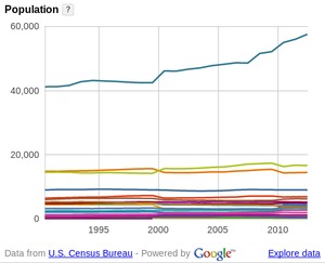
Suwannee River Basin is bigger than several states, less populous than any.
Seems like an easy question, but requires some research:
how many square miles are drained by the rivers in WWALS watersheds?
This is the answer:
| River | Georgia | Florida | Total |
|---|
| Withlacoochee | 2,090 | 270 | 2,360 |
|---|
| Alapaha | 1,726 | 114 | 1,840 |
|---|
| Upper Suwannee River | 1,904 | 816 | 2,720
|
|---|
| Lower Suwannee River | 0 | 1,590 | 1,590 |
|---|
| Santa Fe River | 0 | 1,400 | 1,400 |
|---|
|
|---|
| Suwannee River Basin | 5,720 | 4,230 | 9,950 |
|---|
Here’s a slightly much extended version of the summary table above:
| River | HUC | Georgia | Florida | Total |
|---|
|
|---|
| Withlacoochee River | (inc. Little) | 2,090 | 37% | 270 | 6% | 2,360 | 24% |
|---|
| Withlacoochee River | HUC 03110203 | (1,206) | 21% | (270) | 6% | (1,510) | 15% |
|---|
| Little River | HUC 03110204 | (860) | 15% | (0) | 0% | (860) | 9% |
|---|
|
|---|
| Alapaha River | HUC 03110202 | 1,726 | 30% | 114 | 3% | 1,840 | 18% |
|---|
| (Willacoochee River) | | (233) | 4% | (0) | 0% | (233) | 2% |
|---|
|
|---|
| Upper Suwannee River | HUC 0310201 | 1,904 | 33% | 816 | 19% | 2,720 | 27% |
|---|
| Lower Suwannee River | HUC 03110205 | 0 | 0% | 1,590 | 38% | 1,590 | 16% |
|---|
|
|---|
| Santa Fe River | HUC 03110206 | 0 | 0% | 1,400 | 33% | 1,400 | 14% |
|---|
|
|---|
| Suwannee River Basin | AU 031102 | 5,720 | 100% | 4,230 | 100% | 9,950 | 100% |
|---|
| GA/FL Basin% | | 57% | | 43% | | 100% |
|---|
For comparison:
-
1,061 square miles:
Apalachicola River (all in Florida)
-
1,300 square miles: St Marys River (765 in Georgia; 535 in Florida)
-
2,059 square miles:
Withlacoochee (South) River (all in Florida; drains directly to the Gulf, not to the Suwannee)
-
2,324 square miles: Ochlockonee River (Georgia and Florida)
-
4,000 square miles: Satilla River (entirely in Georgia)
-
5,540 square miles: Ogeechee River (entirely in Georgia)
-
8,460 square miles:
Flint River (entirely in Georgia)
-
8,740 square miles:
St. Johns River (all in Florida)
-
8,770 square miles:
Chattahoochee River (5,940 in Georgia and 2,830 in Alabama)
-
9,950 square miles:
Suwannee River (5,720 in Georgia; 4,230 in Florida)
-
10,577 square miles: Savannah River (5,821 in Georgia; 4,756 in South Carolina)
-
13,600 square miles:
Altamaha River (including Ocmulgee and Oconee, all in Georgia)
-
19,600 square miles:
ACF: Apalachicola, Chattahoochee, and Flint Basin (Georgia, Alabama, and Florida)
-
24,600 square miles:
Lake Okeechobee basin (entirely in Florida)
So the Suwannee River Basin is quite large, but only half the size of the ACF or Lake Okeechobee drainage systems.
And of course WWALS territory has much lower population than most of those other watersheds.
Notes on Sources
Many of the above figures are from
River Basins of the United States: The Suwannee, by USGS, unknown date
(but uses 1980 city populations),
The basin drainage area is 9,950 square miles, of which 5,720 square miles
are in southern Georgia. The basin area of the Withlacoochee River, the
largest tributary, is 2,360 square miles, of which 2,090 square miles are
in Georgia. The basin area of the Alapaha River is 1,840 square miles,
of which 1,726 are in Georgia.
But stay tuned: there’s much more for comparison.
Update 2019-11-08: after adding Santa Fe River Basin on September 26, 2019.
Update 2018-01-04: Lower Suwannee River; see Suwannee Riverkeeper.
Update 2015-11-01: After addition of the upper Suwannee River as WWALS territory.
Update 2015-06-02: added HUC from a
USGS summary, and Upper and Lower Suwannee with Extended Table, and corrected some arithmetic.
Divergent Sources
Or is that the answer?
Suwannee River Watershed, Florida’s Water, Florida Department
of Environmental Protection,
The Suwannee River originates in Georgia and flows southwest to the
Gulf of Mexico. It is the largest watershed in the state, covering 7,702
square miles.
7,702 + 3,816 = 11,518, which is larger than 9,950, and doesn’t
even include the parts of the upper Suwannee River in Georgia.
This Georgia River Network page on the Suwannee River also has a too-large number:
The Suwannee River Basin drains approximately 11,020 square miles….
Convergent Sources
River Basin Characteristics, in Suwanee River Basin Plan, by GA EPD,
unknown date,
The portion of the Suwannee River basin located entirely in Georgia
drains approximately 5,560 square miles. The Suwannee River Basin in
Georgia includes the waters of the Alapaha and Withlacoochee Rivers
which flow south into Florida and join the Suwannee River which
empties into the Gulf of Mexico. The Suwannee River basin drains
approximately 10,000 square miles, with approximately 5,560 square
miles of the basin in Georgia….
The headwaters of the Suwannee River drain approximately 574 square
miles of the Okefenokee Swamp. The Suwannee River flows southwest
through Georgia for 33 miles before entering Florida. Once in
Florida, the Suwannee converges with two of its tributaries, the
Alapaha and Withlacoochee rivers, which both originate in Georgia.
The Suwannee River is a blackwater stream with extremely acidic
waters. A pH reading of 3.6 was recorded July 22, 1997 (U.S.
Geological Survey, 1997).
The GA-EPD numbers more or less match the USGS numbers,
with the FL-DEP (and GRN) numbers being much different.
In another publication FL-DEP agreed on the Suwannee and Alapaha
River Basin totals, but not on the Withlacoochee River.
Nutrient and Dissolved Oxygen
TMDL for the Suwannee River, etc. 24 September 2008,
The Suwannee Basin drains approximately 10,000 square miles of south
Georgia and north Florida, discharging an annual average of
approximately 10,000 cubic feet per second (cfs). The Suwannee River
is the second largest river in the state in terms of flow. Within
the Suwannee Basin, the Alapaha, Withlacoochee, and Upper Suwannee
watersheds lie almost entirely in Georgia. These are dominated by
surface water runoff, as are the Florida portions of the basin in
the Northern Highlands region. After crossing the Cody Scarp, ground
water discharges from springs and diffuse seepage strongly
influences the Suwannee River and makes up the baseflow of the
river….
The Alapaha River drains approximately 1,800 square miles in Georgia
and Florida and joins the Suwannee southwest of Jasper, Florida. The
Alapaha River flows through karst terrain with numerous sinkholes,
stream sinks, and springs. At times, sinkholes in the streambed
capture the river’s entire flow. Once underground, the river flows
through solution channels in the limestone for approximately 19
miles and is presumed to emerge at two springs: Alapaha Rise and
Holton Creek. The Withlacoochee River, which drains approximately
1,500 square miles in Georgia and Florida, originates near Tifton,
Georgia, and flows south past Valdosta, Georgia, to join the
Suwannee River at Ellaville. The flow in the Withlacoochee River is
highly variable, reflecting the river’s response to rainfall in the
watershed. The river is affected by wastewater treatment plant
discharges in Tifton and Valdosta and pulp mill discharge in Jumping
Gully Creek at the state line.
Since 1,500 is quite a bit less than 2,360,
it looks to me like FL-DEP forgot about the Little River tributary
of the Withlacoochee River.
If so, that gives us an estimate for the Little River:
2,360 – 1,500 = 860 square miles.
Here’s another tidbit.
Appendix A, The Alapaha – Willacoochee River Watershed Restoration Action
Strategy Implementation Project, Seven Rivers RCD, unknown date,
The Alapaha — Willacoochee River Subwatershed is located in
south-central Georgia within the Alapaha River Watershed (HUC
03110202). It has an approximate land area of 148,286 acres (233
square miles) and flows through Ben Hill, Irwin, Coffee, Berrien and
Atkinson counties.
So the Willacoochee River, being long and thin, doesn’t actually
drain many square miles.
I’ll go with the numbers in the summary table.
For comparison, from
Chapter 2: Basin Overview, in
Water Quality Assessment Report: Suwannee,
The Santa Fe River, a tributary to the Suwannee River, is in some
respects a smaller version of the Suwannee. This river system drains
about 1,400 square miles of north Florida, discharging an annual
average of more than 1,600 cfs. The Santa Fe River flows west from
its headwaters in the Santa Fe Lakes area, in the easternmost
portion of the watershed, joining the Suwannee near Branford. Its
two important tributaries, New River and Olustee Creek, have their
headwaters in southern Baker County. A third
tributary, the Ichetucknee River, is a clear, spring-fed stream and a very
popular recreational site.
The Upper Santa Fe watershed, in the Northern Highlands, is
dominated by surface water runoff. At the Cody Scarp, the river goes
underground and reemerges supplemented by ground water flow. As the
Santa Fe flows across the Gulf Coastal Lowlands, it gains
significant flow from numerous springs, including the Ichetucknee
River. Because ground water dominates its flow, the Lower Santa Fe
is for the most part a spring-fed river.
The eastern two-thirds of the Santa Fe watershed has surface
drainage features, including lakes, streams, and wetlands. The
western third lacks surface drainage, except for the Santa Fe and
Ichetucknee Rivers and Cow Creek. The upper watershed is
characterized by nearly level pine flatwoods with gently rolling
hills. Tributary streams are fairly well incised into the landscape,
which occasionally opens into broad, forested floodplains. In the
middle portion of the watershed, moderate to gently rolling hills
with areas of prominent karstic features, such as sink depressions
and captured streams, create surface relief. The lower watershed is
primarily a broad, slightly undulating karst plain with interspersed
wetlands.
So the Santa Fe River is much like the Alapaha River,
except the Santa Fe is completely in Florida
and has more springs, especially in its tributary the Ichetucknee River.
Why Divergent
That FL-DEP chapter has a clue to how FL-DEP
can have another, much higher, square mile number:
it also reports on
other nearby rivers that do not actually flow into the Suwannee River,
such as the Aucilla, Econofina, and Fenholloway Rivers.
Indeed, it says right at the beginning of the chapter:
The Suwannee Group 1 Basin covers 7,702 square miles in north
central Florida within all or part of 14 counties. Portions of the
basin in several watersheds also extend into southern Georgia. The
basin area discussed in this report encompasses most, but not all,
of the area within the Suwannee River Water Management District
(SRWMD). The Suwannee Group 1 Basin includes the watersheds of the
following river basins, as identified by their eight-digit
hydrologic unit codes (HUCs)— Upper Suwannee, Lower Suwannee,
Alapaha, Withlacoochee, Aucilla, Econfina—Steinhatchee, Santa
Fe, and Waccasassa.
So that larger Florida number is not actually for the
Suwannee River Basin, and the USGS numbers in the table are correct.
USGS has a handy summary in
Boundary Descriptions and Names of Regions, Subregions, Accounting Units and Cataloging Units
which confirms that the larger area number includes
several river systems that do not flow into the Suwannee:
Subregion 0311 — Suwannee: The coastal drainage and associated
waters from the Withlacoochee River Basin boundary
to and including the Aucilla River Basin. Florida,
Georgia.
Area = 13800 sq.mi.
Accounting Unit 031101 — Aucilla-Waccasassa: The coastal drainage
and associated waters from the
Withlacoochee River Basin boundary to and
including the Aucilla River Basin,
excluding the Suwannee River Basin.
Florida, Georgia.
Area = 3870 sq.mi.
Cataloging Units
03110101 — Waccasassa. Florida.
Area = 936 sq.mi.
03110102 — Econfina-Steinhatchee. Florida.
Area = 1930 sq.mi.
03110103 — Aucilla. Florida, Georgia.
Area = 1000 sq.mi.
None of those rivers are in the Suwannee River Basin proper.
And Withlacoochee to Aucilla makes no sense to categorize
their location since the Aucilla River is west of the Withlacoochee
while the Waccasassa River is east.
Fortunately, that USGS HUC reference also has (much of) what we’re looking for:
Accounting Unit 031102 — Suwannee: The Suwannee River Basin.
Florida, Georgia.
Area = 9930 sq.mi.
Cataloging Units
03110201 — Upper Suwannee. Florida, Georgia.
Area = 2720 sq.mi.
03110202 — Alapaha. Florida, Georgia.
Area = 1840 sq.mi.
03110203 — withlacoochee. Florida, Georgia.
Area = 1510 sq.mi.
03110204 — Little. Georgia.
Area = 884 sq.mi.
03110205 — Lower Suwannee. Florida.
Area = 1590 sq.mi.
03110206 — Santa Fe. Florida.
Area = 1390 sq.mi.
-jsq, John S. Quarterman, Suwannee RIVERKEEPER®
You can join this fun and work by becoming a WWALS member today!

 Valdosta,
May 15th, 2015 — Three sponsors have signed up for the third annual
BIG Little River Paddle Race on Saturday, May 16, 2015: Tifton
Rotary Club, Cook
Medical Center, and Bret
Wagenhorst, MD. You can register at the event tomorrow morning.
Last year also saw paddlers from as away as New York and Pennsylvania
and even a couple from Germany. Come have a grand time paddling with
friends, fathers and sons, husbands and wives, mothers and daughters.
Valdosta,
May 15th, 2015 — Three sponsors have signed up for the third annual
BIG Little River Paddle Race on Saturday, May 16, 2015: Tifton
Rotary Club, Cook
Medical Center, and Bret
Wagenhorst, MD. You can register at the event tomorrow morning.
Last year also saw paddlers from as away as New York and Pennsylvania
and even a couple from Germany. Come have a grand time paddling with
friends, fathers and sons, husbands and wives, mothers and daughters.