Tag Archives: rope

Lowering the boom at Sugar Creek 2022-01-23

Update 2022-01-31: Another trash boom across Sugar Creek 2022-01-30.

Maybe this will catch some trash before it floats down Sugar Creek to the Withlacoochee River.

[Boom and preparations]
Boom and preparations

Suwannee Riverkeeper John S. Quarterman and WWALS Science Committee Chair Dr. Tom Potter brought some 3/4-inch sissel rope and 4-inch flexible drain pipe down to Sugar Creek at the bottom of the Salty Snapper property off Gornto Road, and turned it into a boom across the creek.

For why we did this, see Sugar Creek Trash 2022-01-15. Continue reading

Cypress Creek South (CR 6) to Cone Bridge, Suwannee River, 2019-05-04

Update 2024-05-14: Pictures: Cypress Creek South (CR 6) to Cone Bridge, Suwannee River 2019-05-04.

Rescheduled due to low water. Now we’re starting at Cypress Creek Launch on CR 6, and paddling to Cone Bridge Ramp.

A quiet, tranquil 9.4 mile section of the Suwannee River on a paddle appropriate for paddlers of any level.

When: Gather 9:00 AM, Launch 9:30 AM, Saturday, May 4, 2019

Put In: Cypress Creek South Launch @ CR 6. From White Springs, Travel north on CR 135 to SR 6, turn right; travel east to the bridge. At the foot of the bridge, turn left onto road shoulder and follow the road to the river.
From Valdosta, GA, travel south on I-75 to exit 460 for FL-6 toward Jasper, FL; travel east 11.4 miles, turn right to stay on FL 6. Continue through Jasper onto Hatley Street, which becomes CR 6. Continue 14.5 miles to the left turnoff just before the Suwannee River.

GPS: 30.50737, -82.71711

Take Out: Cone Bridge Ramp. From Lake City, travel north on US 441 to NW Cone Bridge Road; turn left and follow road to ramp.

Bring: a rope to drag your boat, the usual personal flotation device, boat paddles, food, drinking water, warm clothes, and first aid kit.

Also trash pickers and trash bags: every WWALS outing is also a cleanup.

Free: This outing is free to WWALS members, and $10 (ten dollars) for non-members. We recommend you support the work of WWALS by becoming a WWALS member today!

Event: facebook, meetup
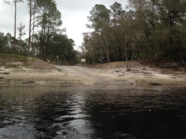
Photo: John S. Quarterman, Cypress Creek South Launch, 2016-09-05
Photo: John S. Quarterman, Cypress Creek South Launch, 2016-09-05.

This paddle is on the Suwannee River Wilderness Trail (SRWT). Continue reading

Cone Bridge, Big Shoals Portage, to Suwannee Wayside Park, Suwannee River, 2019-05-04

Update 2019-04-18: Due to low water, changed to Cypress Creek South (CR 6) to Cone Bridge, Suwannee River, still May 4, 2019.

This 15.6 mile paddle includes a strenuous portage around Big Shoals, the biggest whitewater rapids in Florida and paddling over a smaller set of rapids at Little Shoals. Due to the portage which involves climbing up and down steep, sandy banks with kayaks, carrying kayaks 300 feet and lifting over downed trees, this trip is listed as difficult. You must be physically able to get back into your kayak on the slippery edge of this swift moving section of the Suwannee River. We help each other as much as possible, but ultimately you are responsible for your boat. We will take a break at the shoals and enjoy the outstanding view. No one is paddling over the shoals and this portage is the only way around.

When: Gather 8:30 AM, Launch 10 AM, Thursday, May 4, 2019

Put In: Cone Bridge Ramp, From Lake City, travel north on US 441 to NW Cone Bridge Road; turn left and follow road to ramp in Columbia County.

GPS: 30.445156, -82.670845

Take Out: Suwannee Wayside Ramp, From White Springs, travel south on US 41 to the river; the ramp is on the south side in the town park. Hamilton County.

Bring: a rope to drag your boat, the usual personal flotation device, boat paddles, food, drinking water, warm clothes, and first aid kit.

Also trash pickers and trash bags: every WWALS outing is also a cleanup.

Free: This outing is free to WWALS members, and $10 (ten dollars) for non-members. We recommend you support the work of WWALS by becoming a WWALS member today!

Event: facebook, meetup

Photo: Gretchen Quarterman, Cone Bridge Boat Ramp, 2015-11-22

This paddle is on the Suwannee River Wilderness Trail (SRWT). Continue reading

Cleanup and Outing: Nankin Landing to Madison Highway: Withlacoochee River 2017-10-14

Now also a Rivers Alive cleanup in conjunction with Keep Lowndes-Valdosta Beautiful (KLVB). You can clean up, or clean up and paddle! Best to bring a rope for your boat: the Withlacoochee River is low, and there may be a few spots of dragging over shoals.

Through KLVB: Call (229)671-3698 to be assigned to Nankin Landing or another location.

Through WWALS: Come on down to Nankin Boat Ramp 9AM Saturday October 14, 2017!

State Line Shoals

Where: 6899 Clyattville-Nankin Rd, Valdosta, GA 31601, in Lowndes County, 30.675192, -83.394143

Details: See Continue reading