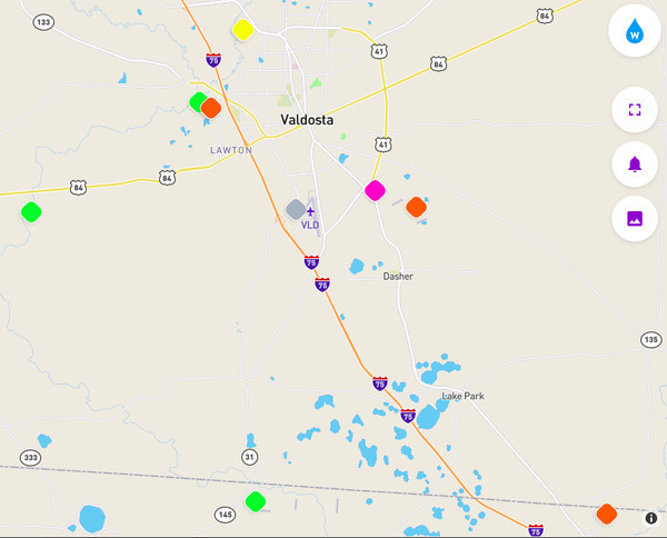
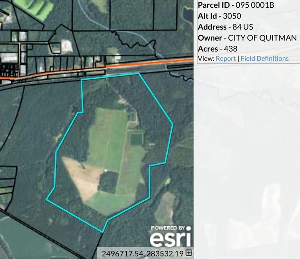
Quitman spilled raw sewage again yesterday, January 3, 2019, from its Land Application Site (LAS) east of town, south of US 84, next to Okapilco Creek. GA-EPD in its Sewage Spills Report of today finally got the river basin right (Suwannee), but seems to have forgotten which creek that LAS is near.
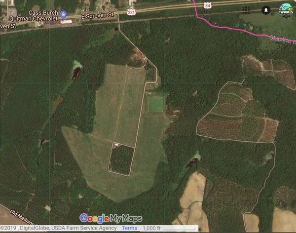
Quitman LAS on the WWALS
google map
for the
Withlacoochee and Little River Water Trail (WLRWT).
No amount is reported yet, but Quitman usually spills between 20,000 and 80,000 gallons of raw sewage. We shall see.
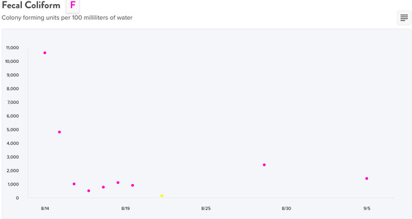
Spills reported to GA-EPD through 2019-01-03
That Quitman spill is the only new one in the Suwannee River Basin for the past 30 days.
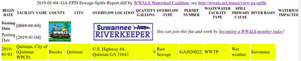
WWALS diff of 2019-01-03 and 2019-01-04 GA-EPD
Sewage Spill Reports.
A bunch of other reports are rolling off the end, as indicated by Continue reading