After the One Mile Branch Cleanup at VSU,
let’s head west on US 84 to the Withlacoochee River and paddle
(or hike) downstream to Spook Bridge: if you’ve seen the locally-made movie,
come see the bridge!
In between we may see the river part of Wade Spring, and we will see
the railroad bridge and the old, closed, Blue Springs road bridge,
aka Spook Bridge.
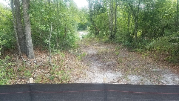
Then we will paddle (or hike) upstream to the Sabal Trail pipeline crossing,
also less than a quarter mile.
If you don’t want to do either, we will tell you how to get to Spook Bridge by land to greet us when we get there.
When:
1PM, Saturday, November 11, 2017
Put In:
US 84, park between the bridges on the Lowndes County side.
We will climb down the steep rocky embankment between the bridges,
seen from the Brooks County side in this picture:
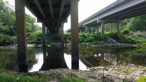
Photo: John S. Quarterman,
From Brooks County to Lowndes County, under the US 84 bridge, 85.2 on the Quitman Gauge, May 22, 2017.
Anyone in reasonable shape can climb it.
GPS:
30.793608, -83.451435
Bring:
mud boots, plus
the usual personal flotation device, boat paddles, food, drinking water, warm clothes, and first aid kit.
Also trash pickers and trash bags: every WWALS outing is also a cleanup.
Free: This outing is Free!
And we recommend you support the work of WWALS by
becoming a WWALS member today!
Event:
facebook,
meetup Continue reading →

![[Catching up, 11:08:10, 30.85035, -83.34855]](https://www.wwals.net/pictures/2019-02-03--troupville-spook-outing/20190203_110810.jpg)
![[Every outing is a cleanup, 10:50:14, 30.8516814, -83.3469376]](https://www.wwals.net/pictures/2019-02-03--troupville-spook-outing/20190203_105014-0.jpg)
![[Movie: Waterfall (786K), 30.87078, -83.02267]](https://www.wwals.net/pictures/2016-05-07--us84-to-mayday-alapaha-river/KVID4839.jpg)
![[Boat light, double moon, 18:30:47, 31.0273566, -83.1061174]](https://www.wwals.net/pictures/2018-12-22--banks-lake-solstice-moon-paddle/20181222_183047.jpg)