Tag Archives: DNR

WWALS Honored at Georgia DNR Confluence Conference as Volunteers of the Year 2020-08-29

FOR IMMEDIATE RELEASE

Hahira, GA, August 31, 2020 — WWALS Executive Director Gretchen Quarterman zoomed into the annual Georgia Adopt-A-Stream Confluence conference on Saturday, August 29, 2020, so WWALS could receive the statewide Volunteer of the Year award while we were finishing the Twomile Branch Cleanup.

[Award and Cleanup]
Award and Cleanup

The award is for “Individual has gone beyond the call of duty to improve water quality and meet AAS goals.” We emphasized it was not just one volunteer, but many, in our one-minute award acceptance video. We also thanked Georgia Power again for a grant. We didn’t have time to mention we’re getting testing kits to WWALS testers in Florida, upcoming WWALS water quality testing training, and branching out to the Santa Fe River, but all that is in this post.

Testers shown in the video include Sara Jay, Scotti Jay, Suzy Hall, Alex Chesna, Bobby McKenzie, Jacob Bachrach, and Trudy Cole. Continue reading

Naylor Boat Ramp Park is not Lola VPA or WMA 2019-05-19

If you’re down at the beach on the Alapaha River, just upstream from US 84, in the new Lowndes County Naylor Boat Ramp Park, and a game warden should happen to say you need a WMA pass, please tell him you’re in a public park owned by Lowndes County, and if there’s any doubt about that, please consult the Lowndes County Tax Assessors online map, or call Lowndes County, or call me.

[Beach]
Beach, Lowndes County Tax Commission Map, Parcel 0259 030B.

There seems to be some confusion, possibly because the Georgia Department of Natural Resources (DNR) map for the Lola Tract WMA does not show Continue reading

Lola Tract: WMA in Lanier and Lowndes Counties

Update 2019-05-09: fixed URLs and added map.

It has a name and it is listed: Lola Tract; WMA Stockton:

Offus84
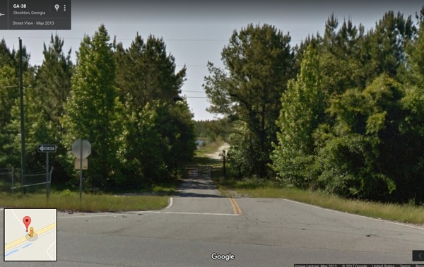
Google Streetview, Lanier County CR 123 off of US 84 aka GA 38.

Lola Tract WMA is a 391 acre property near Stockton. Hunting opportunities include deer, bear, turkey and small game.

This property is only open during hunt dates.

Directions:

From Stockton Take Hwy. 84 west for 1.4 miles. WMA kiosk is on the right. WMA is on both sides of the river.

Voluntary Public Access Area

Continue reading

WMA in Lanier and Lowndes Counties

Yes, it’s a WMA on both sides of the Alapaha River, and it will open for hunting this year. It’s also one of seven or eight, all also Dr. Acree’s land. They will each have names, which are currently unknown, but will pop up in the next few days on the DNR website.

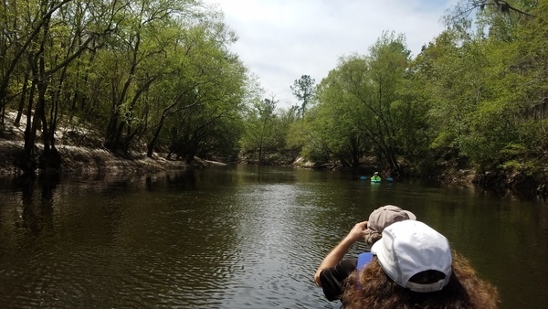
Floating downstream
Photo: John S. Quarterman, 2 April 2017, in Alapaha River, Hotchkiss Road to US 84 2017-04-02

This WMA information is from someone who’s been on site and knows the details, Continue reading

Drilling mud oozing up into the Withlacoochee River from Sabal Trail HDD

Update 2016-11-14: GWC Dirty Dozen Press Conference at US 84 Bridge with tour of Sabal Trail HDD 2016-11-16

Update 2016-11-13:Sabal Trail still leaking drilling mud into the Withlacoochee River at US 84 in GA 2016-11-12

FOR IMMEDIATE RELEASE

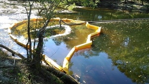
Hahira, GA, November 11th 2016 — Sabal Trail leaked drilling mud up from their HDD pilot hole into the Withlacoochee River. Turbidity curtains and black pipe from the north bank They knew this before WWALS asked two weeks ago what is that yellow thing in the river? They did not tell WWALS or the public that this thing they testified could not happen did happen. The evidence is in writing from Sabal Trail’s contractor to the Georgia Environmental Protection Division.

This wasn’t even the actual horizontal directional drilling (HDD) borehole: it was just the smaller pilot hole. What will happen to the Withlacoochee River (or nearby water wells) with the main borehole? What will happen to the Ochlockonee River west of Moultrie, GA? What will happen to the Santa Fe River, where Sabal Trail is drilling now, or the Suwannee River, where it will drill soon, both Outstanding Waters of Florida, supposed to have extra measures of environmental protection? What about the Tallapoosa, Chattahoochee, or the other Withlacoochee (south) River?

“Why should we accept any risk to our waters, or eminent domain to take our lands, for an unnecessary pipeline, now that Continue reading

Albany reporter objects to citizens asking a public official to represent them against the invading Sabal Trail pipeline

Thanks, Carlton Fletcher, for reminding the public the fight against Sabal Trail isn’t over! Come tell FERC what you think in Moultrie tonight, Valdosta Wednesday, or Lake City Thursday.

Asking our most local representatives to table or deny a motion threatening our Withlacoochee River and Okapilco Creek isn’t “magic”: it’s democracy. Maybe GA-DNR should publish contact information for its board members to make that easier. Meanwhile, David won against Goliath and we can too.

Carlton Fletcher, Albany Herald, 26 September 2015, CARLTON FLETCHER: Anti-pipeline letter steps over line: Continue reading

Georgia Outdoor Map

Interesting interactive map by Georgia Department of Natural Resources, Georgia Outdoor Map. Their PR of 14 March 2014, DNR Launches Interactive Map of Recreational Lands,

The Georgia Department of Natural Resources (DNR) today unveiled an interactive map that identifies DNR-managed lands and outdoor recreation opportunities. The “Georgia Outdoor Map” includes state parks, wildlife management areas, public fishing areas, boat ramps, and historic sites. Users are able to search by category to find locations where they can camp, hunt, hike, fish or explore history.

Continue reading