Update 2020-01-25: Superseded by WWALS Suwannee River Basin Map and All Landings in the Suwannee River Basin, now that Suwannee Riverkeeper territory includes the entire Basin plus Estuary, since Waterkeeper Alliance agreed to add the Ichetucknee and Santa Fe Rivers on September 26, 2019.
Update 2017-10-30:
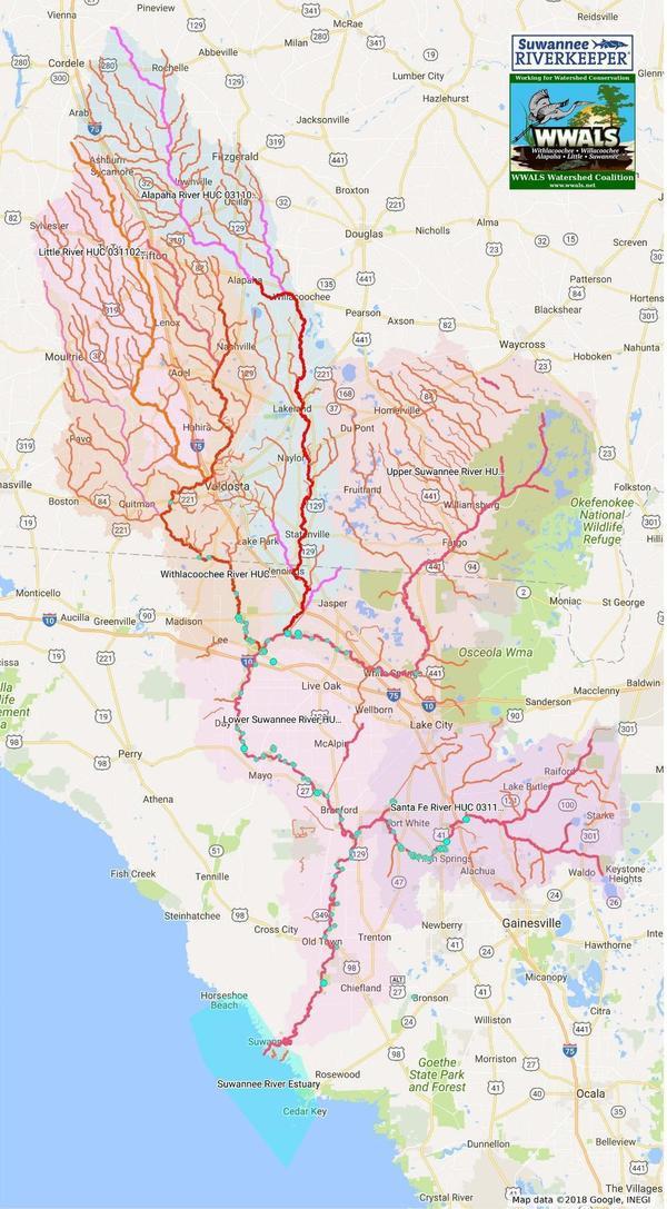
River flowlines.
Update 2017-10-08:
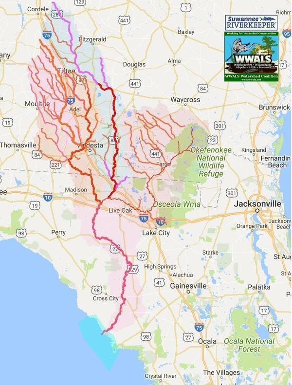
Better colors plus a Suwannee River Basin map.
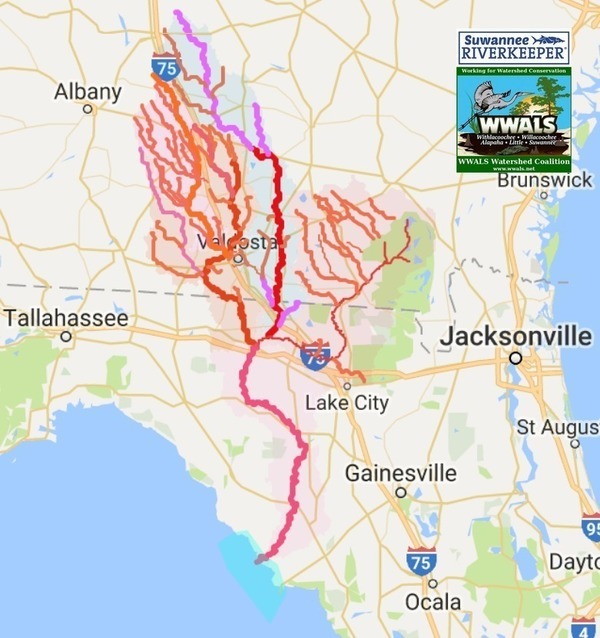
Update 2017-04-13: Since December 2016 WWALS Watersheds have included the Lower Suwannee River HUC 03110205
and the Suwannee River Estuary, approved by Waterkeeper Alliance the same time as the license for Suwannee RIVERKEEPER®.
Click on this link for an interactive google map of WWALS watersheds.
The images you see here are static screenshots of that google map. Follow the link above for the actual google map.
The watershed outlines are from USDA-GDG (see below under How To). I added the separate colors and widths for each watershed, and I drew the Suwannee River Estuary outline.
Update 2016-03-27: More how to do this.
Update 2016-03-03: Better outline widths and colors.
Update 2016-02-26: Better colors and transparent shaded areas.
The watersheds shown are for these Hydrologic Unit Codes (HUCs):
- HUC 03110203: Withlacoochee River
- HUC 03110204: Little River
- HUC 03110202: Alapaha River, including Willacoochee River
- HUC 03110201: Upper Suwannee River
- HUC 03110205: Lower Suwannee River
- Suwannee River Estuary
The screenshots below shows more detail of WWALS watersheds. To zoom in for even more detail, use the google map.
Google Map of WWALS Watersheds
Follow this link for the interactive google map of WWALS watersheds, and it is also embedded below.
Suwannee River Basin
See separate post.
Other Maps
Many other maps are available under Maps on the WWALS website.
-jsq, John S. Quarterman, Suwannee RIVERKEEPER®
You can join this fun and work by becoming a WWALS member today!
How to construct a HUC google map like this
If you want to find and map some other HUCs, start with USGS HUC finder.
Once you have a HUC, use the USDA GDG, https://gdg.sc.egov.usda.gov/, to select any state, place Hydrologic, and the numeric HUC code.
Then select under Order Map layers, “8 Digit Watershed Boundary Dataset NRCS Version”. (If you want more precision, select 12 digit, or even more precise numbers.) Click Continue.
Then Select File Format ESRI Shape. And a map projection, probably Geographic NAD83. Then Inclusion Extract, and Delivery Download. Click Continue.
You’ll need to enter an email address and associated parameters. Then click Continue.
Finally, click Place Order.
I don’t know any way to select multiple HUCs at the same time. However, you can click on WHERE in the top of the left menu and pick another one to order, until you successively order all the ones you want.
A few minutes later, you’ll get email with where to download your data. Pick up that ZIP file.
You can extract the data from the ZIP file in the usual manner, such as by unzip.
Then you’ll need to convert the shapefile into KML if you want to use it with a google map. For that you’ll need most likely ogr2ogr; follow the link for how.
-jsq, John S. Quarterman, Suwannee RIVERKEEPER®
You can join this fun and work by becoming a WWALS member today!
Short Link:


Pingback: Streamer on the Suwannee, Alapaha, and Withlacoochee Rivers | WWALS Watershed Coalition